First timer? In this formerly once-a-day blog (and now pretty much a once-every-three-or-four days blog), I have my computer select a random latitude and longitude that puts me somewhere in the continental United States (the lower 48). I call this “landing.” I keep track of the watersheds I land in, as well as the town I land near. I do some internet research to hopefully find something of interest about my landing location. To find out more about A Landing A Day (like who “Dan” is) please see “About Landing” above. To check out some recent changes in how I do things, check out “About Landing (Revisited).”
Landing number 2251; A Landing A Day blog post number 681.
Dan: Geez. For the 4th time since revising my random lat/long methodology (34 landings ago), I’ve landed in . . . SD. For you regular readers with your short term memory still intact, you also know that this is my second SD landing in a row! That makes SD my 58th double.
In case you’re thinking that my current random lat/long generator is less than random, note that I “landed” twice in the Atlantic Ocean (once, just missing FL) before I found myself back in SD . . .
Of course, SD is an OSer, bumping my Score up from 1025 to 1033. Want to know what I’m talking about? Check out the tab “About Landing (Revisited)” above.
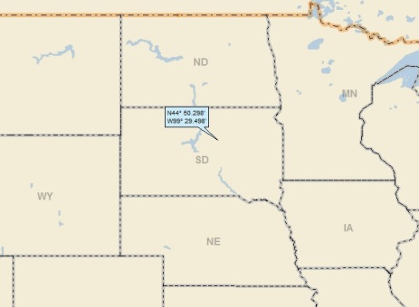
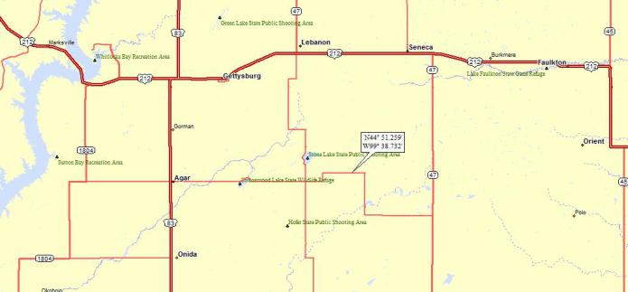
Here’s my regional landing map:
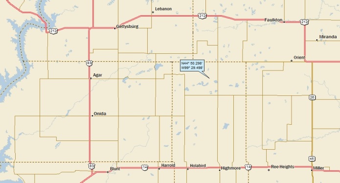
And, my local landing map:
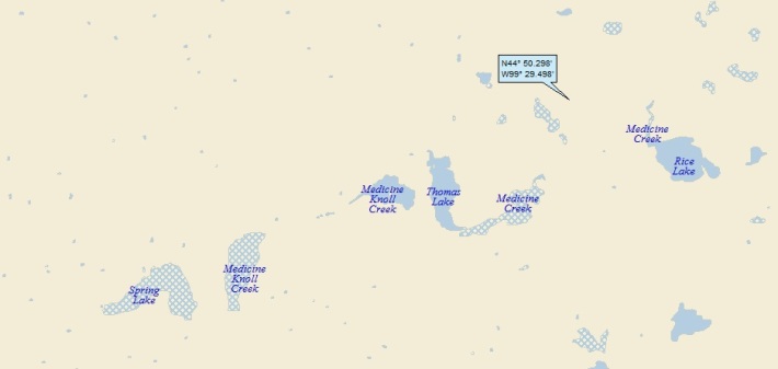
Here’s my streams-only map, showing that I landed either in the watershed of Medicine Ck or Okobojo Ck:
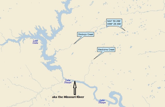
I used the Google Earth (GE) elevation tool to determine that runoff from my landing headed south towards Medicine Ck, and not west towards Okobojo Ck. Anyway, Medicine Creek makes its way to the Missouri R (408th hit); and, of course, on to the MM (882nd hit).
It’s time for my GE spaceflight in to Central SD. Fasten your seatbelts, click HERE and enjoy the trip – then hit your back button.
Here’s a GE shot showing SV coverage:

And here’s what the orange dude sees:
I had to go quite a ways downstream to get SV coverage of Medicine Ck:

Here ‘tis:
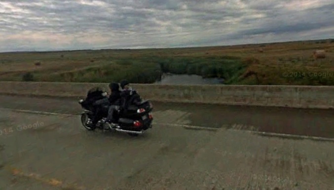
I wonder if the motorcycle rider was away of the passing Googlemobile? Probably not . . .
As is fairly frequently the case, the small towns in the vicinity had a familiar ring to them. A quick search of ALAD revealed that I landed very close to today’s landing back in July of 2010 (landing 1906). Here’s my landing map from back then:
Once again, here’s today’s landing map:
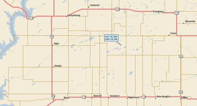
Wow. The two landings are only 7.5 miles apart! To put things in perspective, this is my 679th ALAD landing. The area of the lower 48 is 3,061,039 square miles. Dividing the area by 679 gives me about 4,500; that’s to say that each landing, on average, covers 4,500 square miles. Taking the square root, we get a hunk of real estate 67 miles x 67 miles. So you can see that 7.5 miles is very close indeed.
Obviously, one of the first thing I did was check out my 2010 landing. I picked Faulkton as my titular town, although, as you’ll see, I featured a number of towns. I’m going to go ahead and do some copy and paste action, but then I’ll come back to post some new material. The following is from the old post:
I must admit that I had trouble finding some items of real interest in the vicinity of my landing, so here’s a little this and that. I’ll start with the “Welcome to Gettysburg” sign:

No additional comment needed.
Moving over to Faulkton. I found some nice old pictures of the town from the Christ and Ingeborg families page on rootsweb.ancestry.com.
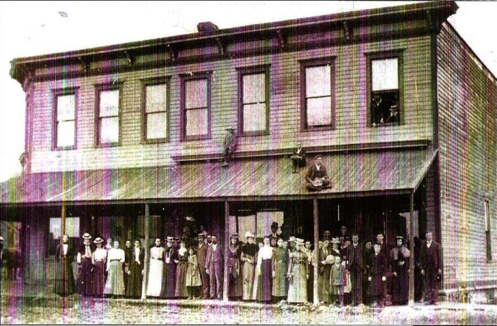
Here’s the old courthouse, from the late 1800’s. What a bunch of posers (especially the guys on the roof . . .)
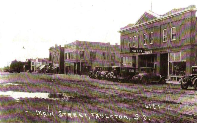
Here’s a shot of Faulkton Main Street in the 1920s:
Here’s a wonderful overview photo taken at the turn of the century (with the website caption underneath):

This is my favorite photo. This is Faulkton in 1900 or 1901. This is looking south, with the old school to the bottom left to the Methodist Church. This is certainly a capture of time. Notice the girl standing by the school and the kids walking on the dirt paths.
I mentioned to Leslie Hansen that there probably isn’t a building left standing from this photo and he said there was one house that he knew of. Certainly many little ‘Houses on the Prairie’ here!
South of Faulkton is the little town of Orient. Here’s a cool picture from the late 1800’s in Orient:
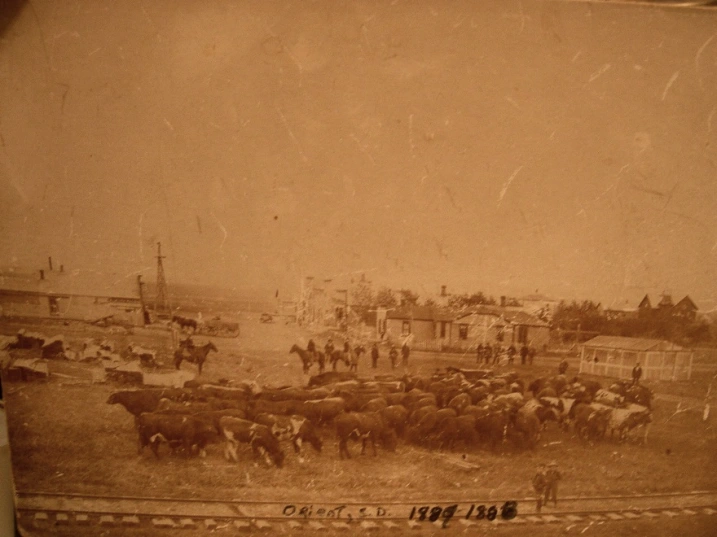
I guess there were no local ordinances prohibiting driving cattle through town!
Click HERE if you’d like to see more pictures and descriptions from the Rootsweb.Ancestry.com web site.
The little town of Agar just celebrated their centennial. Part of the celebration was a trek by covered wagon:

Moving back to the Rt 212 bridge over the lake, here’s another shot of the bridge. You have to love the sign . .

Enough flashbacks. My recent research uncovered a couple of things I missed (or didn’t bother with) back in 2010. I’ll start with a very-close-in streams-only shot near my landing:
Street Atlas is sometimes kind of funky about how they show streams. Note that off to the east, it says “Medicine Creek” a couple of times, but further west, it says “Medicine Knoll Creek” (even though an actual stream course isn’t shown). Anyway, I Google Medicine Knoll and found out that it’s a large hill along Medicine Ck, just south of Blunt (see local landing map). Medicine Knoll is an interesting place!
I found an article in the Pierre, SD “Capital Journal” website by Lance Nixon (Jan 13, 2013), entitled “Paha wakan: Medicine Knoll Still Hides Ancient Secrets in the Grass.” Here are some excerpts (with photos from the article):
BLUNT, S.D. — They are about a day’s journey east of Fort Pierre, the start of July 1839, and the geographer Joseph Nicollet records what they see in his journal as he and his companions pause to examine the forks of the East Medicine River and the hill looming above it:
“This last-mentioned river derives its name from a beautiful hill on its right bank, called by the Sioux Pahah wakan – translated by the voyageurs ‘Butte de Medicine,’ and in English, Medicine Hillock, or knoll,” Nicollet writes in his journal. “It is to be remarked, in fact, of the prairies of this region that they present such low insulated hillocks, to which the Sioux apply the somewhat generic name of re or pahah, according as they are more or less elevated above the surrounding plain. The affix wakan indicates that the locality is to them peculiarly remarkable, or even sacred, and a spot which they select in preference for some of their ceremonies.”
Nicollet was right in more ways than he knew. In fact Medicine Knoll, though Nicollet knew it only by its Sioux name, may have been an ancient ceremonial place already in use hundreds of years before the Sioux arrived.
Somewhere in the grass of that knoll that Nicollet and his party climbed to look out across the country was the man-made feature that made it an important ceremonial site, and one still intensely interesting to archaeologists: A stone mosaic that makes the outline of a snake in the grass.
It’s known to archaeologists as site 39HU70, and they say is probably the best known of the effigy sites in South Dakota.
No one knows for sure who made it or why.
The total length of the snake, following the curves, is 360 feet, and the total number of stones and bowlders used in the outline and including the two for the eyes is 825, of which at last ten occupied their present positions previous to the construction of the snake …”
Here’s a picture of the snake, with the caption underneath:
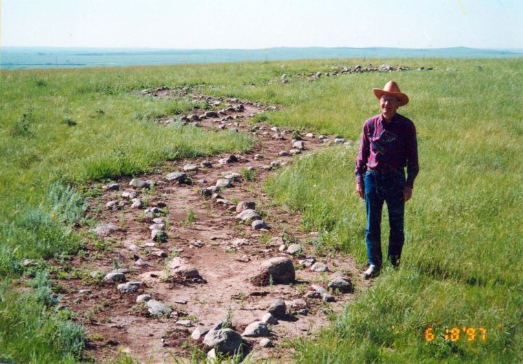
Royal Runge, the rancher who formerly owned Medcine Knoll site from 1938 to 1999 and took care to preserve it, is shown here alongside the snake mosaic made of stones that archaelogists believe is close to 500 years old. The photo is from 1997.
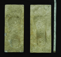
Well there you have it. Moving back to Gettysburg, I found that there’s a large rock (called, appropriate enough) Medicine Rock that is housed in the Dakota Sunset Museum in Gettysburg. The rock has deeply-embedded human footprints and some hand prints as well.
Here’s some info from the SD State Historical Museum website:
People in ancient times chipped animals, symbols, foot and hand prints into rocks called prayer rocks (inyan wakan) or medicine rocks. The carvings themselves are known as petroglyphs. The Arikara, Hidatsa, and later the Sioux people used medicine rocks in vision quests, prayer and as oracles.
Here’s a picture of Gettsyburg’s Medicine Rock.

You can’t see the petroglyphs in the above photo, but here’s a shot of a plaster cast of two of the footprints:
Here’s an old shot of the rock in its original location (which was flooded when the Missouri River was dammed up in the 1960s):

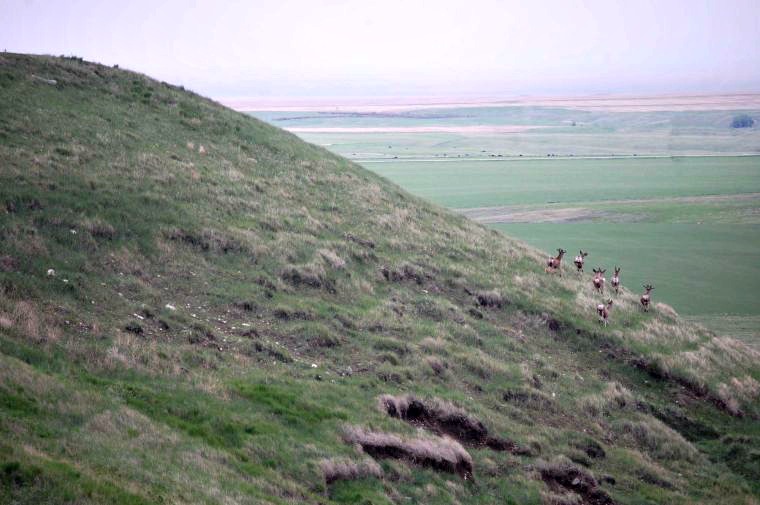
Time for some GE Panoramio shots – all within about 20 miles of my landing. I’ll start with one by JB the Milker (who I featured on my last post!):
Here’s another, this one by Troy Larson:
I’ll close with this sunset shot over Lake Louise (about 20 miles SE of my landing) by Doe4Rae:

That’ll do it . . .
KS
Greg
© 2016 A Landing A Day


