First timer? In this formerly once-a-day blog (and now more-or-less a twice a week blog), I have my computer select a random latitude and longitude that puts me somewhere in the continental United States (the lower 48). I call this “landing.” I keep track of the watersheds I land in, as well as the town I land near. I do some internet research to hopefully find something of interest about my landing location. To find out more about A Landing A Day (like who “Dan” is and what the various numbers and abbreviations mean in the first paragraph), please see “About Landing,” (and “Abbreviations” and “Cryptic Numbers”) above.
Landing number 2081; A Landing A Day blog post number 509.
Dan – Are you kidding me? Nine out of ten landings are OSers? Yup, thanks to this landing in . . . WY; 74/66; 1/10; 151.0.
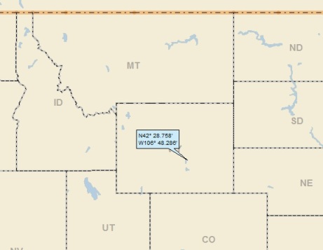
My regional landing map shows that I landed near the middle of the state:
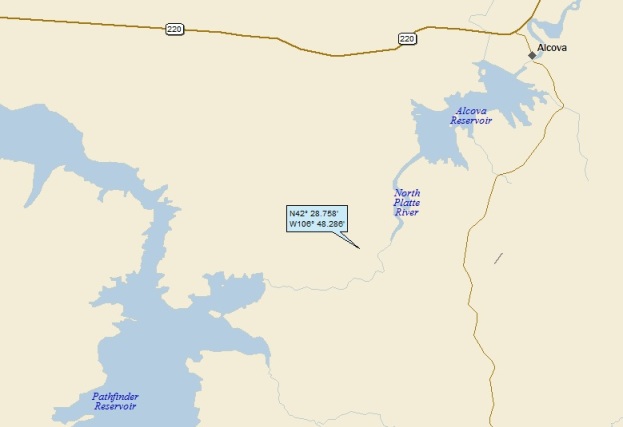
Moving closer in, you can see that I landed along the North Platte River, between two reservoirs:
My watershed analysis is pretty straight-forward: North Platte R (27th hit); to the Platte (60th hit); to the Missouri (379th hit); to the MM (817th hit).
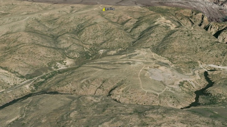
Here’s my Google Earth (GE) shot, looking north past the North Platte:
I noticed a steep canyon just to the east and north. It turns out this is Fremont Canyon. Here’s a GE shot of the Canyon, looking downstream towards Alcova Reservoir (more about the Fremont Canyon in a bit).
So, I must check out the town of Alcova. Here’s a GE shot; it looks like maybe 20 people live there:
Wiki says that 76 people live there. That must include the suburban sprawl that don’t show up on this photo. Not surprisingly, there’s really nothing about Alcova to talk about.
So, I think that Fremont Canyon is worth a quick look. Check out this video! It gets a little repetitive (it should only be 2 minutes long, not 4), but is definitely worth a quick look. I hung around to the end; you’ll see why I did, but don’t feel you have to. The video is from Calculated Risk Films:
I have some GE Panoramio shots of the Canyon, but I’m going to save them for the end of the post.
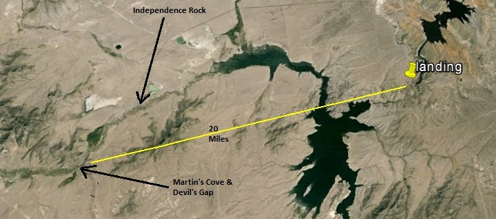
Here’s a GE look at some features 15 – 20 miles west of my landing: Independence Rock, Devil’s Gate and Martin’s Cove:
They’re all related because they’re right along the combined route of the Oregon Trail, California Trail and the Mormon Trail (collectively known as the Emigrant Trail). Here’s a map showing the trail route in the general vicinity of my landing:
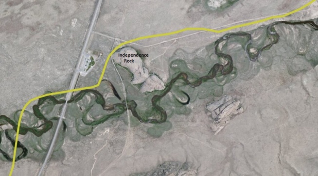
So let’s start with Independence Rock. Here’s a close-up of the trail as it wraps around the rock:
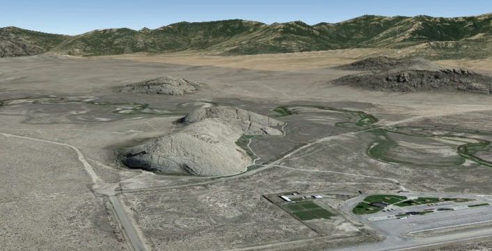
Here’s a GE shot of the rock, looking South:
Wiki has the following to say:
The rock lies directly along the route of the Emigrant Trail (the collective name for the Oregon, California and Mormon trails). Pioneers usually left the Missouri River in the early spring, attempted to reach the rock by July 4 (Independence Day in the United States), in order to reach their destinations before the first mountain snowfalls (thus the name). John C. Frémont camped a mile below this site on August 1, 1843, and made this entry in the journal of his 1843-’44 expedition:
“Everywhere within six or eight feet of the ground, where the surface is sufficiently smooth, and in some places sixty or eighty feet above, the rock is inscribed with the names of travelers. Many a name famous in the history of this country, and some well known to science, are to be found among those of traders and travelers…”
Fremont carved a large cross into the rock monolith, which was blasted off the rock on July 4, 1847 by some among hundreds of California and Oregon emigrants who had gathered on the site. Many Protestants considered the cross Fremont carved to be a symbol of the Pope and Catholicism. John Frémont was actually a member of the Episcopal Church (United States).
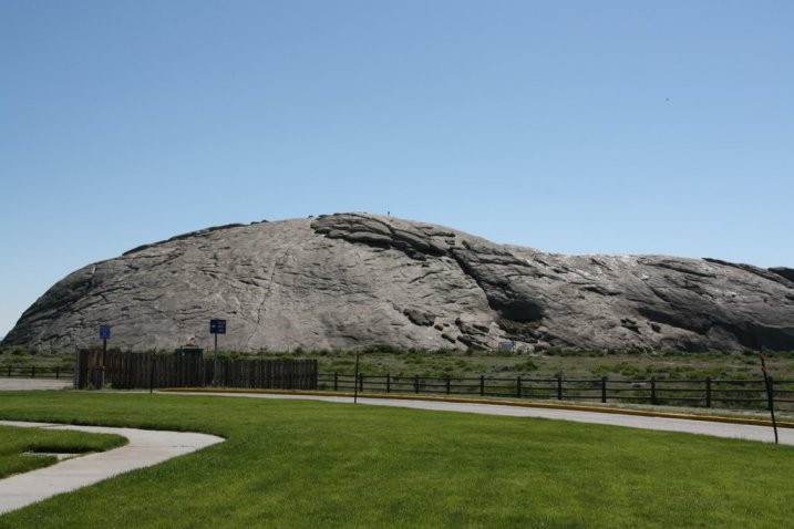
Here’s a GE Panoramio shot of the rock by ea1494:
I lifted this close-up of some names carved on the rock from the Patrick Family Vacation 2010 blog:
How about Martin’s Cove and Devil’s Gate? Here’s a shot showing the trail as it wends its way by the Gate, and through the Cove:
From Wiki about Martin’s Cove:
In November 1856, about 500 Mormon emigrants in the Martin Handcart Company were halted for five days in the Cove by snow and cold while on their way to Salt Lake City. The Martin Handcart company had begun its journey on July 28, 1856 which was dangerously late in the season and would ultimately lead to the disaster. Although the number who died in the Cove is unknown, more than 145 members of the Martin Company died before reaching Salt Lake City.
Handcart Company? From Wiki:
The handcart pioneers were participants in the migration of Mormons to Salt Lake City, Utah, who used handcarts to transport their belongings. The Mormon handcart movement began in 1856 and continued until 1860.
Motivated to join their fellow Church members in Utah but lacking funds for full ox or horse teams, nearly 3,000 Mormon pioneers from England, Wales, Scotland and Scandinavia made the journey from Iowa or Nebraska to Utah in ten handcart companies.
The trek was disastrous for two of the companies [the Martin Handcart Company being one], which started their journey dangerously late and were caught by heavy snow and severe temperatures in central Wyoming. Despite a dramatic rescue effort, more than 210 of the 980 pioneers in these two companies died along the way. John Chislett, a survivor, wrote, “Many a father pulled his cart, with his little children on it, until the day preceding his death.”
Although fewer than 10 percent of the 1846–68 Latter-day Saint emigrants made the journey west using handcarts, the handcart pioneers have become an important symbol in Mormon culture, representing the faithfulness and sacrifice of the pioneer generation.
Man, those Mormons were something . . .
Just downstream from the Cove is a gap in a ridge known as Devil’s Gate. From the National Park Service:
Devil’s Gate is a narrow cleft carved through a bedrock ridge by the Sweetwater River. Devil’s Gate became visible approximately 15 miles to the east along the Emigrant Trail. The gorge was impassable to wagons, and the trail passed to the south of the ridge, but this dark, gloomy canyon intrigued the emigrants. Many camped here, and almost all took the detour to inspect the gorge.
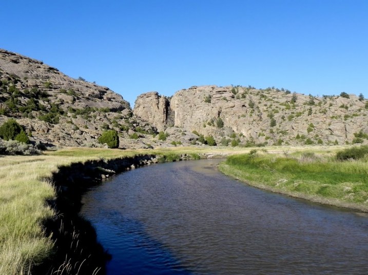
Here’s a lovely Panoramio shot (by High Desert) of Devil’s Gate from the banks of the Sweetwater River as it flows through Martin’s Cove:
Here’s a closer-in shot looking through the gap, from wunderground.com:
From Wiki, here’s some more about the Gate:
Devil’s Gate is a remarkable example of superposed or an antecedent drainage stream. The Sweetwater River cuts a narrow 100-meter deep slot through a granite ridge, yet had it flowed less than a kilometer to the south, it could have bypassed the ridge completely. The gorge was cut because the ridge of rock was originally buried by valley fill sediments. The river cut downward and when it hit granite, kept on cutting. It was a matter of pure chance that the river hit the buried ridge where it did.
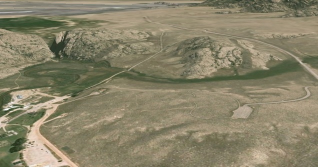
Here’s a GE shot that show’s Devil’s Gap (to the left). You can see that it seems as though the river could have much more easily flowed around the ridge instead of through it . . .
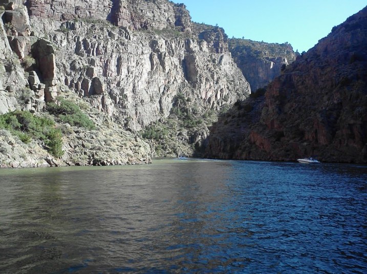
I’ll close with a couple of Panoramio shots back up near my landing (both of Fremont Canyon). First this, by Maslaten of the downstream end of the Canyon, where the North Platte flows into the Alcova Reservoir:
Finally, here’s a great Canyon shot by Chris Sanfina:
That’ll do it.
KS
Greg
© 2013 A Landing A Day
