First timer? In this formerly once-a-day blog (and now more-or-less a once or twice a week blog), I have my computer select a random latitude and longitude that puts me somewhere in the continental United States (the lower 48). I call this “landing.” I keep track of the watersheds I land in, as well as the town I land near. I do some internet research to hopefully find something of interest about my landing location. To find out more about A Landing A Day (like who “Dan” is and what the various numbers and abbreviations mean in the first paragraph), please see “About Landing,” (and “Abbreviations” and “Cryptic Numbers”) above.
Landing number 2140; A Landing A Day blog post number 568.
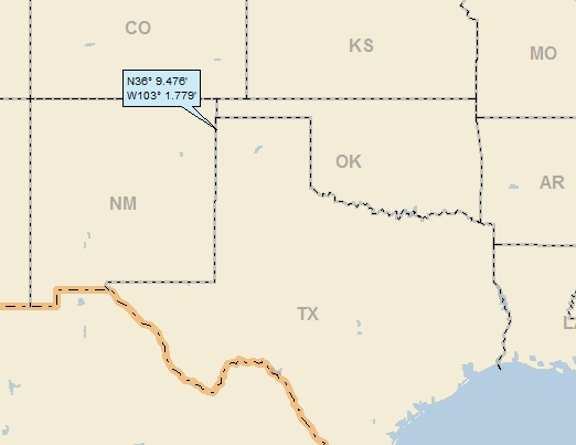
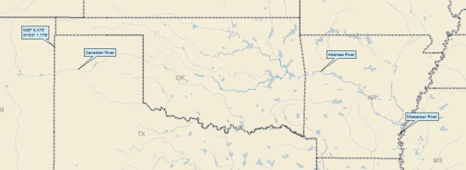
Dan: On the positive side, I’m 2 for 3 USers; on the negative side, I’m only 2 for 8 USers. But hey, I’ll take this landing in the granddaddy of USers . . . TX; 159/188; 2/10; 6; 147.7. Here’s my regional landing map:
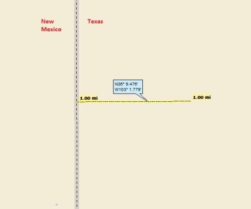
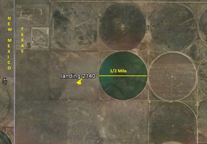
Looks mighty close to NM, eh? Let’s zoom in a bit:
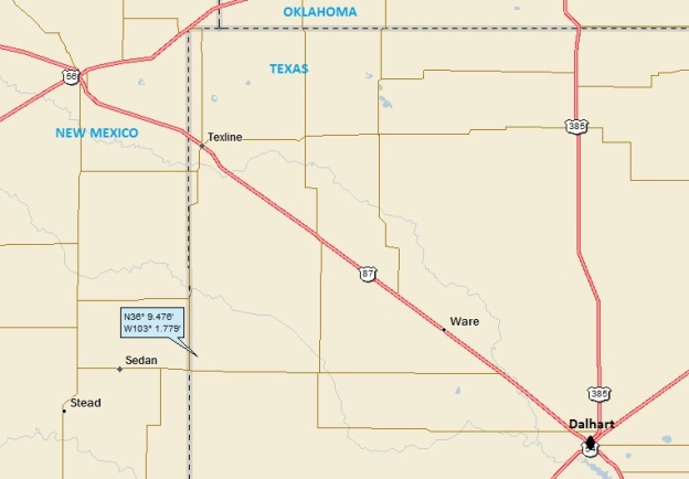
I’ll say I’m close. I’ll zoom back a little and add the highways and towns:
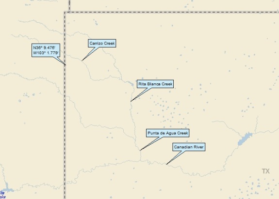
Here’s part 1 of my watershed analysis:
I landed in the watershed of the Carrizo Ck; on to the Rita Blanca Ck; to the Punta de Agua Ck to the Canadian R (42nd hit). Hey wait a second – just two landings ago, I landed in the watershed of a Carrizo Creek in SE Colorado. That landing wasn’t too far away (about 65 miles due north), but, obviously, these are two separate Carrizo Creeks.
Checking back, I found that I’ve landed in the watershed of four Carrizo Creeks – one in Arizona and one in California in addition to the two discussed above. FYI, carrizo means “reed” in Spanish. Moving right along to part 2 of my watershed analysis:
So the Canadian flows to the Arkansas (116th hit); on to the MM (841st hit).
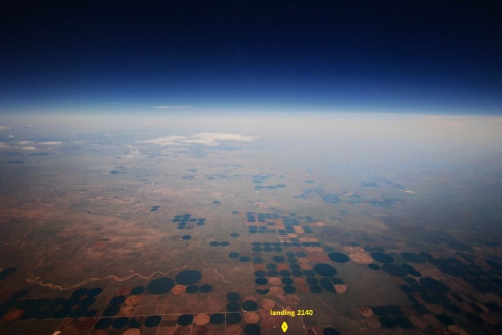
Here’s my Google Earth (GE) flight in from space:
Here’s a static GE shot showing (once again) my proximity to the TX / NM border:
Back up on my local landing map, you can see Stead & Sedan NM along with Texline, Ware & Dalhart TX. One of my ALAD rules is that the town I feature must be in the state where I landed, thus eliminating Stead & Sedan NM from competition as my titular town. Of course, I must find a hook (which eliminates Texline). Here’s what The Handbook of Texas has to say about Ware:
WARE, TEXAS. Ware was thirteen miles northwest of Dalhart in southern Dallam County.
The operative word is “was.” So, I’m left with Dalhart. From Wiki:
Dalhart is a city in both Dallam and Hartley counties in the U.S. state of Texas.
OK class. Let’s put on our thinking caps. Can anyone guess why Dalhart is called Dalhart?
Here’s something of some interest about Dalhart from Wiki:
Dalhart was in the center of the Dust Bowl, an area adversely affected by a long period of drought and dust storms during the Great Depression of the 1930s. It was here that Tex Thornton, operating on the now debunked concussion theory, coaxed today’s inflation adjusted equivalent of $1 million from the locals on claims he could fire rocket-powered explosives into the clouds and cause rain.
From the Handbook of Texas about Tex Thornton:
THORNTON, WARD A. “TEX” (1891–1949), well shooter and oilfield fire fighter. He first traveled to the Texas Panhandle in 1920, while working with the United States Torpedo Company of Wichita Falls.
I’m going to interrupt to provide a little background about a well shooter and a torpedo (leaving cloud seeding aside for the moment). I’ve borrowed this from Alexis Madrigal, writing for The Atlantic (8/21/13):
Before the fracking gas boom of the last 10 years, before the rise of mega oil companies, before the entire 20th century, actually, humans figured out how to increase the flow of fossil fuels from a well. It was simple: take an iron container about the size of a large thermos, stick some black powder or other explosives into it, stick a blasting cap on it, send it down the well, and then send a weight down to detonate it. BOOM. They called this, “Shooting the well!” And yes, I believe the “!” is required, as in Yahoo!
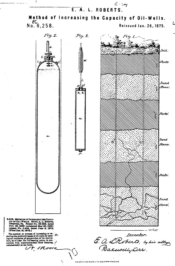
The process was first commercialized by Colonel E.A.L. Roberts in 1865, a veteran of the Civil War, and he soon formed the The Roberts Petroleum Torpedo Company. But his success spawned a host of imitators (one of which is our hero, Tex Thornton).
Here’s a shot of Mr. Roberts’ 1865 patent:
Back to the Handbook of Texas:
Thornton soon found that the limestone formations in the Panhandle oil and gas field necessitated the use of as much as 500 quarts of nitroglycerin to shoot each well. He established his own business, the Tex Thornton Torpedo Company.
The high gas content in the Panhandle field made a well shooter’s job particularly hazardous. More than once Thornton reportedly caught shells of nitro that were forced back up well holes by gas bubbles (hopefully avoiding explosions!).
The great amount of gas in the Panhandle field also made well fires a constant menace, and Thornton quickly gained a reputation as the man to put them out. Wherever there was danger of causing fires by using explosives, he used massive amounts of water and steam to smother the flames. This process usually took about three weeks, required twenty to thirty men, and employed fifty steam boilers.
The better-known and more spectacular mode called for extinguishing the blaze with a charge of nitroglycerine exploded over the burning well. The blast choked off the oxygen and snuffed out the fire. The most dangerous part of the operation, however, was capping the still-blowing well. Thornton’s exploits earned him fame as the “king of the oil-well fire fighters.”
It turns out that the rather extensive coverage of Tex Thornton in the Handbook of Texas presents very little about his cloud seeding:
During the 1930s he invented a device with which he sought to produce rain by bombing clouds, but with only limited success. His ability to make friends and his generosity were legendary. He was killed on June 22, 1949, by a pair of hitchhikers to whom he gave a ride, and was buried in Llano Cemetery in Amarillo.
Interesting that Wiki dug up the dirt about scamming a million dollars . . .
There’s more of interest in Wiki about Dalhart:
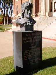
At the Dallam County Courthouse, Dalhart honors the memory of James R. Fox, Jr. (March 16, 1919—March 11, 1943), who flew supplies to China via the notorious “Hump Route” for Pan American Airways, then a joint Chinese and American company, during World War II. Fox and his two Chinese copilots were killed when their Douglas C-52 cargo plane crashed. In 2002, the Peoples Republic of China made a bronze bust in Fox’s honor and presented it to Dalhart.
Here’s a picture of the bust:
Here’s what Wiki has to say about the Hump:
The Hump was the name given by Allied pilots in the Second World War to the eastern end of the Himalayan Mountains over which they flew military transport aircraft from India to China to resupply the Chinese war effort of Chiang Kai-shek and the units of the United States Army Air Forces based in China.
Airlift operations over the Hump accounted for 685,304 gross tons of cargo carried eastbound during hostilities, including 392,362 tons of gasoline and oil, with nearly 60% of that total delivered in 1945. Hump route aircraft made 156,977 trips eastbound between 1 December 1943, and 31 August 1945, losing 373 aircraft.
I was totally unaware that this airlift operation took place, much less the scale of it! And take a deep breath and think about it. Three hundred and seventy three aircraft were lost during this operation. The scope of the operations and losses during WW II stagger the imagination.
Check out this old-style newsreel about the operation:
Back to Dalhart & Wiki:
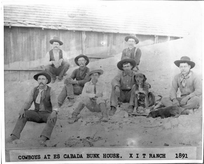
The XIT Ranch was a cattle ranch in the Texas Panhandle which operated from 1885 to 1912. Comprising over 3,000,000 acres of land, it ran for two hundred miles along the border with New Mexico [obviously, including my landing location], varying in width from 20 to 30 miles.
In 1879, the Texas Legislature appropriated 3,000,000 acres of land to finance a new state capitol. In 1882, the Legislature struck a bargain with Charles B. and John V. Farwell of Chicago, Illinois, under which the Farwells (with mostly British investors), agreed to build a new $3,000,000.00 Texas State Capitol in Austin and to accept the 3,000,000 acres of Panhandle land in payment.
Wow. Think about it. The Farwells got 3,000,000 acres at $1/acre! Sounds like a good deal. Continuing with Wiki:
The XIT ranch started operations in 1885. The XIT brand was originated to thwart rustlers because it was hard to alter. At its peak, the ranch handled 150,000 head of cattle within its 1,500 miles of fencing. The ranch also erected 325 windmills and 100 dams across its land.
However timing was bad for the XIT as cattle prices crashed in 1886 and 1887. By the fall of 1888, the ranch was unable to sell its cattle and make a profit. The cattle were constantly plagued by rustlers and predators, especially wolves leading to further losses for the syndicate.
In 1901, the syndicate that owned the ranch began selling off the land to pay foreign investors as the bonds became due. By 1905, most of the land was subdivided, with large tracts being sold to other cattlemen and small amounts of land being sold to farmers.
Here’s a cool shot from Wiki of XIT cowboys:
And what the heck. Here’s what the state of Texas got for giving away 3,000,000 acres of dry panhandle land:
Of course, I checked out the local GE Panoramio shots, and I found one by Will Lyster, labeled “View from the backseat of my SR-71 over Clayton NM.” The SR-71 was a high-tech high-altitude US Air Force surveillance plane that operated from 1964 until 1998. Here’s a Wiki shot of what one looked like:
So, getting back to Will Lyster’s shot. Here ‘tis:
I messed with GE a little, and was able to come remarkably close to replicating the SR-71 shot:
How about that . . . and by the way, you can just see the yellow pushpin for landing 2138 (Springfield CO, where I also landed in a Carrizo Creek watershed).
Less than two mile east of my landing is this Pano shot of Pronghorn Antelopes by Rusty Gilmore:
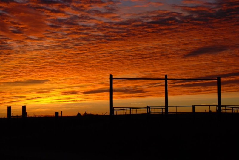
I’ll cheat a little, and close with a shot a few miles west of my landing (all right, all right, it’s in NM), by WornMatt:
That’ll do it.
KS
Greg
© 2014 A Landing A Day
