First timer? In this formerly once-a-day blog (and now pretty much a once-every-four-or-five days blog), I have my computer select a random latitude and longitude that puts me somewhere in the continental United States (the lower 48). I call this “landing.” I keep track of the watersheds I land in, as well as the town I land near. I do some internet research to hopefully find something of interest about my landing location. To find out more about A Landing A Day (like who “Dan” is) please see “About Landing” above. To check out some recent changes in how I do things, check out “About Landing (Revisited).”
Landing number 2304; A Landing A Day blog post number 734.
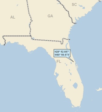
Dan: I’m on a roll – 4 straight USers, and seven out of the last eight. Of course, a new record low Score (from 599 down to 583). What’s more, this was my first Florida landing since I changed how I get my random lat/longs 88 landings ago.
“What is he talking about?” you may ask. Check out “About Landing (Revisited)” to answer all of your questions. Well, maybe not all your questions. For that, you’ll need to read “About Landing.” Or, more simply, don’t worry about it and just keep reading.
Here’s my regional landing map:
And my very local landing map:
Let me back up a little:
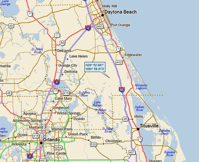
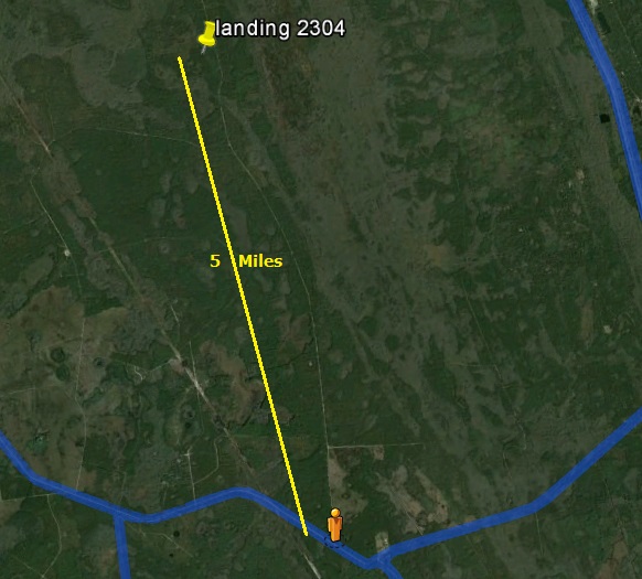
You can see that I landed in what appears to be a relatively empty hunk of real estate between Orlando and Daytona Beach (more about that emptiness in a bit). FYI, that’s the northern portion of Cape Canaveral to the south and east of Titusville.
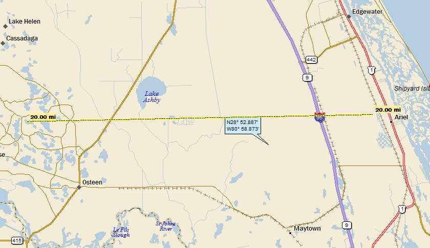
My streams-only map shows that I landed in the watershed of Cow Ck:

Cow Creek makes its way to Deep Creek, on to the St. John’s River (5th hit, making the St. Johns the 166th river on my list of rivers with 5 or more hits).
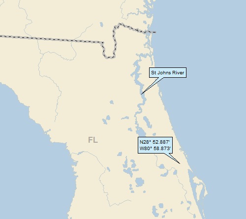
Zooming back some you can see that the St. Johns makes its way north (past Jacksonville, trust me on this), and out to the ocean:
But before I go any further, I have to tell a little story about this particular landing. It was Thursday, October 6th, and I had just finished up preparing and saving the draft of my Prewitt & Thoreau NM post. (I generally have a few posts in the queue at any given time).
Hurricane Matthew was the big story on the news, and my wife Jody and I were looking at some of the projected storm path graphics. At that moment, the storm was off the coast of southern Florida, headed north towards a possible landfall in central Florida, not far from Cape Canaveral.
As is my custom, I alerted Jody to the fact that I was about to land, and would be letting her know about my new landing location in a minute or two. When I saw my lat/long, I thought to myself, “either the ocean or Florida” (I have a pretty good sense of where I’ll end up after a quick look at the lat/longs. After all, I’ve done this 2,304 times . . .)
So anyway, I was looking at windytv.com, which is a cool website that shows wind patterns and velocities around the whole world. As one would expect, the hurricane really stands out. You can also look at future wind patterns, and I was checking out where Matthew’s eye would be Friday morning.
And then I landed and I couldn’t believe it. Here’s a windytv shot showing the Friday morning location of the eye coinciding with my landing location:
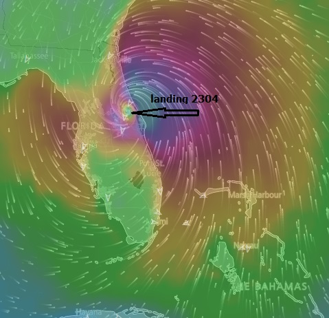
FYI, the wind velocities are represented by the colors on the map.
Of course, as it turned out, the eye stayed off-shore. Here’s the actual windytv shot from the next morning:

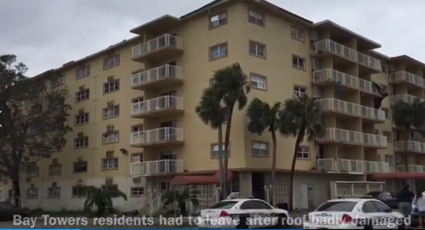
So how did Titusville (the largest coastal town on my local map) make out? Not bad at all. Here are some damage shots from FloridaToday.com, starting with this apartment complex (Titusville Bay Towers) that looks OK but has been condemned because the roof blew off, and the water damage was so severe:
And this, the standard shot of a tree that fell on a house:

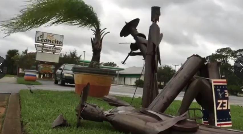
And this: Musician down! Musician Down!
Before leaving Titusville (which is essentially hookless), I have a personal story to tell. Titusville was named after Henry Titus (1823-1881). He was born in Trenton NJ, just down Route 31 from my home in Hopewell Township.
Also just a few miles from my home (and in Hopewell Township) is the town of Titusville, named after what I assume must be the same Titus family.
It just so happens that my father’s family has deep roots in the greater Trenton (Mercer County) area, with the Hill family arriving from Long Island the late 1600s. The only reason I’m living in the geographic bosom of my father’s family is because my former employer (Mobil Oil) used to operate a research facility in Hopewell Township, where I worked.
Anyway, my cousin Jim did some family research, and discovered that way back in the day, three Hill brothers married three Titus sisters. I’m not sure exactly where I’m going with this, but obviously my Hill family has a historical (and genetic) connection with the Titus family . . .
After all of the above verbiage, I’m way past due for my GE (Google Earth) spaceflight. Instead of taking off from Cape Canaveral, I’m landing there. Click HERE to check it out, then hit your back button.
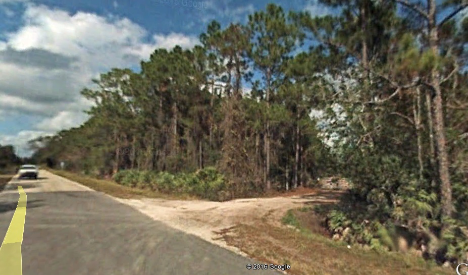
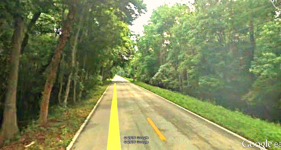
Who’d a thunk that between Orlando and Daytona Beach, I’d land in the woods? Not much for a GE Street View, but I thought I’d take a look at the dirt road you’d have to take to get close to my landing:
And here’s what the Orange Dude sees:
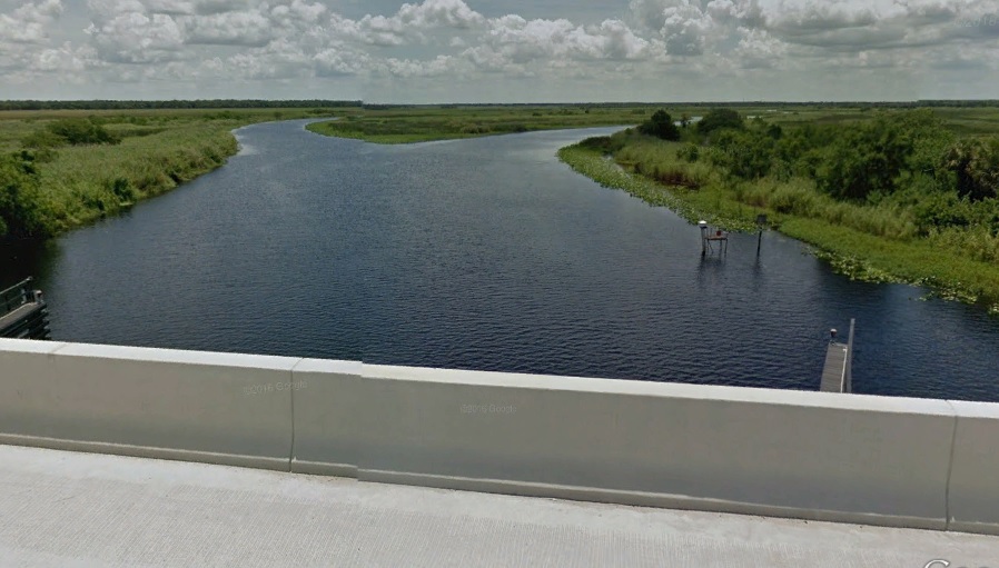
Just down the same road (headed west), I could get a look at Cow Creek:

Just for the heck of it, I thought I’d take a look at the St. Johns River:

By the way, the huge blobs of blue representing intense Street View coverage are Sanford to the south and Deltona to the north (with Orlando a little further west). Further east and north towards Daytona, it’s also intensely blue. But anyway, here’s what the Orange Dude sees:
Back to my landing, I found an article from Florida-Backwoods-Travel.com, entitled “Maytown Road – Pathway Through Florida Wilderness.” This article addresses the none-blue area around my landing. Here are some excerpts:
It’s hard to believe that just a few miles from Orlando there is a huge quiet zone that is largely unpopulated. It doesn’t really have a name. It’s the vast wilderness between Deltona, Sanford and the East coast. It’s probably 150,000 acres, more or less.
The main access through this wilderness is Maytown Road. This road starts in the small town of Osteen and heads east across Central Florida to Oak Hill on the Halifax River. It is a lightly traveled paved road. When I first traveled it some 40 years ago it was dirt all the way. It was all too easy to get stuck during muddy conditions. Today it’s a breeze to make the drive and it’s almost as quiet as it was back then.
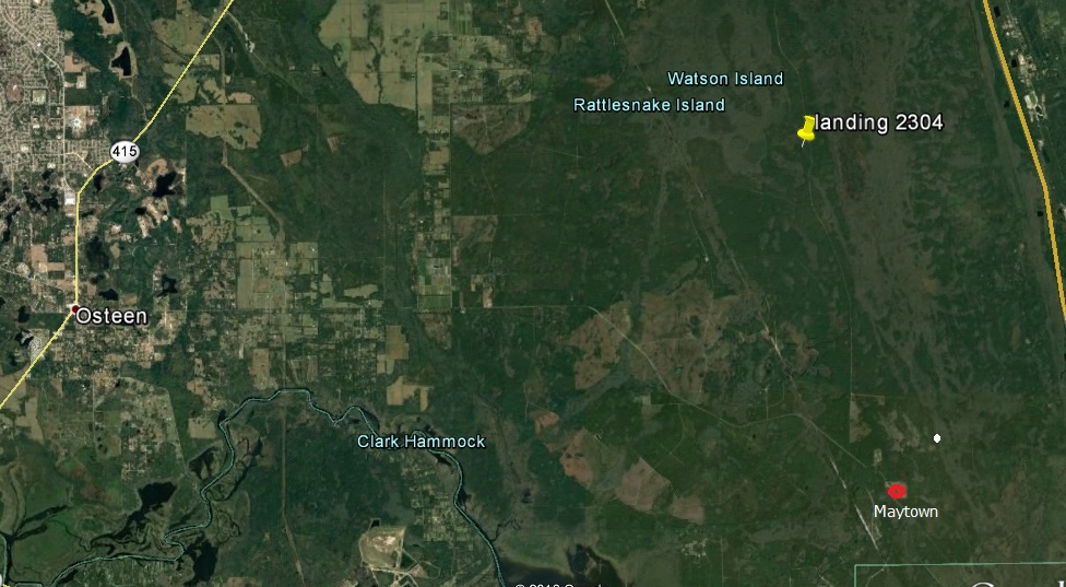
Here’s my local landing map with Maytown Road labeled:

And a GE shot, showing the area around my landing, and labeling Maytown:
Back to the write-up:
There are no real towns in this wilderness. Names of old places that maybe once existed can still be found on some maps: Kalamazoo, Farmton, Cow Creek, Maytown.
Kalamazoo is a private tract of about 11,000 acres that was once planned to be a giant celery farm and self sufficient village. Pioneers from Kalamazoo, Michigan bought the land and tried to get it started about 100 years ago.
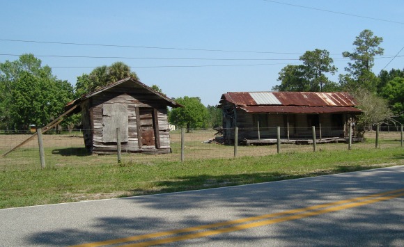
Maytown is a ghost town that used to be a crossroads for two railroads. The railroads are long gone and all that remains in Maytown are a few old abandoned buildings:
Make sure you pull off Maytown Road now and then, turn off the car engine and just listen to the quiet. You will be amazed.
Here’s a random GE Street View shot of Maytown Road near my landing:
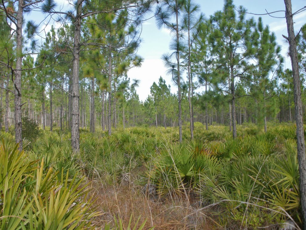
Well, boys and girls, we’ve come to one of your favorite parts of the show: checking out GE Panoramio shots, taken near my landing. These two come from 7-8 miles west of my landing. First this, by Mike Holdsworth of Palmetto (the ground cover) and “Long Leaf” evergreen trees:
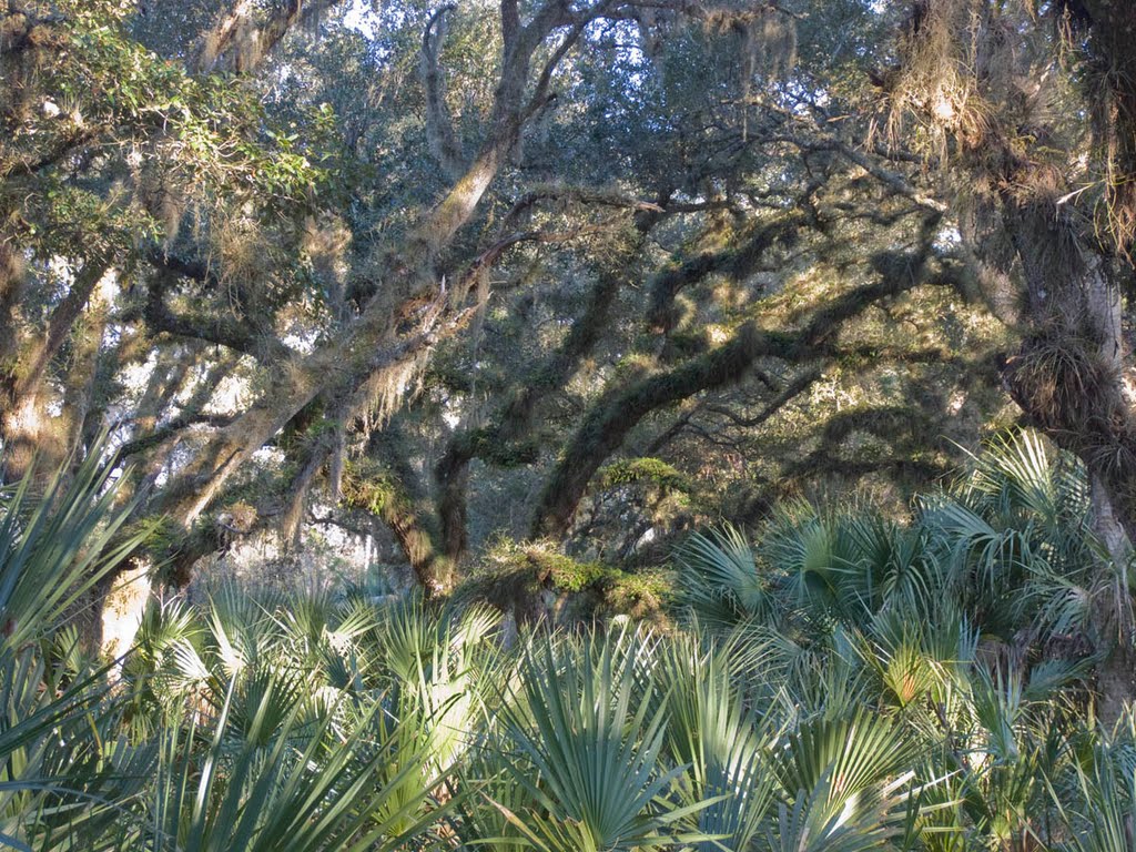
I’ll close with this artsy Live Oak / Palmetto shot by Popcorn Studios:
That’ll do it . . .
KS
Greg
© 2016 A Landing A Day
