First timer? In this formerly once-a-day blog (and now more-or-less a once or twice a week blog), I have my computer select a random latitude and longitude that puts me somewhere in the continental United States (the lower 48). I call this “landing.” I keep track of the watersheds I land in, as well as the town I land near. I do some internet research to hopefully find something of interest about my landing location. To find out more about A Landing A Day (like who “Dan” is and what the various numbers and abbreviations mean in the first paragraph), please see “About Landing,” (and “Abbreviations” and “Cryptic Numbers”) above.
Landing number 2128; A Landing A Day blog post number 556.
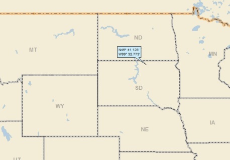
Dan: I guess that the landing god just couldn’t see his way to three record low Scores in a row, so he decided that an OSer was in order . . . SD; 59/54; 6/10; 3; 147.0. Here’s my regional landing map:
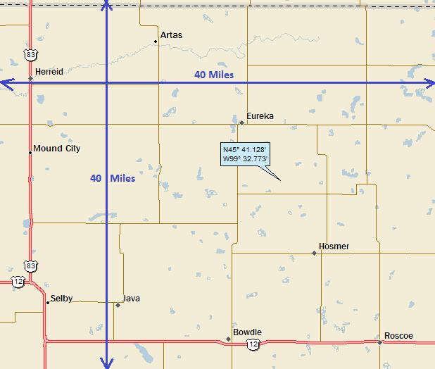
My local landing map shows a 40 mile by 40 mile area with numerous small towns:
Here’s the population rundown:
Artas 9
Eureka 868
Hosmer 208
Bowdle 502
Roscoe 329
Herreid 438
Mound City 71
Selby 642
Java 129
Hillsview 3
Don’t see HIllsview? And Hillsview got top billing? How did that happen? Well, more about that later. Anyway, add ‘em up and you get 3,199. I’ll up it to 5,000 for the entire region, assuming that a couple of thousand folks live even further out in the country. So, a 40 x 40 area is 1,600 square miles, and the population density is 5,000/1,600 = about 3 people per square mile. This comes to 0.005 people per acre (or 1 person for each 200 acres). Wow. M-T!
Any questions?
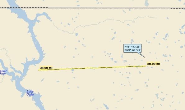
My watershed analysis ended up being simple. Here’s a streams-only map:
I landed in one of those glacial “prairie pothole” regions (click HERE to go to my Grenville SD post, which talks all about prairie potholes). Anyway, my drainage generally follows the yellow line, hopscotching from lake to lake. In reality, rainfall that lands on my landing just about never really makes it all the way to Lake Oahe (the damned up Missouri River), but because I couldn’t figure out a particular lake as an endpoint, my watershed analysis is simply Missouri River (386th hit); to the MM (834th hit).
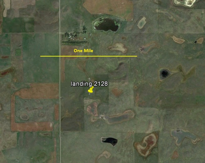
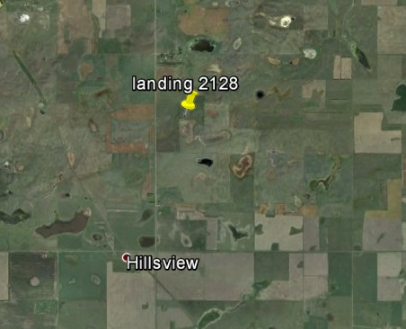
Here’s my GE shot, showing (of course), an agricultural scene:
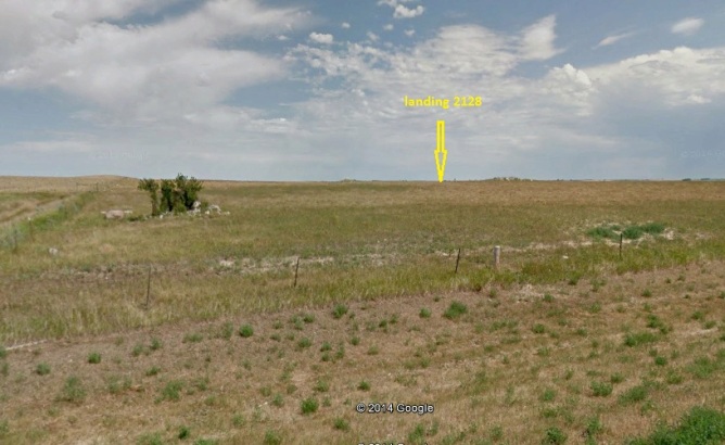
See the north-south road to the west? It’s about a third of a mile from my landing, and yes, it has Street View coverage. Here’s the view towards my landing:
Of course, I googled each and every town. Think I could find a hook? Well, I found nothing (OK, except for Hillsview, nearly nothing). Making this a unique A Landing A Day post, I’ll feature one (count ‘em) one photo from each town (except Hillsview).++++++++++ioooooooooooooooooooooooooo]-\weeeeeeeeeeeeeeeeeeeeeeeeeeeeeeeeeeeeeeeeesxzc[LORENZO THE CAT JUST WALKED RIGHT TO LEFT OVER THE KEYBOARD, HITTING THE CAPS LOCK KEY ON HIS WAY OUT].
I’ll start with Artas, and this photo by William Flood, entitled “deserted brown prairie church:”
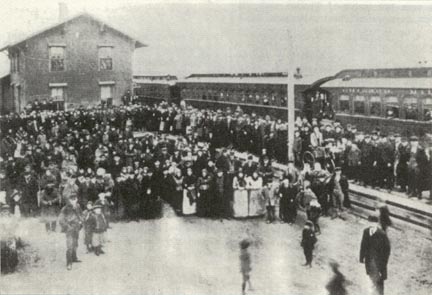
Moving to Eureka, here’s a picture from the North Dakota State University library, part of the Germans from Russia Heritage Collection. The caption is below the photo:
Seven coaches of German-Russian emigrants arrive in Eureka, SD., 1892. Photograph from the book, Eureka: 1887-1937.
And now, Hosmer. Here’s a great auto graveyard photo by Martha Mehlhaff:
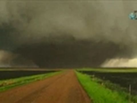
Oh my. Check out this tornado near Bowdle, from World news (wn.com):
And then in Mound City, we have this shot of the Albrecht clan (from the same NDSU Germans from Russia website):
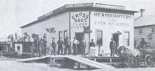
The next three photos are from the same source, starting with this turn of the century shot from Selby:
This shot of a threshing machine from Herreid:
And this shot of the Java marching band:
And, from Roscoe, this absolutely outstanding photo (credits in the caption):
So that covers all of the towns except Hillsview. So, here’s the HIllsview story. While on Google Earth, I noticed this:
So, GE shows a town not shown on my Street Atlas map. And yes, Hillsview has a Wiki entry (please read the entire piece):
Hillsview is a town in McPherson County, South Dakota. The population was 3 at the 2010 census.
As of the census of 2010, there were 3 people and 1 household residing in the town. The racial makeup of the town was 100% White.
There was 1 household of which 100% were married couples living together. 0% of all households were made up of individuals. The average household size was 3 and the average family size was 3.
The median age in the town was 53.5 years. 0% of residents were under the age of 18; 33.3% were between the ages of 18 and 24; 0% were from 25 to 44; 66.7% were from 45 to 64; and 0% were 65 years of age or older. The gender makeup of the town was 33.3% male and 66.7% female.
So, there’s one family in Hillsview. Mom and Dad are between 45 & 64 years old. Their daughter (aged 18 – 24) is still living at home. Here’s a GE shot, showing what appear to be two areas of civilization in Hillsview:
Remarkably, note that the blue lines indicate Street View coverage, and yes, the GoogleCam actually covers both areas!
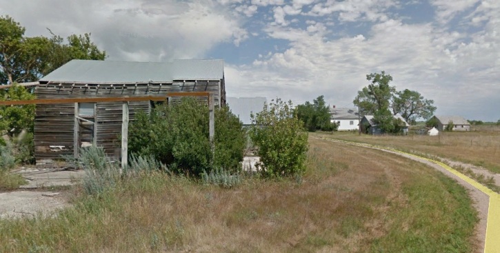
Here are a couple of shots from the southern road:
I don’t think anyone lives here.
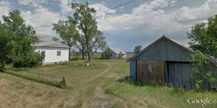
Moving north, here’s a shot of what appears to be a more lively spot (including streetlights!):
There’s actually a house behind the trees on the right side of the above photo (where I assume the three people live).
But wait! I actually stumbled on a newspaper article about Hillsview! The Bismark Tribune published a 2006 article by Dirk Lammers (an AP writer!), entitled:
Hillsview Enjoys Status as S.D.’s Smallest Town
Here are some excerpts:
HILLSVIEW, S.D. – This McPherson County town just south of Eureka once was home to a couple hundred people and boasted its own butcher shop, bank and ZIP code.
Today its residents can fit around a kitchen table.
Welcome to Hillsview – the smallest incorporated town in South Dakota.
Jim Imberi, 76, is one of Hillsview’s three residents and serves as president of the trustees. His wife, Helen, and son, Cletus, round out the population.
“Except ours, there are no houses here that are livable and nobody’s going to move a house here,” said Helen Imberi, who serves as Hillsview’s treasurer.
Cletus Imberi sits on the town board as an alderman.
Eight streetlights paid for through the town’s treasury illuminate what’s left of the village. The Imberis live on property dotted with several structures on the north side of the town’s only county road. An abandoned schoolhouse and hardware store sit across the street.
In the 1940s, Hillsview’s creamery, grocery store, blacksmith and liquor store were kept busy by residents and visitors who made their livings from the railroad, the town’s feed mills and surrounding farms.
Children such as the Imberis’ oldest son, Gervase, learned the three Rs in the town’s schoolhouse.
But a town can’t survive without young people, and young people can’t make it without good jobs, Jim Imberi said.
Asked about Hillsview’s future, Cletus Imberi said he doesn’t see much hope. Jobs are scarce, and people no longer can afford to farm off the land. He thinks most land eventually will wind up in the hands of big-city hunters.
Hillsview doesn’t levy its own tax, so the only money that comes into the town treasury is through small transportation allotments that cover such things as street maintenance.
McPherson County Auditor Steve Serr said Hillsview received $127 in the second quarter of 2005 and $260 in the third quarter.
“The only thing we really spend it on is lights, and we had our road graveled about two years ago,” Helen Imberi said. “That’s about the extent of it.”
Jim Imberi said staying incorporated allows Hillsview to keep some control.
“Dissolve it and the county gets the money, and they cut off the lights and stuff,” he said. “It’d be stupid.”
There you have it! I think the Imberi’s are smart not to collect any taxes . . .
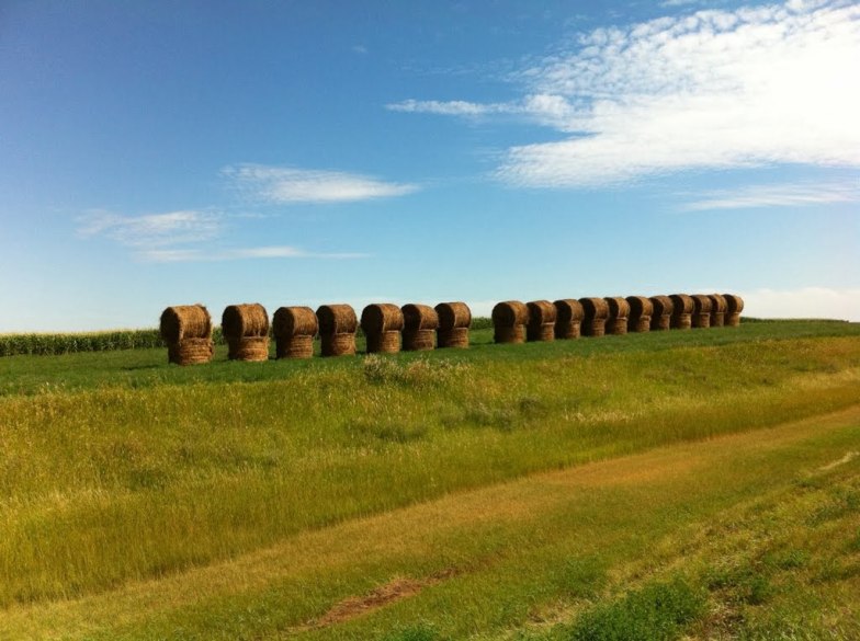
I’ll close with this lovely Pano hale bale shot by Keita202033, taken about 5 miles southwest of my landing:
That’ll do it.
KS
Greg
© 2014 A Landing A Day
