A Landing a Day

A geography blog where random is king . . .

Archive for April, 2014

McNairy County, Tennessee

Posted by graywacke on April 29, 2014

First timer?  In this formerly once-a-day blog (and now more-or-less a twice a week blog), I have my computer select a random latitude and longitude that puts me somewhere in the continental United States (the lower 48).  I call this “landing.”  I keep track of the watersheds I land in, as well as the town I land near.  I do some internet research to hopefully find something of interest about my landing location.  To find out more about A Landing A Day (like who “Dan” is and what the various numbers and abbreviations mean in the first paragraph), please see “About Landing,” (and “Abbreviations” and “Cryptic Numbers”) above.

 Landing number 2097; A Landing A Day blog post number 525.

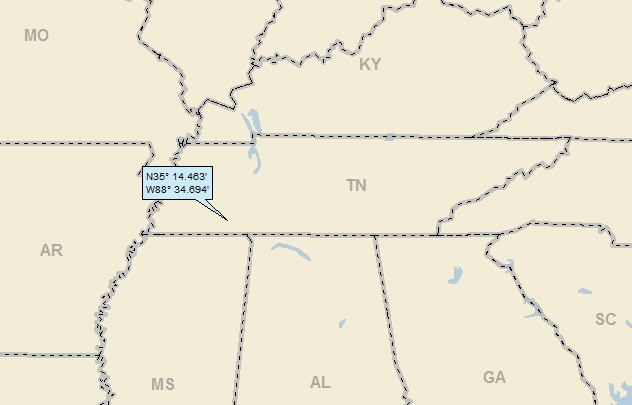
Dan –  I landed on a Perfectly-Subscribed (PS) state (29/29), which made it Over-Subscribed (OS, 30/29).  The now-OSer is . . . TN; 30/29; 7/10; 148.1.  Here’s my regional landing map:

 landing1

And my local landing map:

 landing2

For reasons that will become apparent, here’s another local landing map, showing that I landed in McNairy County (as is apparent by this post’s title):

 landing4

A streams-only map shows my watershed breakdown:

 landing3

I landed in the Cypress Ck watershed, on to the Tuscombia R (first time ever!); on to the Hatchie R (first time ever!); on to the Mississippi (824th hit).

 Note that I landed much closer to the Tennessee R than the Mississippi.  That’s just the way the watershed crumbles . . .

 In beginning my research for this post, I checked out Bethel Springs (of course), but could find out nothing.  I then moved on to Selmer.  This from Wiki:

Selmer (pop 4,400) is a town in McNairy County, Tennesseee. It is the county seat of McNairy County and is named after Selma, Alabama.  Buford Pusser served as the sheriff of McNairy County from 1964 to 1970.

 First things first.  Selmer is named after Selma?  The logic of “Selmer” escapes me.

 And then – Buford Pusser.  If you’re like me, a reference to Buford Pusser is peripherally vague (like maybe I’ve heard the name before).  However, if you’re a student of 1970’s culture, you’re likely saying “Walking Tall!!!”

 In a nutshell, Buford Pusser was a young sheriff of McNairy County (thus the county map above).  To say that he lead a storied life is putting it mildly.  Here’s some information about the man, from Wiki:

Buford Pusser (1937 – 1974) was the Sheriff of McNairy County, Tennessee, from 1964 to 1970. Pusser is known for his virtual one-man war on moonshining, prostitution, gambling, and other vices on the Mississippi-Tennessee state-line. His efforts have inspired several books, songs, movies, and a TV series.

 Phew.  Now you see why I had to feature the guy!  Here’s some more:

Pusser was Adamsville’s police chief [see landing map] and constable from 1962 to 1964. He then was elected sheriff of McNairy County, Tennessee, after incumbent sheriff, James Dickey was killed in a freak auto accident, becoming the youngest sheriff in Tennessee’s history. Pusser promptly began trying to eliminate the Dixie Mafia and the State Line Mob.

 I’ll start out with a musical tribute to Mr. Pusser I found on You Tube (put up by AuburnTigersFan12):


With some further info on both his life and the 1973 movie “Walking Tall,” here are some excerpts of a USA Today piece from April 1974 (published only a few months before he died; more about that later):

The big sleeper movie hit of the past year—in parts of the South it has out-grossed The Godfather—is Walking Tall.  It is the real-life story of a crusading, club-swinging Tennessee sheriff named Buford Pusser. Or is it? When pressed as to the film’s fidelity during a 44-state promotion tour, Pusser concedes that Walking Tall was, well, “about 80% real,” 20% cinematic license.

The indisputable facts about Pusser were dramatic enough before Hollywood ever moved in. As a beefy (6’6″) 19-year-old, he accused one of the illegal casinos along the Mississippi border of cheating him out of $300 with loaded dice. He was beaten up so badly that his wounds needed 192 stitches. When he recovered, Buford went after his assailants with a hickory stick.

That was the beginning of a campaign over the next few years (culminating in his years as the McNairy County Sheriff) to close down the so-called “shopping center for sinners” flourishing on the Tennessee – Mississippi state line. In the process Buford was involved in the controversial shootings of a couple of citizens and took a few bullets and beatings himself before a final tragic automobile ambush in which his wife was killed and his face was riddled by rifle fire.

Seven years and 16 plastic-surgery operations later, Pusser’s face has been largely restored, and he is living comfortably on his 7% piece of the movie profits and $1,000 per personal appearance. And, at 36, he has been the further subject of ballads, a biography (The Twelfth of August) and “Buford for Governor” bumper stickers all around the state. (“I have no plans to run now,” he says.)

In the movie account of all this, Joe Don Baker was cast as Buford. The movie clearly takes some liberties.  For example, Pusser is depicted as a former Marine hero when, in fact, he was medically discharged shortly after basic training because of asthma. Further, Walking Tall uncritically glorifies Pusser’s violent, perhaps overzealous enforcement of justice, of which even Buford now says, “I may have bent the law at times.”

The producers, having already grossed $40 million on a film shot for $1.5 million, are naturally contemplating a sequel.

 Moving along to the real Buford.  Tragically, his wife was murdered during an attempt on Buford’s life.  Here’s a local newspaper headline about the murder of Mrs. Pusser:

newspaper headline about mrs pusser

 Check out this account of the murder and the aftermath (from Wiki):

According to Pusser, on the pre-dawn morning of August 12, 1967, his phone rang, informing him of a disturbance call on New Hope Road in McNairy County. He responded, with his wife Pauline joining him for this particular ride.

Shortly after they passed the New Hope Methodist Church, a car came alongside Pusser’s; and the occupants opened fire, killing Pauline and leaving Pusser, who had suffered a bullet wound to the chin, for dead. He spent eighteen days in the hospital before returning home and would need several more surgeries to restore his appearance.

Pusser vowed to bring all involved with his wife’s death to justice.  He identified four assassins: Carl “Towhead” White, George McGann, Gary McDaniel, and Kirksey Nix.  As it turned out, Pusser did not have sufficient evidence to bring anyone to trial.

On April 4, 1969 White was gunned down in front of the El Ray Motel on U.S. Highway 45 in Corinth, Mississippi. The alleged triggerman was a small-time hood named Berry Smith.  W.R. Morris, author of The State Line Mob: A True Story of Murder and Intrigue, wrote in 1990 that Pusser himself had hired the hit man who killed White with one shotgun blast to the head.

In late 1970, both McDaniel and McGann were found shot to death in Texas. Pusser was suspected by some law enforcement officials of having killed both, but was never tied to either murder.

Nix, never legally charged in the case, nonetheless lived a life of crime, and spent much of his life in prison (where he died) for two unrelated murders.  Nix has repeatedly refused to comment about Pusser’s claims that he was one of Pauline Pusser’s killers.

 Phew. 

I thought that I needed to see the movie before completing this post.  I went on Netflix.  No luck.  I looked in the DVR library.  No luck.  While I’m sure that I could have downloaded an illegal copy of the movie, I went on Amazon to buy a DVD. 

 Unbelievably, a new DVD cost $70+, and the cheapest used I could find was $14!!  So, I bought the used DVD and, after writing all of the above portions of this post, sat down with my wife Jody to watch the film.

 I figured it was going to be violent (making Jody turn away from the screen), and it was (and she did).  But all in all, it was a good movie.  After my internet research, I was obviously aware of the real-life Pusser and the fact that the movie took some liberties.  But knowing that his wife was going to be murdered was tough. 

 I’ve always been one to shed tears during emotional moments (weddings; listening to great live music; seeing great art; or getting my heartstrings intentionally tugged as was the case here).  And sure enough, I had enough invested in Buford and his wife (and the movie was done well enough) that some big ol’ tears went tumblin’ down my cheeks as the grisly murder scene inevitably unfolded.  Knowing that it was true makes it pack quite the wallop.

 The most obvious “flaw” in the real-life story is the murky way Buford’s wife’s murder was never really resolved.  Was Pusser actually responsible for any of the deaths of the people he accused?  No one knows.  The movie side-stepped all that with Buford driving his car into the speak-easy that was the site of the prostitution ring that was the focus of much of the movie, killing two of the proprietors who were inside (and who were two of the gunmen in the car that opened fire). 

 So . . . the real Buford lived long enough to collect some movie royalties.  What did he do with his new-found wealth?  Bought a souped-up Corvette.  And, at age 37, what did he do with his new Corvette?  Got behind the wheel  drunk, and lost control at high speed.  He didn’t make it. . .

 Getting back to more traditional ALAD fare while staying with Buford for a while, here’s the “Welcome to Adamsville” sign (Pano by Ben Tate):

 pano ben tate welcome to adamsville

Also by Ben, here’s a shot of the entrance to the Buford Pusser Museum in Adamsville:

 pano ben tate pusser museum

I’ll end with a couple of Pano shots by Trbfl15, both within a few miles of my landing.  First, apparently there’s a logging industry in McNairy County (which, by the way, is how Buford’s father made a living):

 pano trbf15 clear cut

And apparently, they grow a little cotton here as well:

pano trbf15 cotton field


That’ll do it.

 KS

 Greg


© 2014 A Landing A Day


Posted in Uncategorized | Tagged: , , , , , | 1 Comment »

Mine La Motte, Missouri

Posted by graywacke on April 23, 2014

First timer?  In this formerly once-a-day blog (and now more-or-less a twice a week blog), I have my computer select a random latitude and longitude that puts me somewhere in the continental United States (the lower 48).  I call this “landing.”  I keep track of the watersheds I land in, as well as the town I land near.  I do some internet research to hopefully find something of interest about my landing location.  To find out more about A Landing A Day (like who “Dan” is and what the various numbers and abbreviations mean in the first paragraph), please see “About Landing,” (and “Abbreviations” and “Cryptic Numbers”) above.

 Landing number 2096; A Landing A Day blog post number 524.

Dan –  A new all-time record low Score, thanks to this landing in USer . . . MO; 45/48; 7/10; 147.7.  Here’s my regional landing map:

 landing1

Even though my lat/long marker obscures the name of the state, trust me, it’s Missouri.  My local landing map shows my proximity to Frederickstown as well as my titular “Mine La Motte:”

 landing2

You can see some watershed information on the above map as well.  I landed in the Stannett Creek watershed, on to a new river for me, the Castor; on to another new river, the Little; on to the St. Francis River (4th hit); on to the Mighty Mississippi (823rd hit).

 Although this was my first landing on this particular Little River, believe it or not, this was my 14th “Little River.”

 Here’s a Panoramio shot of the Castor from just west of my landing, by PurpleBirch65:

purplebirch65 castor river

Great looking river!

Back to my landing, here’s Google Earth (GE) shot, showing a woodsy rural setting:

GE1

You’ll note the big yellow arrow (how could you miss it?).  There’s StreetView coverage on that road, and the arrow shows the location and orientation of this StreetView shot:

 GE2 StreetView

If you wanted to visit my landing spot, this is the dirt road down which you would need to travel . . .

 No offense to Frederickstown, but I couldn’t find a hook.  Of course, I saw the “town” with the intriguing name of Mine LaMotte.  I had to check that out.  From Wiki:

Mine La Motte is an unincorporated community located about six miles north of Fredericktown.  Mine Lamotte dates back to the 1600’s when the Indians practiced lead mining on a small scale.  Europeans then discovered lead here, and Antoine de la Mothe Cadillac brought several hundred workers, including slaves from Santo Domingo, to develop mines in 1717 making it one of the oldest settlements west of the Mississippi River.

La Mothe named the mine after himself, and the town that grew up nearby was named after the mine. In 1804 the village had a population of 150 inhabitants.

Old Monsieur de la Mothe Cadillac got around.  He built a fort at what is now Detroit, and the Cadillac automobile was named after him, as was Cadillac Mountain in Maine.

 Anyway, it’s amazing to me that this early French explorer found lead deposits out in the middle of nowhere and had the technical abilities to mine the stuff.  I wonder how he managed to find the place?  Maybe he had an Indian guide who learned French who could tell him about the lead deposits (since evidently the Indians mined the lead themselves).

 I imagined fairly subtle lead deposits – maybe not obvious to the naked eye.  But I’m wrong about that.  From Wiki about the Southeast Missouri Lead District:

 The Southeast Missouri Lead District, commonly called the Lead Belt, is a lead mining district in the southeastern part of Missouri.

The Lead Belt contains the highest concentration of galena (lead sulfide) in the world. Mineral specimens from the Lead Belt are highly prized by gem and mineral collectors and are found in museums worldwide.

 Exactly why lead ended up being deposited here is a little esoteric, so I’ll skip it.  But here’s a Wiki picture of galena and a calcite crystal (from southeast Missouri).  You can see why the Indians and Monsieur de la  Mothe Cadillac knew there was lead around . . .

 galena & calcite, wiki from missouri

Here’s a close-up of galena, also from Wiki:

 galena closeup wiki

If anyone had any doubt that it was lead, all they had to do was pick it up.  Its specific gravity is 7.5, which means it’s 7.5 times has heavy as water, or almost three times as heavy as an “ordinary” rock.

 From MyLearning.org, this about historical processing (“smelting”) of galena:

 The smelting process is essentially very simple. Pellets of Galena are heated until they reach melting point. Because lead has a low melting point any impurities are not melted and are left as waste. The molten lead can be allowed to drain from the fire hearth into a collecting pot and then poured into molds to form blocks of pure lead metal.

To achieve the temperatures necessary (600-800ºC) to melt the lead from the Galena requires a source of fuel. These temperatures can be achieved with a wood fire along with a constant stream of air to aid combustion.  The air was historically provided by the use of hand bellows, but as mechanization increased the use of a water wheel to drive huge bellows became common.

The heated Galena gives off poisonous fumes (particularly Sulfur Dioxide and also Vaporised Lead). In early small scale smelting these escaped into the atmosphere.

I found a video of a crude galena smelter from Bali where some local guys are gettin’ it done.  This is definitely worth your while:


 Not quite up to U.S. safety standards, eh?  Especially considering that the fumes are toxic . . .

 I also found this video, which I find amusing.  It’s a promotional video for a huge lead smelting operation in China.  The soundtrack is George Winston’s version of Pacabel’s Canon.  No need to bother with the whole video unless you particularly enjoy the music:


 A personal aside (which, Dan, you may remember):  I’m a piano player, and years ago learned to play George Winston’s version of the song.  In fact, I played it as the processional for my daughter Willow’s wedding . . .

 Anyway, in and around Mine La Motte are several lakes which are the result of the historical lead mining operations.  At least one of the lakes is a commercial recreation area where one can swim, use zip lines, go scuba diving (including diving in the old mines).  It’s known as The Offsets, which is a former name for one of the local mines.  Here’s a picture of the lake from TheOffsets.com:

 offsets website photo

Here’s a quick video of people riding the zip lines:


 I’ll close with this shot of the road between Frederickstown & Mine La Motte, by Studio 222:

 studio 222 road shot

 That’ll do it.

 KS

 Greg


© 2014 A Landing A Day

Posted in Uncategorized | Tagged: , , , , , , | Leave a Comment »

Breckenridge, Texas

Posted by graywacke on April 18, 2014

First timer?  In this formerly once-a-day blog (and now more-or-less a twice a week blog), I have my computer select a random latitude and longitude that puts me somewhere in the continental United States (the lower 48).  I call this “landing.”  I keep track of the watersheds I land in, as well as the town I land near.  I do some internet research to hopefully find something of interest about my landing location.  To find out more about A Landing A Day (like who “Dan” is and what the various numbers and abbreviations mean in the first paragraph), please see “About Landing,” (and “Abbreviations” and “Cryptic Numbers”) above.

 Landing number 2095; A Landing A Day blog post number 523.

 Dan –  For the third time in the last 12 landings, I find myself in . . . TX; 154/184; 6/10; 148.3.  Here’s my regional landing map:

 landing1

My local landing map shows that I landed near Breckenridge:

 landing2

Zooming back a little, you can see that I landed very close to a previous landing (landing 2018, my Ft. Griffin post of April 2013).  I’ve decided to ignore Ft. Griffin and concentration instead on Breckenridge.

 landing3

Here’s my Google Earth (GE) shot, showing a ill-defined, semi-arid, rural landscape:

 GE1

My streams-only map shows a fairly straightforward watershed analysis:

 landing4

This was my 5th landing in the Clear Fork of the Brazos River watershed (making it the 153rd river on my list of rivers with five or more hits); on to the Brazos (29th hit).  As shown here, the Brazos goes by Waco, but by no other major cities on its way to the Gulf:

 landing5 regional streams

 From Wiki, about the Brazos:

The Brazos River, called the Rio de los Brazos de Dios by early Spanish explorers (translated as “The River of the Arms of God”), is the longest river in Texas and the 11th longest river in the United States with a length of 1,280 miles.

There seems to be no definitive word on why the river was called “Arms of God,” but I like it and am sorry the name was shortened to “Arms.”

 Moving along to Breckenridge, this from Wiki:

 Breckenridge was a major oil producer in the early 1920s. The population jumped from a thousand to fifty thousand in under five years.

This was one of those genuine Texas Oil Boom Towns.

After checking out Google images, I quickly found that one of Breckenridge’s favorite sons was one Basil Clemons.  From the University of Texas, Arlington libraries (which published a guide to the Basil Clemons photograph collection) I learned that Basil was born in 1887 in Alabama; lived in California where he learned the art of photography; spent time in Alaska taking pictures, but ended up in Breckenridge Texas. 

 basil clemons photo

Here’s a quote from the webpage:

While traveling with a circus in 1919, he returned to Texas. After receiving word that his studio in Seattle was destroyed by fire, he headed toward the oil boom town of Breckenridge in Stephens County, Texas. There he photographed the oil fields, the town, and its surrounding communities, until blindness and other health problems ended his career in 1949.

Clemons lived and developed his photographs in a gypsy wagon without benefit of running water or electricity. Unfortunately, there are no photos in the collection of this wagon other than small portions of the interior or exterior in an occasional print. His photographs epitomize small town America, particularly in the 1920s and 1930s.

This will be a simple post, featuring back-in-the-day shots of Breckenridge by Mr. Clemons.  I’ll start with this one (with Clemon’s own caption below):

car and horse uta.edu

Down In Breckenridge, Texas Where Horses Ride in Fords

 Here’s a shot of a 1929 high school football game:

 1929 football breckenridge 26-0 over abilene

Final score:  Breckenridge 26, Abilene 0.

 Here’s a unique shot!  That’s a rattlesnake being cooked for dinner at the campsite:

 Camp_Ladies rattlesnake roast

The circus came to Breckenridge.  Here’s a featured act:

 elephant trick

A shot of the Breckenridge fire chief on the job:

 Fire_Chief

Here are some shots that might not be from Clemons.  Here’s an oil derrick on Main Street from NY Times archives)

 oil rig 1920 ny times

Speaking of oil derricks, here’s a sea of oil derricks just outside of Breckenridge:

 texas tech old oil field shot

From TXRRHistory.com, here’s a shot of the train station:

 txrrhistory.com old depot

And the elegant Regal Theater (cinematreasures.com):

 regal theater cinematreasures.org

 Going back to Basil, I’ll close with this great shot of . . . well, I’ll just let the picture speak for itself:

 clemons ut arlington

That’ll do it.

 KS

 Greg


© 2014 A Landing A Day

Posted in Uncategorized | Tagged: , , , | 2 Comments »

Circle, Montana (revisited and revisited again)

Posted by graywacke on April 12, 2014

First timer?  In this formerly once-a-day blog (and now more-or-less a twice a week blog), I have my computer select a random latitude and longitude that puts me somewhere in the continental United States (the lower 48).  I call this “landing.”  I keep track of the watersheds I land in, as well as the town I land near.  I do some internet research to hopefully find something of interest about my landing location.  To find out more about A Landing A Day (like who “Dan” is and what the various numbers and abbreviations mean in the first paragraph), please see “About Landing,” (and “Abbreviations” and “Cryptic Numbers”) above.

 Landing number 2094; A Landing A Day blog post number 522.

Dan –  No big deal (I hope), as I landed in my second OSer in a row . . . MT; 119/101; 5/10; 148.8.  We’ll see if I can avoid yet another OSer streak.  Here’s my regional landing map:

landing1

My closer-in landing map shows my proximity to Brockway & Circle:

 landing2

My Google Earth (GE) shot shows that I landed in a farm field surrounded by some peculiar-looking knobs:

 GE1

Zooming back a little, we can see even more knobs.  Gee, if I knew a competent geologist, maybe he or she could help me figure out what these are  . . .

 GE2

Here’s a larger-scale landing map, showing that I landed not far south of the Fort Peck Lake, which is actually the dammed up Missouri River.  The long, south-pointing arm of the lake is thanks to the Big Dry Creek.  Drainage from my landing makes its way there via Skull Creek. 

 landing3

This was my third landing in the Big Dry Creek watershed; my 381st for the Missouri and my 822nd for the MM.

 Funny thing, but Circle seemed familiar; I could even picture in my mind the town logo from a town website.  Searching back, son of a gun if I didn’t land there back in October of 2008 (landing 1566); less than a month before I began blogging.

 This is an opportunity to go over a little A Landing A Day history.  It’s all in “About Landing,” (see the tab on the page above), but I’ll bring it out for this landing. 

 So, I begin every post with “Dan –“ 

 Dan used to live next door (when he was a kid).  His parents still do.  I’ve known Dan almost all of his life – he’s now 27 and living in Denver (and happily married to Anya).  For years and years, Dan spent quite a bit of time at our house because he was best friends with my son Jordan.  Dan happened to be at our kitchen table when I was landing, way back before blogging.  Back then, I simply kept up a spreadsheet with lat/long; nearest town and watershed analysis; and my statistical analysis about states being oversubscribed (OS) or undersubscribed (US).

 Dan expressed an interest in what I was doing, and he asked if I could email him and tell him where I landed each day.  So I did. 

 After Dan went off to college, I began making my emails to him more and more elaborate, until they started looking a little like one of my typical posts. 

 I saw Dan when he was home for a weekend in the fall of 2008.  He said to me something like:  “You’ve got to turn those emails into a blog!”  Dan was familiar with WordPress, and told me that when he was home for Thanksgiving, he’d help me set up my blog.  So that’s what we did, and I couldn’t resist making each post look like an email to Dan.

 So, back to today’s landing near Circle.  When I landed near Circle (October 2008) I was sending fairly elaborate emails to Dan.  Here it is, in its entirety (and let me say that “LG” stands for Landing God, the mythical being who controls my “random” landings):

 10/7/08

 Dan –  Once again, the LG does not want me to become too arrogant and cocky about setting new records and all.  And once again, in his infinite wisdom, the LG has seen fit to saddle me with yet another . . . MT; 94/75; 4/10; 8; 165.5.

 I landed a mere 22 miles due south of where I landed two days ago (near Vida, as you will recall).  As with two days ago, I landed in the Redwater R watershed (4th hit); on to the Missouri. 

 Here’s the StreetAtlas map showing five tightly-clustered landings in McCone County.  The landing two days ago is the northern-most; today’s is the most centrally-located of the five landings.  The Missouri River is the squiggly line at the top.

 old landing map

[Note:  Back then, all of my landings (all 1566 of them) were saved on my Street Atlas map.  Unfortunately, in January 2013 I had to “upgrade” to a newer version of StreetAtlas and lost all of my old locations.  Just for the heck of it, here’s today’s landing with the McCone County boundary shown:]

landing4 mc cone county

Back to my 2008 landing: 

I landed near the town of Circle.  From the Town’s Website:

 old circle website stuff

 Great logo, eh?  “A Great Place to be Around.”  Anyway, that’s the Redwater River visible in the aerial photo above.  More from the town’s website (although I could find nothing on the town’s history or how it got its name):

 The 600 plus residents who reside in Circle enjoy this quiet, peaceful farming and ranching community.  They are not only proud of their heritage, but also of the services that the community can provide.

 The current climate has 4 seasons.  In the winter this area will generally miss the blizzards and heavy snow that pass to the south of us.  The temperature is warmer than the Montana Hi-Line and cold spells are broken with warm chinook winds.  The spring will have some general rains; the summers are nice with about 4 weeks of hot summer weather.  Fall is beautiful, clear, warm weather.  The air is clear and the sky is blue.

 I like the part about the “current” climate.  I guess that during the Ice Age, they may have not had 4 seasons, and maybe during the upcoming Warm Era, they may not also. . . .

 Here’s a shot just outside of Circle:

 old highway shot

And another:

 old nearby scenery

Here’s a smattering of street names in Circle:

 Idaho, Dakota, Washington, Minnesota, North, Railroad, Valley, Custer, Wyoming, Montana, Colorado, and, of course, Main.  Think we’re out west?

 And, an item of further interest (from This Day in Montana History):

 June 20, 1921:  The Army Corps of Engineers snag boat Mandan docks at Fort Benton, Montana.  The Mandan is the last steamboat to reach this historic inland port, although river traffic has been nonexistent since the coming of the railroads three decades earlier.

 June 20, 1921:  On the same day that the Mandan docks in Fort Benton, the town of Circle receives 11.5 inches of rain in a 24-hour period, setting a state record.

 I believe the rainfall record still stands; a heckuva thunderstorm, eh?. 

 Note:  Fort Benton is a couple of hundred miles upstream on the Missouri R from the general McCone County area. I wonder why the Mandan bothered making the trip?

 Here’s a painting of a snag on the Missouri River:

 old picture of a missouri r snag

And here’s a picture of a snag boat (not the Mandan, but I suspect similar):

 old snag boat

 KS

 Greg

 Not bad, eh?  Note that I didn’t say “That’ll do it.”

 I do have a little update.  There’s now a Circle Chamber of Commerce website that gives a little history:

The Town of Circle inherited its name from the brand of the Mabry Cattle Corporation who came here in 1884.  It was common at that time for a ranch to be known by its brand rather than the company or major owner’s name.  In 1905 Peter Rorvik started a store and post office in the old ranch house and naturally name the Post Office “Circle”.  The little town catered to ranchers and farmers.  When McCone County was formed in 1919 Circle won the county seat, an important factor in the towns growth.

 And here’s something that’s really funny.  If this landing were my first Circle landing, I never would have found the “Circle” logo that I liked so much back in 2008.  Today, it’s not on the town Camber of Commerce website.  However . . . if you Google Circle Montana, and go to “Images,” You will see the old circle logo on one and only one image.  The link?  Yours Truly:  A Landing A Day!

 Wait!  A Landing A Day is the link to the Circle logo on Google Images?  That doesn’t make sense.  Unless, I landed in Circle sometime after I began blogging.  Oh my.  Sure ‘nuf.  I missed the fact that I have a Circle landing posted in May, 2010.  Here’s more than a little of that post:

Dan –  After hitting 150.0, I’m 2/8, with today’s OSer . . . MT; 111/91; 4/10; 2; 151.5.  Here’s a somewhat-more-expanded-than-usual landing map, showing a cluster of landings around the peculiarly-named town of Circle.  Today’s landing is the eastern-most:

 old landing10


[Oh my!  This was my infamous 150 landing.  Click HERE to learn more about a Score of 150.]

 Moving on to Circle – it turns out that one of the clustered landings around the town of Circle occurred just before I started this blog, in November 2008.  In my email to you back then, I remarked on the cool logo shown on the town’s website:

 old circle logo pic

You have to the love the slogan – “A Great Place to be Around.”

 Back then, I remarked that I couldn’t find any information about the reason for the name “Circle.”  Well, that was then, and this is now.  Here’s a plaque in town:

 old plaque

If you read it carefully, you’ll see that one Major Seth Mabrey was a big time cattle driver/rancher, in the area, and the brand he used was a simple circle – thus the name.  Well, I Googled ol’ Seth, and out popped an amazing Old West story about Dodge City Kansas that mentions the good Major.  This book was written by an old cowpoke who was there in Texas (and in Dodge, I think) when the events discussed occurred.  Here’s the cover page of the book:

DODGE CITY, THE COWBOY CAPITAL and THE GREAT SOUTHWEST in The Days of The Wild Indian, the Buffalo, the Cowboy, Dance Halls, Gambling Halls, and Bad Men

 BY   ROBERT M. WRIGHT, Plainsman, Explorer, Scout, Pioneer, Trader and Settler

(1913, 2nd. Edition)

 I’ve lifted the story that mentions Major Mabrey.    I’ve done just a little editing here and there.  This is pretty long, but trust me, well worth the read:

 Two of the greatest gamblers and faro-bank [an old west card game] fiends, as well as two of the most desperate men and sure shots, were Ben and Billy Thompson. Every year, without fail, they came to Dodge to meet the Texas drive [cowboys had an annual cattle drive from Texas up to Dodge Kansas, which had a railroad station]. Each brother had killed several men, and they were both dead shots. They terrorized Dodge City and Ellsworth county, the first year of the drive to that place, killed the sheriff of the county, a brave and fearless officer, together with several deputies, defied the sheriff’s posse, and made their “get away”.

 A large reward was offered for them and they were pursued all over the country; but, having many friends among the big, rich cattlemen, they finally gave themselves up and, through the influence of these men who expended large sums of money in their defense, they were cleared. Ben told the writer that he never carried but one gun. He never missed, and always shot his victim through the head. He said, when he shot a man, he looked the crowd over carefully, and if the man had any close friends around or any dangerous witness was around, he would down him to destroy evidence. The last few years of his life, he never went to bed without a full quart bottle of three-star Hennessey brandy, and he always emptied the bottle before daylight. He could not sleep without it.

 Ben was a great favorite with the stockmen. They needed him in their business for, be it said to their shame, some of them employed killers to protect their stock and ranges and other privileges, and Ben could get any reasonable sum, from one hundred to several thousand dollars, with which to deal or play bank.

 Ben Thompson was the boss of gamblers and killers in Austin, and another man – Bishop, I think was his name – was the boss of gamblers and killers in San Antonio.  Great rivalry existed between these two men, and they were determined to kill each other. Word was brought to the Bishop that Ben was coming down to San Antonio to kill him, so he had fair warning and made preparations. Ben arrived in town and walked in front of Bishop’s saloon. He knew Ben was looking for the drop on him, so he stationed himself behind his screen in front of his door, with a double-barreled shotgun. Whether Ben was wise to this, I do not know, but when Ben came in, he fired through this screen, and the San, Antonio man fell dead with a bullet hole in his head, and both barrels of his gun were discharged into the floor.

 Ben was now surely the boss, and numerous friends flocked to his standard, for “nothing succeeds like success”. Some say that this victory made Ben too reckless and fool-hardy, however.

 Some time after this, the cattlemen gathered in Austin at a big convention – something like three thousand were there. At this convention, Ben was more dissipated and reckless than ever, and cut a big figure. There was a congressman who was Ben’s lawyer and friend (I won’t mention his name). After the convention adjourned, thirty or forty of the principal stockmen and residents of Texas remained to close up business and give a grand banquet (and let me say right here, these men were no cowards).

 That night, Ben learned that they had not invited his congressman, to which slight he took exceptions. The plates were all laid, wine at each plate, and just as they were about to be seated, in marched Ben with a sixshooter in his hand. He began at one end of the long table and smashed the bottles of wine, and chinaware as he came to it, making a clean sweep of the entire length of the table.  Let me tell you, before he got half through with his smashing process, that banquet hall was deserted. Some rushed through the doors, some took their exit through the windows, and in some instances the sash of the windows went with them and they did not stop to deprive themselves of it until they were out of range.

 This exploit sounded Ben’s death knell, as I remarked at the time that it would, because I knew these men.

 Major Seth Mabrey [the Circle connection!] was asked the next day, what he thought of Ben’s performance. Mabrey had a little twang in his speech and talked a little through his nose. In his slow and deliberate way, he said: “By Ginneys! I always thought, until last night, that Ben Thompson was a brave man, but I have changed my mind. If he had been a brave man, he would have attacked the whole convention when we were together and three thousand strong, but instead, he let nearly all of them get out of town, and went after a little bunch of only about forty of us.”

 After this, the plans were laid to get away with Ben. He was invited to visit San Antonio and have one of the good old-time jamborees, and they would make it a rich treat for him.  He accepted.  They gave a big show at the theater for his special benefit. When the “ball” was at its height, he was invited to the bar to take a drink, and, at a given signal, a dozen guns were turned loose on him. They say that some who were at the bar with him and who enticed him there were killed with him, as they had to shoot through them to reach Ben.

 At any rate, Ben never knew what hit him, he was shot up so badly. They were determined to make a good job of it, for if they did not, they knew the consequences. Major Mabrey was indeed a cool, deliberate and brave man, but he admitted to outrunning the swiftest of them when the bullets started flying.

 Major Mabrey would hire more than a hundred men every spring for the drive, and it is said of him that he never hired a man without first looking him over carefully.  Months after he could call him by name and tell when and where he had hired him.

 The Major built the first castle or palatial residence on top of the big bluff overlooking the railroad yards and the Missouri River, in Kansas City.

 A truly amazing look at the Old West.  The lawlessness can only be imagined!

OK.  I’m back.  The NOW me.  This April 2014 landing.  I’ll close with some Pano shots from near my landing.  Here’s a lovely shot of Brockway (the town closest to today’s landing), by Mark Van Fleet:

pano brockway mark van fleet

Here’s a shot taken 10 miles east of my landing, by Chris Carroll  (most definitely copyrighted  . . . ):

 pano chris carroll great shot 10 mi e

Here’s a shot from 10 miles west of my landing of some badlands, by J Belote:

 pano j belote badlands 10 mi w

I’ll close with this lovely shot from 10 miles east of my landing, once again by Mark Van Fleet:

 pano mark van fleet 10 mi e

 KS

 Greg


© 2014 A Landing A Day

Posted in Uncategorized | Tagged: , , , , | Leave a Comment »

Tacoma, Washington

Posted by graywacke on April 7, 2014

First timer?  In this formerly once-a-day blog (and now more-or-less a twice a week blog), I have my computer select a random latitude and longitude that puts me somewhere in the continental United States (the lower 48).  I call this “landing.”  I keep track of the watersheds I land in, as well as the town I land near.  I do some internet research to hopefully find something of interest about my landing location.  To find out more about A Landing A Day (like who “Dan” is and what the various numbers and abbreviations mean in the first paragraph), please see “About Landing,” (and “Abbreviations” and “Cryptic Numbers”) above.

 Landing number 2093; A Landing A Day blog post number 521.

 Dan –  After five USers, a return to a western OSer . . . WA; 52/49; 6/10; 148.5.  Here’s my regional landing map:

 landing1

Here’s my close-in landing map (which is what  I saw  after entering my lat/long into Street Atlas):

 landing2

Quite the urban landing, eh?  Near the intersection of  S Fawcett and S 52nd.  Let’s take a close-in look via Google Earth (GE):

 GE1

Hmmm.  I landed in a clump of trees in someone’s back yard near an alley.  And yes, the nearby street (South Fawcett Ave)  has Street View coverage!  Here’s a look up the alley.  My landing is in the trees behind the garage:

 GE2

Backing up a little, here’s another map showing that I landed in South Tacoma:

 landing2a

I quickly realized that I landed near here not long ago – here’s a map showing my nearby Olympia landing (actually posted as Boston Harbor):

 landing3

Remember that post?  I featured those ugly mammoth clams known as geoducks . .

 My watershed analysis isn’t much.  See the map above (2 maps up), where you see “Commencement Bay?”  See all of those fingers of water?  Those are actually Port of Tacoma features.  The western-most finger is the Thea Foss waterway:

 GE thea foss

I’m quite certain that a drop of water that lands in the trees behind the garage just off South Fawcett Avenue will end up in the Thea Foss waterway.  I quickly found out that the waterway is a USEPA Superfund Site; no doubt because of all sorts of nasty chemical glop that was dumped into the waterway over decades & decades of industrial discharges.

 A quick word about Thea Foss herself, from Wiki:

Thea Foss (1857 – 1927) was the founder of Foss Maritime, the largest tugboat company in the western United States (which was launched in Tacoma in 1889). She was the real-life person on which the fictional character “Tugboat Annie” was based.

The fictional character of “Tugboat Annie”, which was based on the life of Foss, first appeared during the late 1920s in a series of stories in the Saturday Evening Post.  This was followed by the 1933 movie Tugboat Annie, starring Marie Dressler and Wallace Beery as a comically quarrelsome middle-aged couple who operate a tugboat.

Poster_-_Tugboat_Annie_01

 The Arthur Foss, one of the oldest wooden-hulled tugboats afloat in the United States, was cast by the Metro-Goldwyn-Mayer movie studio to play in this production.

800px-Tugboat_Arthur_Foss_05

 A sequel called Tugboat Annie Sails Again was released in 1940, followed by another called Captain Tugboat Annie in 1945.

 Sticking with the Thea Foss waterway, Google Earth had a little GE icon out in the water.   I clicked on it, and there was here’s what it said, courtesy of Janna Nichols (Pacific NW Scuba) and Mission-Blue.org:

 For every man, woman and child in Washington State, there are 30 Spotted Ratfish! Found in depths down to 914 m (3000 ft.), recreational divers will occasionally encounter them in much shallower water. This odd-looking fish related to sharks, has a shimmering body with reflective eyes, a narrow rat-like tail, and a toxic dorsal spine. They belong to the family Chimaera, which was a mythological monster with a lion’s head, goat’s body and serpent’s tail.

Here’s a picture of a Spotted Ratfish (from the National Aquarium):

SpottedRatfish from the national aquarium aqua.org

The Mission-Blue piece also had a link to quite the music video, by Ray Troll and the Ratfish Wranglers.  I highly recommend at least giving this piece a shot.  By my third time through, I really started to like it (even though I can’t understand many of the words).

Hard to imagine how much work went into making it!  Amazing what you can find on the internet . . .

 Moving right along to Tacoma.  I’m always a little challenged when I land near large cities like Tacoma.  What to feature?  Well, I happened to notice that one Richard Brautigan was born there.  Hmmm.  Richard Brautigan of “Trout Fishing in America” fame.  I guess I could learn a little about him.  Here are some Wiki excerpts:

richard-brautigan the poetryfoundation.org

 Richard Gary Brautigan (January 30, 1935 – ca. September 14, 1984) was an American novelist, poet, and short story writer. His work often employs black comedy, parody, and satire. He is best known for his 1967 novel Trout Fishing in America.

Brautigan was born in Tacoma, Washington, the only child to Bernard Frederick “Ben” Brautigan, Jr. (July 29, 1908 – May 27, 1994) a factory worker and laborer, and Lulu Mary “Mary Lou” Keho (April 7, 1911 – September 24, 2005), a waitress.

Brautigan was raised in poverty; he told his daughter stories of his mother sifting rat feces from their supply of flour to make flour-and-water pancakes.

In December 1955, Brautigan was arrested for throwing a rock through a police-station window, supposedly in order to be sent to prison and be fed.

He was then committed to the Oregon State Hospital after police noticed patterns of erratic behavior.   At the Oregon State Hospital Brautigan was diagnosed with paranoid schizophrenia and clinical depression, and was treated with electroconvulsive therapy twelve times

In 1984, at age 49, Richard Brautigan moved to Bolinas, California, where he was living alone in a large, old house. He died of a self-inflicted .44 Magnum gunshot wound to the head. The exact date of his death is unknown.

Brautigan’s writings are characterized by a remarkable and humorous imagination. The permeation of inventive metaphors lent even his prose-works the feeling of poetry. Evident also are themes of Zen Buddhism like the duality of the past and the future and the impermanence of the present.

Phew.  Poster child for “troubled soul, incredibly creative”.   What about “Trout Fishing in America?”  From Wiki:

Trout Fishing in America is a novella published in 1967. It is an abstract book without a clear central storyline. Instead, the book contains a series of anecdotes broken into chapters, with the same characters often reappearing from story to story.

The settings of most of the chapters occur in three locales: Brautigan’s childhood in the Pacific Northwest of the U.S.; his day-to-day adult life in San Francisco; and a camping trip in Idaho with his wife and infant daughter during the summer of 1961. Most of the chapters were written during this trip.

The phrase “Trout Fishing in America” is used in various ways: it is the title of the book, a character, a hotel, the act of fishing itself, a modifier (one character is named “Trout Fishing in America Shorty”), etc.

Brautigan uses the theme of trout fishing as a point of departure for thinly veiled and often comical critiques of mainstream American society and culture.

The book has numerous references throughout American culture.  Interestingly, Apollo 17 astronaut Jack Schmitt named a crater on the moon “Shorty”, after the character in the book.  Here’s an amazing picture of Shorty (with the Earth in the background)

Sampling Shorty.0

 One of my favorite musical acts is named (of all things) “Trout Fishing in America.”  They feature whimsical music, much of which is aimed at children.  Jody and I have seen them live three times (most recently in Philly at the World Café). 

My all-time favorite song by them is “Pico de Gallo:”


 Here’s them doing a cover of “Eleanor Rigby:”


 I’ll need to close with a couple of photos featuring Mt. Rainier (located about 25 miles away).  First, this one (also featuring the Thea Foss Waterway):

 tacoma_wa_ju_top

And then this, looking past the Tacoma Narrows Bridge:

tacoma-wa

 That’ll do it.

KS

 Greg


© 2013 A Landing A Day

Posted in Uncategorized | Tagged: , , | Leave a Comment »

Last Chance, Colorado

Posted by graywacke on April 2, 2014

First timer?  In this formerly once-a-day blog (and now more-or-less a twice a week blog), I have my computer select a random latitude and longitude that puts me somewhere in the continental United States (the lower 48).  I call this “landing.”  I keep track of the watersheds I land in, as well as the town I land near.  I do some internet research to hopefully find something of interest about my landing location.  To find out more about A Landing A Day (like who “Dan” is and what the various numbers and abbreviations mean in the first paragraph), please see “About Landing,” (and “Abbreviations” and “Cryptic Numbers”) above.

 Landing number 2092; A Landing A Day blog post number 520.

Dan –  I’m streaky (as usual), but this time on the USer side.  I’m up to five USers in a row, thanks to this landing in . . . CO; 71/71 (note that CO is now a PSer); 6/10; 148.1.  Also note that a 148.1 sets a record low for my Score.

 Here’s my regional landing map:

 landing1

My local landing map shows that I landed along Route 36, an incredibly-rural highway that heads due east out of Denver and heads over to Kansas:

 landing2

The towns you see are teeny, and there are more little towns both east and west along Route 36.  Strangely, my Street Atlas map didn’t include my titular town (I had to add it myself). 

 Here’s a streams-only landing map:

 landing3

I had to use the Google Earth (GE) elevation tool to figure out that from my landing it’s a downhill run to the Arikaree R (3rd hit); on to the Republican R (22nd hit); to the Kansas R (59th hit); to the Missouri R (380th hit); to the MM (821st hit).

 My GE shot shows the expected agricultural setting:

 GE1

The road just east of my landing doesn’t have Street View coverage, but the next road over did.  So here’s a shot looking west, with my landing about two and a half miles away:

 GE2

It didn’t take long on Google to realize that I had no hooks for the closest towns that I could see on my landing map.  But when I zoomed back out on GE, I could see a cluster of Panoramio photos quite a ways west of my landing.  When I zoomed in, GE let me know that the town of Last Chance is located at the intersection of Routes 36 & 71.  It knew instantly that I had my hook. 

 Here’s what Wiki has to say:

 Last Chance (pop 25) is situated at the intersection of U.S. Highway 36 and State Highway 71 in a sparsely populated area of eastern Colorado. The town was supposedly so named because it was once the only place for travelers to secure fuel and provisions for many miles in any direction.

Hee Haw saluted Last Chance on Nov 16, 1974.

More about Hee Haw later.  But first I’ll turn to a piece I found on GhostTowns.com by D. Squat:

 I have extensive and vivid memories of this town going back to the 1940s and 1950s before I-70 took the traffic south.  It was a busy center for travelers in the 1940s and 1950s, and probably earlier than that (before I was born).  In those days, it was a major stop on the road east out of Denver. It was the last stop (“Last Chance”) at which a traveler could make a pitstop:  get gas, food, lodging, souvenirs, etc. It was a lively town in those days with motels and cafes all clustered together under bright neon lights. Last Chance – or what’s left of it – is at the junction of routes 36 and 71 in northeastern Colorado.

Today there are several abandoned buildings, mostly houses, a motel and a fairly-recently closed Dairy King. The cafes are gone but a couple of signs remain.

 I’ll hit up Hee Haw first, and then show some Last Chance pictures.  As I mentioned earlier, Wiki said that Hee Haw did a feature on Last Chance.  Hee Haw was a corny TV show featuring country music and country humor that started in 1969 and ran all the way until 1992.  I probably watched it now and again, but pretty much ignored it.  Just for the heck of it, I looked through You Tube for a Hee Haw piece.  I found something that in a very short time featured a large number of famous people, including: 

Charley Pride  (country singer)
Lorne Greene  (actor, Pa on “Bonanza”)
Loretta Lynn  (country singer)
John Ritter  (actor on “Three’s Company”, son of country singer Tex Ritter)

Dennis Weaver  (actor, Matt Dillon’s sidekick Chester on “Gunsmoke”)
Will Geer  (actor, Grandpa on “The Waltons”)
Ruth Buzzi  (comedienne, regular on “Laugh In”)
Jerry Reed  (country singer)
Ernest Borgnine  (actor, McHale on “McHale’s Navy”)
Tennessee Ernie Ford  (country singer “You Load Sixteen Tons, What do you Get?”)
Tammy Wynette  (country singer)
George Goebel  (actor, comedian, “The George Goebel Show”)
Billy Carter  (President Carter’s brother)
Johnny Bench  (baseball player)
Johnny Cash  (“The Man in Black”)

I’m familiar with nearly all of the above.  Anyway, here ‘tis:


 Getting back to Last Chance, I’ll start with a Pano shot by RonHed:

 pano ronhed last chance road sign

Remember that I mentioned “D. Squat” above (the author of the GhostTowns.com piece).  Well, he has posted numerous Pano shots under his full name, Diddley Squat.  Here they are:

 pano diddley squat cafe


pano diddley squat dairy king


pano diddley squat motel


pano diddley squat rail cars


I’ll close with this (also by Mr. Squat):

 pano diddley squat cool green building


 That’ll do it.

 KS

 Greg

© 2013 A Landing A Day

Posted in Uncategorized | Tagged: , , , , , , , , , | Leave a Comment »