First timer? In this formerly once-a-day blog (and now more-or-less a twice a week blog), I have my computer select a random latitude and longitude that puts me somewhere in the continental United States (the lower 48). I call this “landing.” I keep track of the watersheds I land in, as well as the town I land near. I do some internet research to hopefully find something of interest about my landing location. To find out more about A Landing A Day (like who “Dan” is and what the various numbers and abbreviations mean in the first paragraph), please see “About Landing,” (and “Abbreviations” and “Cryptic Numbers”) above.
Landing number 2072; A Landing A Day blog post number 499.
Dan – After an 8/9 run, I can’t complain too heartily about this OSer landing in . . . WY; 73/66; 8/10; 148.6.
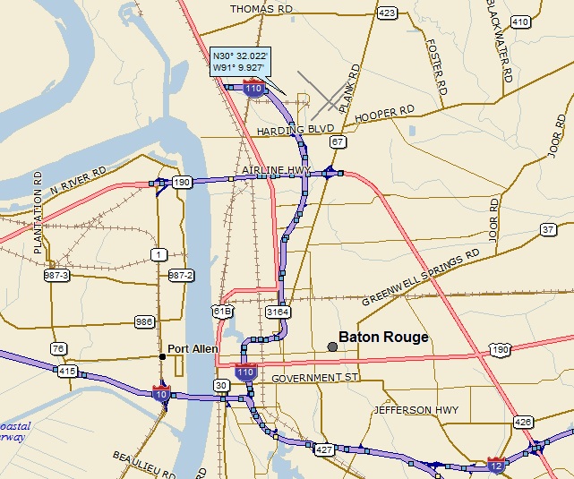
As always, I’ll start with my regional landing map:

Followed up by my closer-in landing map:

I’ll back up a little so you can see that I’m between Buffalo & Sheridan, just east of the Big Horn Mountains:

By the way, back in 1974, I was in geology field camp (part of my Master’s Degree program at Kent State). Our field camp (which is like the geologists’ version of military boot camp) was based in the Black Hills of SD. However, one weekend, we headed west across WY and, after stopping at Devil’s Tower (of “Close Encounters” fame), we went to a hotel in Buffalo. The next day, we headed west on Route 16 up into the Big Horn Mountains, and took a hike up along a stream, supposedly keeping track of all of the glacial features that we saw.
Well, all I remember are the mosquitos. Never before, never since, have I been so brutally accosted. I distinctly remember looking down at one arm, and seeing 10 or so mosquitos, biting away. Of course, I began to slap like crazy. After killing the skeeters lined up on my arm, I looked down at my other arm (the one involved in the slapping). There were now 10 or so of the little buggers on that arm. Slap slap slap slap slap slap slap slap slap slap. Back to the other arm. Slap slap slap slap slap slap slap slap slap slap.
Etcetera, etcetera, etcetera.
The only break in the cycle was to crazily slap my face when I had a chance. I remember a whole bunch of us gave up and just started running as fast as we could down the trail to get to the cars. Glacial features?? What glacial features??
Moving right along . . . to my Google Earth (GE) shot:

I landed in the foothills of the Big Horns. Of course, I zoomed back a little more to get a look at the mountains:

The stream at the bottom of the slope below my landing is the South Piney Ck, which flows of course, to the Piney Ck; on to the Clear Ck; to the Powder R (11th hit); to the Yellowstone R (52nd hit); to the Missouri R (378th hit); to the MM (815th hit).
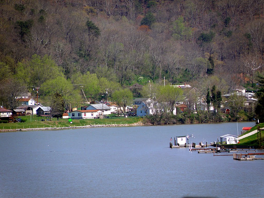
Here’s a Panoramio shot of the South Piney by Lifting Heavy (taken about two thirds of a mile northeast of my landing:

Moving right along to Story. Guess what? There’s no story in Story. So I was looking around Story, and saw that the erstwhile Fort Phil Kearny used to be nearby:

Before we continue, it’s important that everyone pronounce Kearny correctly. It’s CAR – knee (more about why I care about the pronunciation later).
There was much drama right here in the greater Story area, back in the day. You absolutely must read this piece from History.com (specifically, this day in History – December 21, 1866). It is quite the story . . .
Tensions in the region started rising in 1863, when John Bozeman blazed the Bozeman Trail, a new route for emigrants traveling to the Montana gold fields. Bozeman’s trail was of questionable legality since it passed directly through sacred hunting grounds that the government had promised to the Sioux, Cheyenne, and Arapahoe in the Fort Laramie Treaty of 1851.
Thus when Colorado militiamen murdered more than two hundred peaceful Cheyenne (about two thirds of whom were women and children) during the Sand Creek Massacre of 1864, the Indians began to take revenge by attacking whites all across the Plains, including the emigrants traveling the Bozeman Trail. The U.S. government responded by building a series of protective forts along the trail; the largest and most important of these was Fort Phil Kearney, erected in 1866 in north-central Wyoming.
Indians under the leadership of Red Cloud and Crazy Horse began to focus their attacks on Fort Phil Kearney, constantly harassing the soldiers and raiding their wood and supply parties. On December 6, 1866, Crazy Horse discovered to his surprise that he could lead a small detachment of soldiers into a fatal ambush by dismounting from his horse and fleeing as if he were defenseless. Struck by the foolish impulsiveness of the soldiers, Crazy Horse and Red Cloud reasoned that perhaps a much larger force could be lured into a similar deadly trap.
On the bitterly cold morning of December 21, about 2,000 Indians concealed themselves along the road just north of Fort Phil Kearney. A small band made a diversionary attack on a party of woodcutters from the fort, and Commandant Colonel Henry Carrington quickly ordered Colonel Fetterman to go to their aid with a company of 80 troopers. Crazy Horse and 10 decoy warriors then rode into view of the fort. When Carrington fired an artillery round at them, the decoys ran away as if frightened. The party of woodcutters made it safely back to the fort, but Colonel Fetterman and his men chased after the fleeing Crazy Horse and his decoys, just as planned. The soldiers rode straight into the ambush and were wiped out in a massive attack during which some 40,000 arrows rained down on the hapless troopers. None of them survived.
With 81 fatalities, the Fetterman Massacre was the army’s worst defeat in the West until the Battle of Little Bighorn in 1876. Further Indian attacks eventually forced the army to reconsider its commitment to protecting the Bozeman Trail, and in 1868 the military abandoned the forts and pulled out. It was one of only a handful of clear Indian victories in the Plains Indian Wars.
Here’s where Fettermen met his fate:

Wow. It looks like I found the story in Story, and what a story. Taken in the context of a good guy / bad guy narrative of righteous revenge, the Indians are undoubtedly the good guys, and their revenge is indeed righteous.
Note that “Fetterman Massacre” is a white man’s term. The Indians called the event the “Battle of the Hundred in the Hand.”
I found some GE Panoramio shots of the battlefield. This, by CMarks175 shows the battlefield monument up on top of the ridge. I believe that this is the ridge over which the Indians lured Fettermen to the trap.

Here’s a close-up of the monument, by Vasily Vlasov:

Back to Phil Kearny. When I saw “Fort Phillip Kearny” while researching this post, I immediately pronounced it correctly: CAR-knee. How did I know? Because just across the Passaic River from Newark NJ is Kearny (named after the same Phil Kearny).
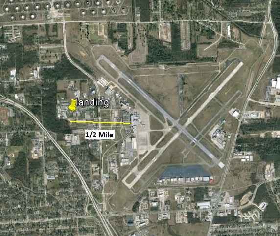
I’m in the environmental field, and us Jersey environmental types all know Kearny. Most of Kearny is residential, but then there’s this part of Kearny (known as South Kearny):
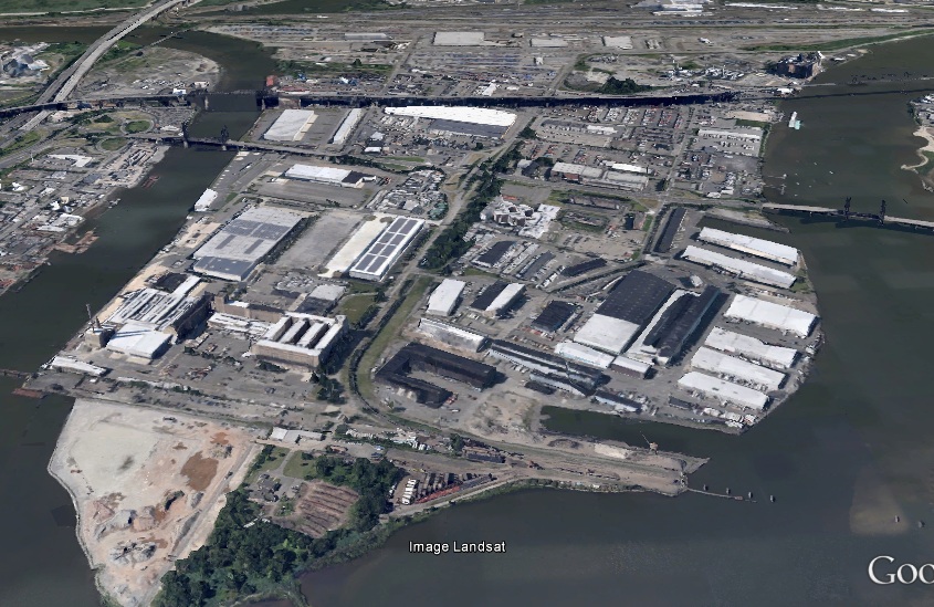
We’re looking north. That’s the Passaic River to the west (with Newark at the left edge of the photo); the Hackensack River is to the east, and Jersey City is across the Hackensack. There’s just a wee bit of contamination in South Kearny . . .
Back to WY: I’ll close with this Panoramio shot (by V. Vlasov) from the site of the Battle of the Hundred in the Hand, looking west towards the Big Horns:

That’ll do it.
KS
Greg
© 2013 A Landing A Day