A Landing a Day

A geography blog where random is king . . .

Archive for November, 2021

Decatur, Cassopolis and Paw Paw, Michigan

Posted by graywacke on November 26, 2021

First timer? In this formerly once-a-day blog (and now pretty much a once-a-week blog) I use an app that provides a random latitude and longitude that puts me somewhere in the continental United States (the lower 48).  I call this “landing.”

I keep track of the watersheds I land in, as well as the town or towns I land near.  I do some internet research to hopefully find something of interest about my landing location. 

To find out more about A Landing A Day (like who “Dan” is) please see “About Landing” above.  To check out some relatively recent changes in how I do things, check out “About Landing (Revisited).”

Landing number 2548; A Landing A Day blog post number 993

Dan:  Today’s lat/long (N42o 5.300’, W85o 59.261) puts me in SW Michigan:

My local landing map:

My streams-only map shows that I landed in the watershed of the Dowagiac Creek, which flows to its momma, Dowagiac River (1st hit ever, making the Dowagiac my 1,264th river):

Zooming back, the Dowagiac discharges to the St. Joseph River (3rd hit); on to Lake Michigan (41st hit).  Of course, Lake Michigan’s water travels to Lake Huron, to Lake Erie, to Lake Ontario, to the St. Lawrence River (114th hit).

Moving over to Google Earth, the Orange Dude had a so-so look at my landing:

The OD had stand up tall so he could see over the corn fields:

The OD & I couldn’t find a worthwhile view of the Dowagiac River, but we managed to get this scenic look at the St. Joseph River about 20 miles to the south of my landing:

Let’s start out with the town closest to my landing:  Decatur.  From Wiki:

The Village of Decatur are named after Stephen Decatur, Jr., celebrated as a hero of the War of 1812. 

Wiki also noted that Edgar Bergen is a famous son.  First about Stephen, from Wiki:

At age 25, he is the youngest man to reach the rank of captain in the history of the United States Navy.  He served under three presidents, and played a major role in the early development of the U.S. Navy. In almost every theater of operation, Decatur’s service was characterized by acts of heroism and exceptional performance. His service in the U.S. Navy took him through both Barbary Wars in North Africa, the Quasi-War with France, and the War of 1812 with Britain. He was renowned for his natural ability to lead and for his genuine concern for the seamen under his command.  His numerous naval victories against Britain, France and the Barbary states established the United States Navy as a rising power.

Oh, all right.  Barbary Wars? Both Barbary Wars?  I’ve heard the term, but basically have no clue.  Wiki:

The Barbary Wars were two wars fought by the United States, Sweden, and the Kingdom of Sicily against the Barbary states (including Tunis, Algiers, and Tripoli) in the early 19th century (Barbary is the region encompassing much of North Africa).  “Barbary Pirates” were capturing and plundering hundreds of foreign vessels each year.  The pirates were renegade Muslims not affiliated with the seat of Ottoman power.

Sweden had been at war with the Tripolitans since 1800 and was joined by the newly-independent US.  The First Barbary War extended from 1801 to 1805, with the Second Barbary War lasting only three days, beginning and ending in June 1815.

“And the final Jeopardy answer in the ‘Foreign Wars’ category is:  The US, Sweden and the Kingdom of Sicily were united against a North African foe in these wars.” 

And I love the name “Tripolitan.”  One either travels a lot, or takes mind-altering drugs . .

OF course, Tripoli is in LIbya:

And yes, the word “barbarian” has its root with these pesky North Africans.

One more stop along the Barbary Coast (actually just Tripoli), thanks to the Marine Hymn:

From the Halls of Montezuma
To the shores of Tripoli
We fight our country’s battles
In the air, on land, and sea.

I’m skipping most of the lyrics, but I can’t resist the final lines:

If the Army and the Navy
Ever look on Heaven’s scenes,
They will find the streets are guarded
By United States Marines.

Here’s a recent shot of the “Shores of Tripoli.”

And then there’s Edgar Bergen.  From Wki:

Edgar Bergen (born Edgar Berggren; 1903 – 1978) was an American actor, comedian, vaudevillian and radio performer, best known for his proficiency in ventriloquism and his characters Charlie McCarthy and Mortimer Snerd. He was the father of actress Candice Bergen.

Bergen was born of Swedish parents in Chicago, Illinois, although soon thereafter his family moved to a farm near Decatur, Michigan, where they stayed until he was four.  His family returned to Sweden, where he learned the language. After his family had returned to Chicago, when he was eleven, he taught himself ventriloquism from a pamphlet called “The Wizard’s Manual”.

He managed to perform in front of famous ventriloquist Harry Lester who was so impressed that he gave the teenager almost daily lessons for three months in the fundamentals of ventriloquism.

In the fall of 1919, Edgar paid Chicago woodcarver Theodore Mack $36 to sculpt a likeness of a rascally red-headed Irish newspaper boy he knew. The head went on a dummy named Charlie McCarthy, which became Bergen’s lifelong sidekick. He had created the body himself, using a nine-inch length of broomstick for the backbone, and rubber bands and cords to control the lower jaw mechanism of the mouth.

He went on to a long career on stage, on radio (yes, radio, where he didn’t have to worry about not moving his mouth) and TV. 

I found a You Tube clip from the old Steve Allen show, where Edgar brings out Charlie McCarthy, Effie Klinker and Mortimer Snerd.  It’s a little long, but worthwhile to watch at least some of it.

Even without the ventriloquism, his ability to glibly move between characters is incredible.

It’s time for a quick visit to Cassopolis (County Seat of Cass County), home town of one Ed Lowe.  From Wiki:

 Edward Lowe (July 10, 1920 – October 4, 1995) was an American businessman and entrepreneur, noted for the invention of cat litter.   He was described as “building a huge business from nothing”, and as being a textbook example of an individual who “created a product, brought it to marketplace, invented an industry and sold his business for millions”.  By the time of his death, his company was worth about five hundred million dollars (or $849 million today, adjusted for inflation).

[Personal note:  My father, James Lynton Hill, was born on the exact same day as Ed Lowe.  More about my dad in a bit.  Back to Wiki:]

Before Lowe’s invention, people kept their cats outside, using ashes, dirt or sand as cat litter when it was necessary to keep them inside. One day in January 1947, Mrs. Draper, Edward Lowe’s neighbor in Cassopolis, Michigan, asked him for some sand to use as cat litter. Her sand pile was frozen so she had been using ashes but they tracked all over her house. Instead of sand, Lowe gave her some clay called Fuller’s Earth, a set of clay minerals capable of absorbing their weight in water. She found it worked far better than sand or ashes.

In 1947, Lowe decided to sell the clay. He packaged it in five-pound bags and called it “Kitty Litter”. He suggested that a local pet store sell it for 65 cents. The store owner refused, saying that it would not sell because sand was so much cheaper.  Lowe told him to give it away free until people were willing to pay for it.

Lowe drove around the country selling Kitty Litter. He even cleaned boxes at cat shows so he could get a booth to demonstrate his product. Eventually, the product began to sell, and he founded Edward Lowe Industries and created Tidy Cat cat box filler in 1964.  By 1990, Edward Lowe Industries was the top producer of cat box filler.

In Lowe’s later years, he sold his business to a management team funded by venture capitalists from New York and Chicago. The sale went through in 1990, with the company being renamed the Golden Cat Corporation.  The sale was later estimated by The New York Times as being $200 million (or $396 million today).  Following his death, Golden Cat Corporation was sold to Ralston Purina.

I don’t know about you cat people, but I am now an exclusive user of clumping kitty litter . . .

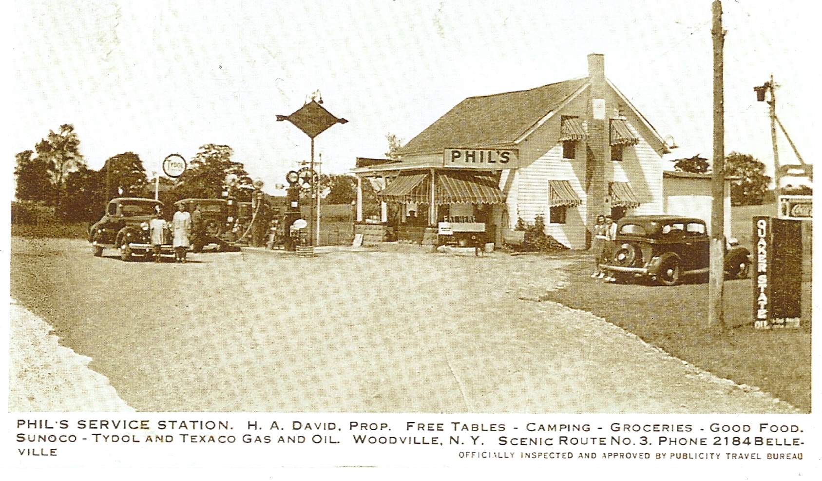
Before telling a brief Dad story, I’ll move up to the town of Paw Paw (which is along Paw Paw River, which flows into Paw Paw Lake).  Wiki notes that the town is named after paw paw trees that once grew along the Paw Paw River. 

After some research, I found a SeriousEats.com article entitled “Pawpaws:  America’s Best Secret Fruit.”  Here are some excerpts:

If you’re lucky, America’s best secret fruit might be growing on a tree close to your backyard. Or perhaps a county or two away. Finding it takes effort, but it’s rejuvenating effort. Tromping around in the woods seeking pawpaws makes me feel more a little more human, and the pawpaw’s enticing taste is only one of its rewards. What begins under a leafy canopy ends in your kitchen, with untold culinary possibilities.  

Pawpaw trees, the largest edible fruit trees native to North America, produce greenish-blackish fruit, usually three to six inches long. The flesh is pale to bright yellow and contains a network of glossy, dark brown seeds. A pawpaw’s flavor is sunny, electric, and downright tropical: a riot of mango-banana-citrus that’s incongruous with its temperate, deciduous forest origins. They also have a subtle kick of a yeasty, floral aftertaste a bit like unfiltered wheat beer. “The flavor of pawpaws is forceful and distinct,” writes culinary historian Mark F. Sohn diplomatically in his encyclopedic book, Appalachian Home Cooking.

A pawpaw is a homely, unassuming thing on the outside; it’s possible to unwittingly pass a tree laden with half a dozen of the things. But let’s say you notice the pawpaws, and reach for a ripe one. The best way to enjoy a pawpaw is right there in the woods, tearing into it as if you had claws. Rip the skin away, slurp the pulp, and spit out the seeds. It’s a gooey, sensuous, primal experience. You have now eaten from the tree of earthly knowledge, and guess what? It tastes really damn good.

Pawpaws grow from the Great Lakes down to portions of the Florida Panhandlef:

The members of the Lewis and Clark expedition ate pawpaws for pleasure, and, for a period in Missouri in 1806, subsistence. Our early American ancestors enjoyed pawpaws for centuries, spreading them as far west as Kansas. In 1541, the expedition of conquistador Hernando de Soto recorded Native Americans growing and eating pawpaws in the Mississippi Valley.

And even though they had to clear pawpaw trees to create farmable land, white settlers savored pawpaw fruit—often the only fresh fruit available nearby. There are towns named Paw Paw in Michigan, West Virginia, Kentucky, and Oklahoma (Mid-Atlantic and Midwest states make up the pawpaw hot zone.)

Easy-bruising pawpaws have a short shelf life and don’t currently fit in the business model of big agriculture. A scattered network of academics and horticulturalists are researching to see if that could change, if someday a growing and marketing strategy could make pawpaws an enticing new product in the produce aisle.

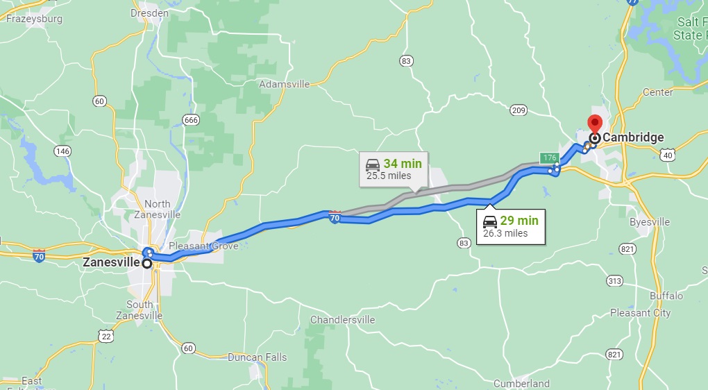
I’ll close with a short story about my father, born on precisely the same day as the kitty litter guy.  He was a Presbyterian Minister from 1945 (when he graduated from Princeton Theological Seminary) until his untimely death of a heart attack in 1967 at age 47.  In the 1960s, he was minister of the First Presbyterian Church of Zanesville, Ohio. 

My Mom & Dad were not big drinkers, but they enjoyed a martini (gin with a splash of vermouth and an olive) before dinner.  And occasionally (when they were feeling a little wild and crazy), they’d splurge and enjoy a martini nightcap as well. I have no memories of any parental tipsiness.

Anyway, Dad was very aware of his image as a pillar of the community; a bastion of righteousness.  Well, drinking didn’t quite fit in with that image.  But of course, his supply of gin & vermouth (especially the gin) had to be periodically replenished.  Could he just slip in to a Zanesville liquor store?  No way!  What if someone saw him?

But he figured that a drive to a liquor store in Cambridge would eliminate the problem:

My Dad put in very long hours – besides the immediate churchy stuff like writing sermons, planning and conducting Sunday church services, presiding over weddings and funerals, and running what is essentially a small business (he led a fund-raiser for an expensive remodeling of the church’s interior and he opened up a community center in the disadvantaged side of town), he was always visiting live-alone elderly folks and making hospital visits.

The bottom-line is that I didn’t see much of my father.  But it became a tradition for my Dad to ask if I wanted to go with him to the liquor store, which I always enthusiastically agreed to.  I don’t remember actually going in the liquor store – he probably didn’t want to expose his impressionable young son to such an establishment – so I just sat in the car while he went in. 

We lived in Zanesville when I was between the ages of 10 and 17, and OK, maybe I turned him down a few times as I got into my later teen years.  But our liquor store trips are a lasting memory. . .

I noticed a grouping of photo icons posted on GE just west of my landing:

The photographer for all of these is a gentleman with the difficult-to-spell-and-pronounce name of Mariusz Zielezny. (How many times has he heard “Could you spell that, please?”) Here are the three best:

That’ll do it . . .

KS

Greg

© 2021 A Landing A Day

Posted in Uncategorized | Tagged: , , , , , , , , , , | 3 Comments »

Lake Tahoe, California (Revisited); plus bonus Genoa, Nevada coverage

Posted by graywacke on November 19, 2021

First timer?  In this formerly once-a-day blog (and now pretty much a once-a-week blog), I use an app that provides a random latitude and longitude that puts me somewhere in the continental United States (the lower 48).  I call this “landing.”

I keep track of the watersheds I land in, as well as the town or towns I land near.  I do some internet research to hopefully find something of interest about my landing location. 

To find out more about A Landing A Day (like who “Dan” is) please see “About Landing” above.  To check out some relatively recent changes in how I do things, check out “About Landing (Revisited).”

Landing number 2547; A Landing A Day blog post number 992

Dan:  Today’s lat/long (N44o 54.969’, W92o 38.780) puts me in E-Cen California:

My local landing map shows Lake Tahoe in its entirety with my landing near the southern end of the Lake, as well as landing 2427 (January 2019):

Here’s my local streams-only map:

I landed in the watershed of Tallac Creek, on (of course) to Lake Tahoe.  Zooming back:

Lake Tahoe is the headwaters of the Truckee River (3rd hit) which flows to a dead end:  Pyramid Lake.

As you can anticipate, I landed in a beautiful area.  I’ll move over to Google Earth, and start with this oblique shot showing where the Orange Dude put himself to get a look at my landing:

By the way, that’s Cascade Lake in the foreground, and as you can tell, I didn’t land in its watershed.  Anyway, here’s what the OD sees:

Tallac Creek isn’t much, but the OD was able to find the spot where it crosses the road:

Oh no! I misspelled “Tallac.” Anyway, here’s his downstream look:

I can’t help myself but lift a couple of highlights from my January 2019 Lake Tahoe post:

It’s time to dive right into the crystalline waters of Lake Tahoe.  I’ll start (of course) with the geology.

I’m going to keep it simple (and in my own words).  Probably beginning about 20 million years ago, tectonic forces were uplifting the Sierra Nevada Mountains to the west, and the Basin and Range landscape to the east across Nevada.  These two geologic provinces meet at Lake Tahoe.  Normal faults developed (where two blocks of earth move vertically relative to one another on either side of the fault).  One major fault was on the west side of the lake and another major fault was on the east side.

For reasons I don’t pretend to understand, about 3 million years ago the block of earth between the two faults ended up going down while the blocks on either side of the lake went up (relatively speaking).

Voila!  This downfaulted basin ended up filling with water. From TahoeCam.com:

A lake formed near the southern and lowest part of the basin, fed by snow, rain, and draining creeks and rivers. The lake level increased in depth until it found an outlet, then near the present town of Truckee. Several active volcanoes poured lava into the basin, eventually damming the outlet. The waters rose again, several hundred feet higher than the present level. Finally, a new outlet was cut (the present Truckee River outlet) and the lake level began to lower as the Truckee eroded its valley.

The lake is about 20 miles long and 10 miles wide, and very deep.  Here are some factoids:

  • After the five Great Lake, Lake Tahoe is the sixth largest lake by volume in the United States.
  • With a max depth of 1,645 feet, Tahoe is the second deepest lake (after Crater Lake, at 1,949).
  • Although Tahoe is only the 16th deepest lake in the world, it is the fifth deepest based on average depth.

Here’ a cool 3-D view:

And another:

You can’t help but notice the big chunks (of rocks?) on the floor of the lake.  Here’s another view:

This view suggests that maybe there was a landslide, eh?  Well, there was!

I found an article by Andrew Alden on the website KQED Science entitled “The Tahoe Tsunami:  New Study Envisions Early Geologic Event.”  I’ve lifted some of his words:

Once upon a time (actually between 12,000 and 21,000 years ago), geologists tell us that a massive chunk of Lake Tahoe’s western shore collapsed into the water in a tremendous landslide. The water responded by sloshing high onto the surrounding shores in a series of landslide tsunamis.

The slide, presumably triggered by an earthquake, sent some 12.5 cubic kilometers of rock and sediment into the lake, where it pushed a corresponding amount of water out of the way as huge tsunamis, perhaps 100 meters high. Much of this water burst over the lake’s outlet at Tahoe City and rushed down the Truckee River, where house-sized boulders litter the riverbed today as far downstream as Verdi at the Nevada border.

The rest of the water washed ashore all around the lake in what is called a “megasplash.” The lake would have sloshed back and forth for days afterward, and surely the lake must have been muddy for years; its shores a barren wasteland.

Back to now: Pretty cool, eh?  Don’t you just love a good geology story?  No?!?  Oh, well . . .

I’m going to head east across the state line (about 5 miles from the lake), and pay a quick visit to the town of Genoa, Nevada.  From Wiki:

Founded in 1851, Genoa (pop 1,000) was the first settlement in what became the Nevada Territory. It is home to the oldest bar in the state of Nevada which opened in 1853.

From TravelNevada.com, here’s a shot that very same bar:

Back to Wiki: 

The settlement, founded by Mormons, originated as a trading post called Mormon Station, which served as a respite for travelers on the Carson Route of the California Trail. The town was named “Genoa,” by Orson Hyde, an early Mormon church leader.

I checked out Orson Hyde, and he was one of the original “12 Apostles,” serving under Brigham Young.  He certainly wasn’t Italian, and I wondered why a Mormon would call the town Genoa.  From churchofjesuschrist.org, here’s a list of the first 12 Apostles. I’m looking for a name that ends in “i”:

The Twelve were Lyman Johnson, age 23; Brigham Young, 33; Heber C. Kimball, 33; Orson Hyde, 30; David W. Patten, 35; Luke Johnson, 27; William E. McLellin, 29; John F. Boynton, 23; Orson Pratt, 23; William Smith, 23; Thomas B. Marsh, 34; and Parley P. Pratt, 27.

Nope.  Not an Italian in the bunch.  And then as frequently happens, this whole thought pattern seemed vaguely familiar.  So, I searched my blog for “Genoa,” and lo and behold, I found something (from a March 2020 Genoa Nebraska post).  After a lengthy (but fascinating) discussion of the founding of Genoa NE, I said this:

Before leaving Genoa, I would be remiss if I didn’t say why the town was named Genoa.  Similar to Albion [another town discussed in the post], where I couldn’t find a single word about the name origin, I was similarly stymied here.  I really didn’t believe that some Mormons from England [the group that founded Genoa NE were from England] would name their town after the Italian city, so I kept digging.  I finally found out that Brigham Young briefly lived in Genoa NY as a child. Good enough for ALAD; and, yes, Genoa NY is named after Genoa Italy. 

So, it’s official.  Genoa NV, like Genoa NE is named so becaue Brigham lived in Genoa NY for a while.  My guess is that he spoke (and likely wrote) positively about his time in Genoa.

Here’s a Genoa Italy pic (from Forbes.com):

It’s time to wrap up this post with (what else), a couple of beautiful photos posted on GE.  Here’s a lovely shot of Cascade Lake by Illa:

There’s a teeny pond adjacent to the south end of Cascade Lake, and here’s a pic of that very spot (not far from my landing) by Mike Thornton:

That’ll do it . . .

KS

Greg

© 2021 A Landing A Day

Posted in Uncategorized | Tagged: , , , , | 1 Comment »

River Falls, Hudson, Woodville, Ellsworth and Marlett, Wisconsin

Posted by graywacke on November 12, 2021

First timer?  In this formerly once-a-day blog (and now pretty much a once-a-week blog), I use an app that provides a random latitude and longitude that puts me somewhere in the continental United States (the lower 48).  I call this “landing.”

I keep track of the watersheds I land in, as well as the town or towns I land near.  I do some internet research to hopefully find something of interest about my landing location. 

To find out more about A Landing A Day (like who “Dan” is) please see “About Landing” above.  To check out some relatively recent changes in how I do things, check out “About Landing (Revisited).”

Landing number 2546; A Landing A Day blog post number 991

Dan:  Today’s lat/long (N44o 54.969’, W92o 38.780) puts me in W-Cen Wisconsin:

My local landing map shows my titular towns:

Here’s a neat and tidy streams-only map:

It shows that I landed in the watershed of the Kinnickinnic River (1st hit ever!); on to the St. Croix River (8th hit); on to the MM (987th hit).

Being the kind of guy I am, I noticed that there are various squiggly-line segments of the Wisconsin State Boundaries.  Here’s what I found:

How about that!  Five different rivers mark the boundary!  I wonder if that’s the most for any state?  Probably.

Heading over to Google Earth (GE): the Orange Dude managed to find a spot to spy my landing:

And here’s what he sees:

The Kinnickkinni River flows through River Falls (and yes, there are falls along the Kinnickinni in River Falls).  The OD put himself on a bridge over the river:

He was excited to position himself so he could share a view of a hanging flower pot and still see the river

While checking out bridges for the views of the river, I came across this:

AYKM?  I’m nearly at 1,000 blog posts, and I’ve stumbled on a “Lake Louise” exactly twice:  four posts ago (Byron IL) and then this one.  As my regulars surely remember (Byron was posted on 10/15), I hit Lake Louise (near Banff, Albert) pretty hard in that post.  I’ll obviously not do it again . . .

I have a bunch of quick hitters as we visit my titular towns.  Starting with Hudson, from Wiki:

Hudson was originally called Willow River. It was later named Buena Vista by Judge Joel Foster, founder of River Falls, after returning from the Mexican War where he fought in the Battle of Buena Vista. In 1852, Alfred D. Gray, Hudson’s first mayor, petitioned to change the name of the city to “Hudson”, because the bluffs along the St. Croix River reminded him of the Hudson River in his native New York.

Just like my Lake Louise comment:   AYKM?  I’m nearly at 1,000 blog posts, and I’ve stumbled on a “Buena Vista” exactly twice:  three posts ago (Buena Vista Indiana) and then this one.  As my regulars surely remember (Buena Vista was posted on 10/22), I hit The Battle of Buena Vista pretty hard in that post.  I’ll obviously not do it again . . .

On to Falls River, where I’ll simply present a sentence from Wiki:

On June 23, 1893, a lightning bolt hit the center circus pole at a Ringling Brothers circus performance in River Falls, killing seven and injuring more than a dozen audience members and performers.

What an awful story!  I guess fail-safe lightening rods weren’t required back in the day . . .

Moving on to Woodville.  Wiki’s “History” section doesn’t have much to say:

Founded in 1870, the community was originally named Kelly’s Switch, for a nearby mill owner. In 1874 that name was dropped and the village was renamed after Woodville, Jefferson County, New York.

So, off I went to Woodville NY.  Wiki’s “History” section has even less to say about Woodville NY:

The village of Woodville, St. Croix County, Wisconsin, was named after the hamlet.

Funny, eh?  Anyway, the website NY Mews has some cool Woodville NY back-in-the-day shots:

And here’s a fine hotel:

And then this period piece:

AYKM?!?  Don’t you love “Yourself and Lady are cordially invited to be in attendance.” At least they capitalized the “L.” I wonder if the $1.25 includes the Lady?

Moving on to Ellsworth, which was named for Elmer Ellsworth, the first Union officer to die in the Civil War.  From Wiki:

Ellsworth (a close personal friend of Lincoln’s) was killed at the Marshall House Inn in Alexandria VA on May 24, 1861.  His death occurred the day after Virginia’s secession was ratified, during the Union Army’s take-over of Alexandria.

During the month before the event, the inn’s proprietor, James W. Jackson, had raised from the inn’s roof a large Confederate flag that President Lincoln and his Cabinet had reportedly observed through field glasses from an elevated spot in Washington.  Jackson had reportedly stated that the flag would only be taken down “over his dead body”.

Before crossing the Potomac River to take Alexandria, soldiers serving under Ellsworth’s command observed the flag from their camp through field glasses and volunteered to remove it.  Ellsworth and seven other soldiers entered the inn through an open door.

Unchallenged, Ellsworth sprang up the stairs followed by his soldiers, climbed to the roof on a ladder and cut down the flag with a soldier’s knife. The soldiers turned to descend, with Private Francis E. Brownell leading the way and Ellsworth following with the flag.

As Brownell reached the first landing place, Jackson jumped from a dark passage, leveled a double-barreled shotgun at Ellsworth’s chest and discharged one barrel directly into Ellsworth’s chest, killing him instantly. Jackson then discharged the other barrel at Brownell, but missed his target. Brownell’s gun simultaneously shot, hitting Jackson in the head.

Ellsworth became the first Union officer to die in the Civil War.  Brownell, who retained a piece of the flag, was later awarded a Medal of Honor for his actions.

Lincoln was deeply saddened by his friend’s death and ordered an honor guard to bring his friend’s body to the White House, where he lay in state in the East Room.  Ellsworth’s body was then taken to the City Hall in New York City, where thousands of Union supporters came to see the first man to fall for the Union cause.

Thousands of Union supporters rallied around Ellsworth’s cause and enlisted in the Union Army.  “Remember Ellsworth” became a patriotic slogan. The 44th New York Volunteer Infantry Regiment called itself the “Ellsworth Avengers.”  Simultaneously, Jackson became a celebrated martyr for the Confederate cause.

After the Marshall House incident, soldiers and souvenir hunters carried away pieces of  inn as mementos, especially portions of the inn’s stairway, balustrades, and oilcloth floor covering.  Relics associated with Ellsworth’s death became prized souvenirs.

President Lincoln kept the captured Marshall House flag, although the flag apparently passed to Brownell.  Upon his death in 1894, his widow offered to sell small pieces of the flag for $10 and $15 each, although most of the flag was retained.

Today, most of the flag is held by the New York State Military Museum and Veterans Research Center in Saratoga Springs, which also has Ellsworth’s uniform with an apparent bullet hole.

Our final stop is the teeny village of Martell.  Here’s what it looks like on GE:

The OD let me know there’s a cool old school house he stumbled across:

And here ‘tis:

But what first got my attention about Martell is this StreetView map:

Take a deep breath and check it out.  Here are the various streets in this teeny town:

  • 535th St.
  • 537th St.
  • 770th Ave.
  • 790th Ave.
  • 794th Ave.
  • 799th Ave.
  • 801st Ave.

It seems utterly random, although I’m sure there’s a logical explanation hidden away somewhere . . .

So, here’s a GE detail:

Imagine you live at the intersection.  When asked “where’s your house?”  The answer, is (obviously) “at the corner of 770th & 535th.”

I’ll wrap things with a couple of local pics posted on GE.  First this, by Thomas Warth (less than a mile from my landing):

And then these barns by Reda B:

That’ll do it . . .

KS

Greg

© 2021 A Landing A Day

Posted in Uncategorized | Tagged: , , , , , , , , , | 2 Comments »

Burlington, Wisconsin

Posted by graywacke on November 5, 2021

First timer?  In this formerly once-a-day blog (and now pretty much a once-a-week blog), I use an app that provides a random latitude and longitude that puts me somewhere in the continental United States (the lower 48).  I call this “landing.”

I keep track of the watersheds I land in, as well as the town or towns I land near.  I do some internet research to hopefully find something of interest about my landing location. 

To find out more about A Landing A Day (like who “Dan” is) please see “About Landing” above.  To check out some relatively recent changes in how I do things, check out “About Landing (Revisited).”

Landing number 2545; A Landing A Day blog post number 990

Dan:  Today’s lat/long (N42o 38.127’, W88o 6.119) puts me in SE Wisconsin:

Of course you’re wondering why I labeled Beaver Island.  Stay tuned . . .

My local landing map:

A streams-only map lets me know about my local watershed:

I landed in the Brighton Creek watershed, on to the Salem Branch (of the Des Plaines River, I assume); on to the Des Plaines (1st hit ever!).

Zooming back, and heading a little south:

The Des Plaines joins up with the plain old Plaines, maintains its identity before discharging into the Illinois River (22nd hit).  Although not shown, the Illinois cuts southwest across (what else?) Illinois, before discharging to the MM (986th hit).

Moving over to Google Earth (GE), the Orange Dude found a bridge over Brighton Creek:

Here’s a closer view:

Here’s what he sees, looking upstream towards my landing:

My guess is that the wetlands you see are the result of a shallow glacial lake that has become mostly filled in with sediment.

Staying with GE, the OD could get pretty close to my landing:

If you’re paying any attention at all, you must be asking:  “Why is the OD away from the houses (closer to the landing), but is  right in front of dense woods?”  Well, the OD couldn’t get a good look at the landing spot no matter where he ended up.  Notice the buildings very near to my landing; these are behind the houses, but with no access from the houses.  I found that the dirt road that heads back to the buildings (and my landing) is where the OD put himself.

Here’s what he sees:

Phew.  That was more complicated than usual . . .

Headed west a few miles to Burlington, this in Wiki caught my eye:

From 1844 to 1850, the town of Voree, just to the west of Burlington, was the headquarters of the Strangite branch of the  Church of Jesus Christ of Latter Day Saints (LDS, aka the Mormons), founded by James Strang.

Here’s the only Voree geographical marker I could find:

Back to Wiki:

The Strangites were one of many sects founded during the LDS succession crisis following the death of Mormon founder Joseph Smith. Although James Strang’s group relocated to Beaver Island, Michigan in 1850, his parents remained in Voree. After Strang was shot by two disgruntled members in 1856, he was taken to Voree where he died.

[Now you know why I pointed out Beaver Island on my regional landing map.}

He is buried in a cemetery in Burlington. Strang’s church still maintains a congregation in Voree to this day, and the local historical society has erected a monument to the Mormon settlement there.

Here we go again.  Yes, I  featured the Strangites when I landed in Michigan, fairly close to Beaver Island.  From my August 2014 Charlevoix Michigan post:

Checking out the history of Charlevoix on Wiki, a short paragraph caught my attention:

Soon after its formation in the 1850s, Charlevoix entered into a short-lived conflict with James Strang, leader and namesake of the Strangite Mormons, and then king of Beaver Island.

Say what!?!  “King of Beaver Island?”  This sounds interesting!  Real quick, here’s a GE shot of Beaver Island:

Continuing on Wiki:

Relations between Charlevoix residents and the Strangites were often tense. In 1853, a gunfight broke out between the two groups as the townspeople refused to hand over a man who was called for jury duty on the island, an event known locally as The Battle of Pine River.

When Strang was assassinated on June 20, 1856, many believed residents from Charlevoix to be responsible.

As regular ALAD readers know, I have stumbled on (and featured) the Mormons on numerous posts.  Phew!  I just checked, and I’ve used the word “Mormon” at least once in 29 posts (13 of which were in Utah)!

But this doesn’t look like the typical Mormon story!  Here we go . . .

From BeaverIsland.net (and please take a deep breath and read this carefully!):

James Strang, who would create America’s only kingdom on Beaver Island, was born in New York in 1813.  He expected great things of himself.  He established a law practice at the age of 23, but it failed to satisfy his ambition. When he met Joseph Smith in 1844, he converted to his new evangelical religion as a way of improving his position.

Strang’s debating skills impressed the Mormon leader, who assigned him to found a branch in Burlington, Wisconsin. While Strang was away, Smith was killed. Shortly thereafter Strang produced a letter (written by Smith) naming him as Smith’s chosen heir. He was challenged by Brigham Young, who was more solidly entrenched.  Strang led those who accepted him to Nauvoo, Illinois, and then Voree, Wisconsin, before deciding that God wanted him to bring his flock to Beaver Island.

Producing mysterious brass plates from the ground, and receiving directives from God, Strang formed a colony on Beaver Island in 1848.  By the early 1850s, most of the non-Mormons had left the Island.  The ensuing degree of absolute power went to Strang’s head, and rumors spread about Mormon attrocities.

Strang had himself crowned king, and began taking additional wives. Attempts to oust him by legal means failed, and in 1856 he was assassinated by two disgruntled followers [or two angry Charveloixians, as speculated in the Wiki entry I quoted earlier].

His people [Wiki says there were 2,600] were driven off the Island by an unruly mob from Mackinac Island, which was instigated by speculators eager to grab the land.  [My research says that the hapless Strangites were unceremoniously herded onto commandeered steamships and dumped onto docks in Milwaukee and Chicago.]  During their 8-year occupancy, the Mormons cleared and cultivated the ground, built roads and houses, and changed the Island from a wilderness to a moderate outpost of civilization.  But fate conspired to keep them from reaping the benefits of their toil.

What an amazing story, on several fronts.  James Strang joined Joseph Smith as a martyred church leader whose murderers were never convicted – and, in neither case does it appear that anyone made much effort to bring the murderers to justice.  And how about commandeering steamships, rounding up 2,600 people off of their land, and just dumping them penniless on a dock?  Amazing.  And then there’s the very fact that someone like James Strang could convince 2,600 people to follow him to Beaver Island (let alone the 70,000 who followed Brigham Young to Salt Lake City . . .)

Here’s a Wiki shot of Mr. Strang (taken not long before he was assassinated):

By the way, there are still some Strangites around Voree, Wisconsin (300 or so at last count).  And also, the northern end of Beaver Island is today St. James Township.  That would be St. James Strang Township . . .

Back to now, and back to Voree,

The Strangites have a website.  Here are some excerpts:

Headquartered in Burlington, Wisconsin, we are a small remnant of the church that God re-established upon the earth through the Prophet Joseph Smith on April 6, 1830. We follow Joseph Smith’s legal successor, James J. Strang, and possess a true Priesthood.

Nine days prior to Joseph Smith’s martyrdom at Carthage, Illinois on June 27, 1844, he appointed James J. Strang of Burlington, Wisconsin Territory to be his successor by a letter written and mailed from Nauvoo, Illinois on June 18, 1844. This document became known as the “Letter of Appointment.”

[I can only assume that Brigham Young, who ended up taking the flock to Salt Lake City, and founding the mainstream Mormon church, did not have a letter of Appoitment.  But hey – where’s the letter to Mr. Stang?  And while I’m at it, where are the golden plates that Joseph himself translated and started an entire religion?]

Mr. Strang’s appointment was in accordance with the revelation on succession, D&C 43:2-7 [a scripture reference], received by Joseph Smith at Kirtland, Ohio in February 1831. D&C 43:4 specified that Joseph must appoint a single successor prior to his death. James J. Strang was the only person who claimed a direct appointment by the founding prophet.

He also was the only person who claimed he was ordained by angels as required by D&C 43:7. He met all the succession requirements given by God through revelation. We believe the only way a man may become a Prophet of God is by an Angelic ordination and there can only be one on the earth at a time.

We believe our doctrines are not infused with paganism, mythologies, philosophies, or fables. We also believe our religion is not contaminated by added external rites or ceremonies.

[I wonder if they’re suggesting that the mainstream Mormon church has these attributes?]

We follow the admonition of Jesus – “Do ye the things ye have seen me do, and teach the same things that I have taught.” We are not to be confused with Fundamentalist Mormons who believe in doctrines propagated by Brigham Young.

It’s time to take a look at a couple of barns right around the corner from my landing.  Rich R posted these on GE:

That’ll do it . . .

KS

Greg

© 2021 A Landing A Day

Posted in Uncategorized | Tagged: , , , , , | Leave a Comment »