A Landing a Day

A geography blog where random is king . . .

Archive for February, 2015

Mount Tenabo and the Cortez Mine, Nevada

Posted by graywacke on February 27, 2015

First timer?  In this formerly once-a-day blog (and now pretty much a once-every-three-or-four days blog), I have my computer select a random latitude and longitude that puts me somewhere in the continental United States (the lower 48).  I call this “landing.”  I keep track of the watersheds I land in, as well as the town I land near.  I do some internet research to hopefully find something of interest about my landing location.  To find out more about A Landing A Day (like who “Dan” is and what the various numbers and abbreviations mean in the first paragraph), please see “About Landing,” (and “Abbreviations” and “Cryptic Numbers”) above.

 Landing number 2159; A Landing A Day blog post number 587.

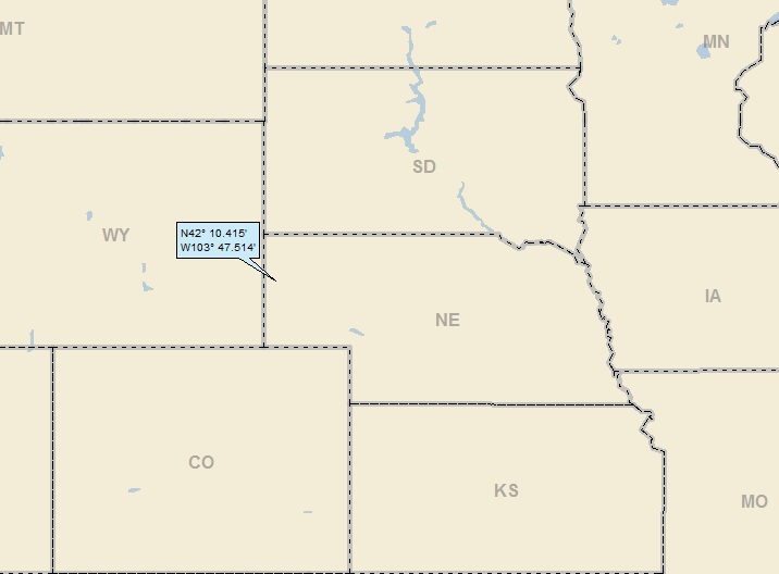
Dan:  Today’s landing marks the 47th straight western / midwestern landing (and rubbing salt in the wounds, it’s an OSer that bumps me back over 150). . . NV; 87/78; 3/10; 25; 150.3.

Here we go again.   47 landings in a row that haven’t touched the east?  Just like my last several posts, I’ll do the statistics:  Each landing, I have a 0.82 chance of a western / midwestern landing.  Raise that number to the 47th power (and then take the inverse) and I get one chance in 11,240 that I would not land in the east for 47 straight landings!!!   Phew. . .

Here’s my regional landing map:

 landing 1

Here’s a very local landing map:

 landing 2

Note Mt Tenabo, and the crazy patchwork of “roads” just west of the mountain.  It turns out that the roads are part of the Cortez Mine, which ends up being featured later in this post.

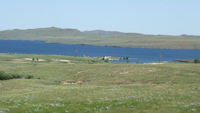
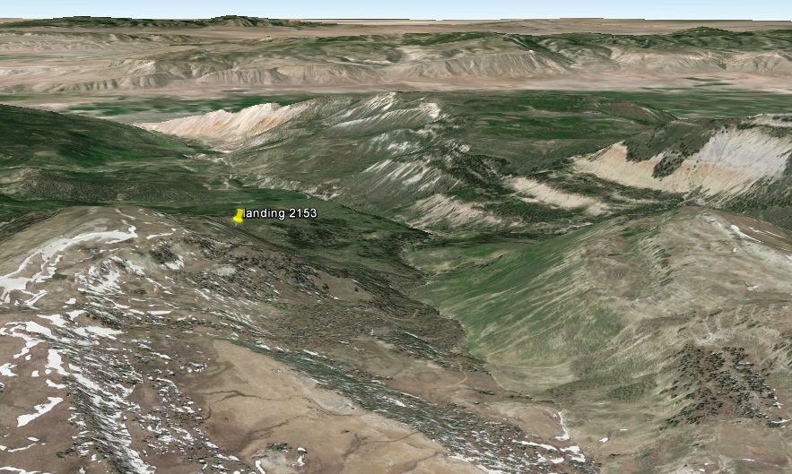
I backed out some to show the isolation of my landing spot:

 landing 2b

Incidently, I had a “Beowawe” post a while back (March 2009 to be more specific).  Of course, it’s chock full of fascinating information.  Feel free to check it out via the search tool.  Here’s my watershed analysis, showing that I landed in the Pine Creek watershed; on to the Humboldt River (25th hit).  For the record, the valley I landed in (with Pine Creek) is known as “Pine Valley.”

landing 3a

Zooming back a little, here’s a look at the entire Humboldt Watershed:

landing 3b

I added the Reese River for completeness’ sake, even though it has nothing to do with this landing.  Interestingly enough, while I’ve landed in the greater Humboldt watershed 25 times, I’ve only landed in the Reese River watershed once!  Seems peculiar, given how long the Reese River is.  


Here’s my Google Earth (GE) landing voyage:


Here’s my usual GE shot showing Street View coverage:

 ge 1 showing sv

Here’s the shot from the orange dude standing on Route 278:

 ge sv landing

I realized that Route 278 continues north and ends up close to where Pine Creek empties in the Humboldt River.  Just for the heck of it, here’s a Street View shot from Route 278 (with Pine Creek directly adjacent), looking north to the Humboldt Valley:

ge sv mouth of pine creek

Here’s a shot of Mt Tenabo (from ColoradoCollege.edu), likely taken not far from my landing, looking west:

 mount-tenabo

From Wiki, about Mt Tenabo:

Mount Tenabo (Shoshoni: “Lookout Mountain”) is the principal peak in the Cortez Mountains. The Western Shoshone people assert that the mountain is of cultural and religious significance.

Silver ore was discovered at Mount Tenabo in 1862 and by the later half of the 1860s, there were at least 20 working silver mills.  Silver remained the principal mining commodity until the 1940s, when gold mining took over.

The Cortez Gold Mining operation opened in 1968, and is currently owned and operated by Barrick Gold. Since 2008, the Timbisha Shoshone tribe has been attempting to halt the expansion of the mine, saying that the damage to the land is irreversible and prevents the use of the lands for religious purposes.  The matter is still in the court system.

Back with GE, here’s an oblique shot looking east past Mt. Tenabo towards my landing:

 ge cortez mine mt tenabo

See the 2.5-mile scar on the landscape?  That’s the Cortez Mine discussed above, owned and operated by Barrick Gold, the world’s largest gold producer.

They have an extensive website that includes a full presentation of their Cortez operations (which includes surface pit mining and an underground operation).  Here’s a cool picture of a fancy schmancy piece of underground mining equipment:

 barrick 01

Here’s one of blasting in the pit, with Mt. Tenabo in the background:

 barick 05

Here’s an overview shot of the pit, looking west:

 barrick 14

Wow.  Check out this cool picture of a big truck:

 barrick 16

And here’s a shot of the big trucks hauling ore to be processed (or hauling waste rock to be put wherever it is that they put it):

 barrick 13

Here’s some of a company write-up about the mining operations:

Cortez is one of the world’s largest and lowest cost gold mines, and the property also has excellent upside exploration potential.  The Cortez property covers approximately 2,800 square kilometers on one of the world’s most highly prospective mineral trends.

The mine produced 1.34 million ounces of gold in 2013 at all-in sustaining costs of $433 per ounce. In 2014, production is expected to be 880,000-920,000 ounces, primarily due to negative grade reconciliations which impacted production in the first half of 2014.

All-in sustaining costs are expected to be at the high end of the range of $750-$780 per ounce. In 2015, production is expected to be below one million ounces due to the sequencing and mining of ore and waste phases.

Proven and probable mineral reserves as at December 31, 2013, were 11.0 million ounces of gold.

Click HERE to go to Barrick’s page about the Cortez Mine.

Wow.  Pretty high finance going on here.  I looked up “all-in sustaining costs” and it is (I think) a comprehensive measure of the costs associated with producing an ounce of gold.  From Nasdaq, here’s a graph of gold costs over the last 3 years:

 nasdaq gold price

Check out 2013.  Prices were falling, but it still looks like they averaged about $1,400/oz.  Wow.  With all-in costs of only $433 for 2013, it looks like they made a few bucks (especially considering that they mined 1.34 million ounces).

OK, OK, so profits were way down in 2014.  But still!

Anyway – want to work there?  Here’s their promotional video about Cortez (actually very well done):


Enough about the mining operation.  There’s still the sticky issue of sacred Indian lands. 

Here’s what Earthworks“No Dirty Gold” (a webpage associated with the Western Shshone Nation) has to say:

Barrick Strikes Gold

In 2005, the Bureau of Land Management (BLM) approved Barrick Gold’s request to explore 30,000 acres in an area around 15 miles from Mt. Tenabo, a site sacred to the Western Shoshone nation located in Nevada. Barrick Gold’s activities disturbed 250 acres of nationally recognized cultural historic sites.

Then in 2008, Barrick sought approval from the BLM for expansion of the Cortez gold mine directly onto Mt. Tenabo. The Cortez Hills Expansion Projection includes a new open pit, three new waste rock facilities, a new heap leach pad, new roads and facilities and the permanent loss of 817 acres of pinion trees.

Members of the Shoshone fear that project approval would threaten sacred Shoshone gravesites, disturb ritual grounds, harm important water sources, and reduce access to pine nuts, a traditional Western Shoshone food source that are harvested from the pinion trees.

In December, 2008, the BLM approved Barrick’s Cortez expansion onto Mt. Tenabo.  A year later, a federal appeals court issued an injunction to halt the mine, determining that the tribes had shown that the mine expansion would likely violate the National Environmental Policy Act.

However, this injunction was lifted in 2012, after a court found that Barrick Gold had corrected potential violations. The tribe is considering appealing this decision.

Click HERE to see the No Dirty Gold site about the mine.

 As is my custom, I’ll leave the controversy alone, except to say that nothing is easy and straightforward when there’s a clash of interests, values and cultures . . .

I’ll close with this GE Panoramio shot by Desert4wd, of Mineral Hill, an old mining area, taken about 10 miles east of my landing:

  pano Desert4wd mineral hill

That’ll do it.

KS

Greg

© 2015 A Landing A Day

Posted in Uncategorized | Tagged: , , , | Leave a Comment »

Scotts Bluff, Nebraska

Posted by graywacke on February 23, 2015

First timer?  In this formerly once-a-day blog (and now a once every three or days blog), I have my computer select a random latitude and longitude that puts me somewhere in the continental United States (the lower 48).  I call this “landing.”  I keep track of the watersheds I land in, as well as the town I land near.  I do some internet research to hopefully find something of interest about my landing location.  To find out more about A Landing A Day (like who “Dan” is and what the various numbers and abbreviations mean in the first paragraph), please see “About Landing,” (and “Abbreviations” and “Cryptic Numbers”) above.

 Landing number 2158; A Landing A Day blog post number 586.

Dan:  Today’s landing marks the 46th straight western / midwestern landing (and rubbing salt in the wounds, it’s an OSer). . . NE; 60/55; 3/10; 149.9.

Here we go.   46 landings in a row that haven’t touched the east?  Just like my last post, I’ll do the statistics:  Each landing, I have a 0.82 chance of a western / midwestern landing.  Raise that number to the 46th power (and then take the inverse) and I get one chance in 9,216 that I would not land in the east 46 straight landings!!!   Phew. . .

Here’s my regional landing map:

 landing 1

My local landing map shows a string of towns along Route 26:

 landing 2

I landed in the watershed of an unnamed tributary to the N Platte River (which probably has a name that I couldn’t find); on, of course, to the North Platte (29th hit); on to the Platte (63rd hit); on to the Missouri (392nd hit); on to the MM (847th hit).  Here’s my watershed map:

 landing 3

Here’s my Google Earth (GE) trip from outerspace:

Route 29 runs north-south less than half a mile west of my landing:

 GE 1 sv map

Here’s the Street View shot from the point of view of the orange dude:

 GE SV landing

I headed a little further north on Route 29, and took this Street View shot looking SSE:

 GE SV N of landing

As you’d expect, I checked ‘out all of the towns on my local landing map (at least the ones in Nebraska), but couldn’t find anything that would be of burning interest to my readers.  So, I decided to feature Scotts Bluff (a rock formation), after which the town of Scottsbluff was named.

I’ll admit to some frustration here.  Landing God, give me a break!  Not only do I land out west all of the time, but I fairly recently (November 2014) landed nearby and also featured hunks of rock that stick up out of the prairie that a bunch of pioneers wrote about in their journals!  Enough already!  But just as the pioneers had to persevere, so must I.

With a little help from GE’s Street View, here goes nothing (well, not much, anyway):

It’s 1855 and you’re a pioneer on your way to Oregon.  You’ve been crossing the seemingly-endless prairie with few if any landmarks.  Your trail follows the North Platte River, keeping to the south bank.  Then, off to your left, you see a bump on the horizon (and please block out the telephone poles, fencing and paved road):

 SV courthouse & jail

Our guide (who had made the trip before) lets everyone know that we’re looking at Courthouse & Jail rocks.  We continue past the rocks (about five miles down the trail).  We take a little detour for a closer look:

 courthouse_jail_rocks-wiki1

We talk about the fact that we’re really getting out west now; we continue on for about 10 miles, and then see a sharp point in the distance:

 SV chimney

Our guide simply says, “Chimney Rock!”  After another five miles, we approach the rock and get a closer look:

 1024px-Chimney_Rock_NE  Mike Tigas

We’re hardly by Chimney rock and we see another landmark:

 SV Castle Rock

“Castle Rock it is!”   Another five miles later, we get a closer look:

 pano castle rock by bfgb

After we pass, we travel another seven or eight miles when we see this:

 SV Scotts Bluff

“You’re looking at Scotts Bluff!  Our trail leads right at the base of it.”  About five miles later, there we are:

 Saddlerock_Scotts-Bluff_NM_Nebraska_USA wiki

That’ll do for our little journey along the Oregon Trail.  Photo attributes:  Courthouse & Jail – Wiki (Caddywagon); Chimney – Wiki (Mike Tigas); Castle – Panoramio (bfgb); Scotts Bluff – Wiki (Decumanus).

Here’s a map (from the National Park Service) of our route and the various landmarks:

 PlatteValleyOregonTrailMap national park service

By the way, see “Mitchell Pass?”  That’s a gap between two bluffs where most of the travelers passed.  Here’s a lovely picture of the pass (this would be our travelers’ view looking back), by Linda Hyde Jackson (Bucknell.edu):

mitchells pass by Linda Hyde Jackson (Bucknell University)

Here’s a GE shot showing the landmarks and the various Street View vantage points I used along the way:

 GE rocks and viewpoints

I’ll close with this Trip Advisor shot of Scotts Bluff:

 scottsbluff-ne-was-named trip advisor

That’ll do it.

 KS

Greg

© 2015 A Landing A Day


Posted in Uncategorized | Tagged: , , , , , | 1 Comment »

Stonyford and Logoda, California

Posted by graywacke on February 20, 2015

First timer?  In this formerly once-a-day blog (and now more-or-less a once or twice a week blog), I have my computer select a random latitude and longitude that puts me somewhere in the continental United States (the lower 48).  I call this “landing.”  I keep track of the watersheds I land in, as well as the town I land near.  I do some internet research to hopefully find something of interest about my landing location.  To find out more about A Landing A Day (like who “Dan” is and what the various numbers and abbreviations mean in the first paragraph), please see “About Landing,” (and “Abbreviations” and “Cryptic Numbers”) above.

 Landing number 2157; A Landing A Day blog post number 585.

Dan:  Today’s landing marks the 45th straight western / midwestern landing (but at least it’s a USer, and the second in a row at that). . . CA; 99/115; 4/10 (first time above 3/10 in 22 landings!); 149.5 (back below 150!).

But still.  45 landings in a row that haven’t touched the east?  Just like my last post, I’ll do the statistics:  Each landing, I have a 0.82 chance of a western / midwestern landing.  Raise that number to the 45th power (and then take the inverse) and I get one chance in 7,557 that I would not land in the east for 45 straight landings!!!   Phew. . .

Here’s my regional landing map:

 landing 1

My local landing shows that my two titular towns are way out in the middle of nowhere:

 landing 2

My watershed analysis shows that drainage from my landing makes its way into East Park Reservoir; on to the Stony Creek and (even though the map doesn’t shot it), on to the Sacramento River (29th hit):

 landing 3

Of course, the Sacramento flows south to San Francisco Bay (which, incidently, is fed from the south by the San Joaquin River and from the east by the Mokelumne River).  Didn’t know that?  Me neither.  Here’s a map:

 landing 3a

Anyway, it’s time for my spaceflight in.  The Eagles have landed:


A little rough around the edges.  My production skills have a way to go . . .

Here’s an oblique GE shot looking northwest:

GE 1


So, of course, I checked out the only two towns on my landing horizon. 

From StonyfordCa.org:

In its earliest incarnation as Smithville, Stonyford history dates back to 1863 when John Smith traveled from Adams County, Illinois, to this mountain-nested valley on the banks of Stony Creek. As reported in a locally written history, John Smith established a hotel, blacksmith shop, and the first lumber and flour mills in the area.

From those beginnings in 1863 to the present, Stonyford has grown hardly at all. There is no hotel in town any longer, and the only businesses are a grocery store-gas station and a bar and restaurant. The sign at the entrance to the town still says “Stonyford, Population 250.”

And then continuing with some straightforward honesty not often seen on municipal websites, this:

While an abundance of natural beauty is Stonyford’s strength, isolation is its weakness. The two closest towns of reasonable size are Willows and Colusa. Each is about 40 miles away. The closest cites with good shopping opportunities are Yuba City/Marysville, Chico, and Woodland. Each of these cities is 65-75 miles away. Sacramento is about 110 miles and the Oakland/San Francisco area about 165 miles distant.

 So how about Lodoga? From Wiki:

The postal authorities established a post office at Lodoga in 1898, closed it in 1913, reopened it later in 1913, closed it again in 1917, reopened it again in 1924 and closed it for good in 1954.

That’s the highlight of Lodoga’s history??  Here’s more:

The locality stands at the southern end of the East Park Reservoir, formed by the 1910 East Park Dam. The dam, the reservoir and other surrounding irrigation facilities were one of the first projects undertaken by the United States Bureau of Reclamation.

And that, dear friends, is that.

Fortunately, I landed in a pretty area, so here comes some Pano Pics.

Here’s one taken by Scott D a couple of miles north of my landing, looking west towards Snow Mountain:

 pano Scott D looking west, just north

And another by Scott D of East Park Reservoir:

 pano Scott D reservoir

Here’s a lovely landscape shot by Wanderlust_Biker, from a couple of miles north of my landing:

 pano wanderlust_biker

Here’s the closest Pano shot to my landing (about a half mile north), by Andy Tomaselli:

 pano Andy Tomaselli a half mile north

Switching gears . . .

A few days ago, I landed on the Bahamian island of Eleuthera.  I mean, like, actually landed.  Here are some pictures I took over the last couple of days of the incredible beauty right in front of our house (on Gaulding Cay Beach).

IMG_0356


IMG_0360 (2)


IMG_0367

IMG_0348

IMG_0383 (2)

 That’ll do it.

 KS

Greg


© 2014 A Landing A Day


Posted in Uncategorized | Tagged: , , , , , , | Leave a Comment »

Drakesboro, Kentucky

Posted by graywacke on February 16, 2015

First timer?  In this formerly once-a-day blog (and now more-or-less a once or twice a week blog), I have my computer select a random latitude and longitude that puts me somewhere in the continental United States (the lower 48).  I call this “landing.”  I keep track of the watersheds I land in, as well as the town I land near.  I do some internet research to hopefully find something of interest about my landing location.  To find out more about A Landing A Day (like who “Dan” is and what the various numbers and abbreviations mean in the first paragraph), please see “About Landing,” (and “Abbreviations” and “Cryptic Numbers”) above.

 Landing number 2156; A Landing A Day blog post number 584.

Dan:  Today’s landing marks the 44th straight western / midwestern landing (but at least it’s a USer). . . KY; 22/28; 3/10; 22; 150.2.

OK, I have to spend a little time on this lack-of-eastern-landings thing.  Check out this Google Earth (GE) shot:

GE US map

See the north-south yellow line I drew?  Believe it or not, there are 181 landings shown on the map.  How many are east of the yellow line?   A measly 14.  14 out of 181 is only 7.7%.

Now let’s look at the area east of the line vs. west of the line.  This is a pretty easy exercise for me (since all of the state areas are of course in my landing spreadsheet).  Note that I split both Kentucky and Tennessee in half (close enough). 

So, the area east of the line is 561,549 square miles, and the area of the lower 48 is 3,119,994 square miles.  Doing the percentages:  18% of the area is east of the line.

Another way of looking at it:

The landing density for the east is 561,549 square miles divided by 14 landings = 1 landing per 40,110 square miles.

The landing density for the west is 2,558,445 square miles divided by 167 landings = 1 landing per 15,320 square miles.

7.7% of landings in 18% of the area?  Landing densities of 15,000 vs. 40,000? What gives?  Well, I can certainly tell you that over the last 181 landings, the entire eastern U.S. is severely US (Under Subscribed).

And how about 44 landings in a row that haven’t touched the east?  I’ll do the statistics:  Each landing, I have a 0.82 chance of a western / midwestern landing.  Raise that number to the 44th power (and then take the inverse) and I get one chance in 6,197 that I would not land east of the yellow line for 44 straight landings!!!   Phew. . .

So, what do you think?  Since I spent all of this time and effort, my next landing will be in the east?  Maybe . . .

Finally.  Moving right along, here’s my regional landing map:

 landing 1

And my local landing map:

landing 2

Wow.  Kind of looks like I landed right in Pond Creek!   I think I’m going to need to look a little closer via Google Earth (GE) to see if I actually landed in the creek.  First, I’ll start with my GE spaceflight in:


Now, I’ll zoom in very closely, and son-of-a-gun, if I didn’t actually land in Pond Creek!  So, here’s my watershed analysis:

 GE Pond Creek

I landed in Pond Creek; on to the Green River (9th hit); on to the Ohio R (133rd hit); to the MM (846th hit).

I found a GE Panoramio shot (by RD Anthony) of a car ferry on the Green River about five miles east of my landing.  The ferry is docked on the far side of the river:

pano RDAnthony

So.  I checked out Drakesboro, and found this in Wiki:

Drakesboro is a 5th-class city in Muhlenberg County, Kentucky.  [I wonder if they have an inferiority complex, wishing that one day they’ll be a fourth class city . .  ]  The population was 627 at the 2000 census. Incorporated in 1888, the city was named for early pioneer William Drake.

Nothing much there.  But then, it went on to say this:

The Four Legends Fountain

Constructed in 1992, the Four Legends Fountain honors four pioneers of the “thumb picking” style of guitar playing often associated with Bluegrass music: Kennedy Jones, Ike Everly, Mose Rager, and Merle Travis.  All four have close ties to Muhlenberg County.  Merle Travis is considered a native son of Drakesboro.

FYI, “thumb picking” involves the use of a plastic guitar pick that fits on the thumb.  Besides the thumb, most of the other picking is done by the index finger.  

After a fairly extensive search, I could find one and only one picture of the Four Legends Fountain.  Here it is, a photo by Carey Gough, from Institute193.org:

 institute 193.org foundtain

See the four guitars on the four poles?

Merle Travis is far and away the most famous of the four (and he’s Drakesboro’s own).  Ike Everly is the father of the famous Everly Brothers (featured in my Central City & Rockport KY post of June 2014).  Kennedy Jones actually pioneered the thumb picking style; the other three legends all claimed to have been strongly influenced by “Jonesey.”  Mose Rager gets more attention shortly. 

So, here’s a short video of Merle where he really shows off his thumb picking style:


One of my favorite musicians is an acoustic guitar player name of Tommy Emmanuel.  I’ve seen Tommy in concert maybe 5 or 6 times (including a road trip to Ottawa!).  Anyway, Tommy is a great admirer of Chet Atkins and Merle Travis. 

Here’s a You Tube video of Tommy playing Merle Travis’ Guitar Rag.  In Tommy’s intro (which I’ve transcribed below), get this:  he talks about Merle Travis, Mose Rager and Drakesboro Kentucky!!


The guy that inspired Chet Atkins was a man named Merle Travis.  And he had a great style; he wrote great songs.  This is one of my favorites of Merle’s.  It’s written about a guy named Mose Rager who opened a barber shop in Kentucky – Drakesboro Kentucky.  And he didn’t cut much hair because he used to sit and play the guitar all day and draw a big crowd, his shop was always full, but no one was getting a haircut.  And legend has it that Mose was a lady killer, and the ones he didn’t kill he crippled up pretty bad.  And so, (laughter) and he had this uh, magnetic attraction; and the people couldn’t resist him.  And he played with a great groove.  Anyway, this is a song about him.  It’s called The Guitar Rag written by Merle Travis.

Well, way down in ol’ Kentucky
There’s a fella mighty lucky
By the way he makes a guitar moan
Hangin’ round, singin’ round a country store
Just pickin’ like a chicken, or pickin’ up corn

And every gal in the county, gathers all around him
Well he’s got rhythm in his bones, yea
My feet start scootin’, the shuffle and drag
Every time I hear the rhythm of the guitar rag

He gets a moanin’ tone, he gets grumble and groan
When he gets pickin’ and pluckin’ the thing
He can make a deacon do the buck-and-wing

All the fat and skinny does a little shimmy
And their heads starts wiggle and wag
My feet start scootin’with the shuffle and drag
Every time I hear the rhythm of the guitar rag

He gets a moanin’ tone, he gets a grumble and groan
Well, he can make a jackrabbit run in the ground
And he can make the Deacon lay the good book down

All the fat and skinny does a little shimmy
And their heads start to wiggle and wag
My feet start scootin’with the shuffle and drag
Every time I hear the rhythm of the guitar rag

My feet start scootin’with the shuffle and drag
Every time I hear the rhythm of the guitar rag

So good ol’ Mose had a barbershop in Drakesboro.  Anyway, I found this short Mose Rager You Tube video:


Almost always, I close my post with some GE Pano photos.  Not this time (I could really find any pretty shots any place close to my landing, except the Green River ferry shot).  So I’m close this post a little differently.

A little research showed me that Merle Travis recorded a number of albums with Tex Ritter.  I featured Tex on my 2013 Carthage TX post.  For that post, I found Tex’s version of “Froggy Went A-Courtin,” and painstakingly transcribed the words.  As I said in that post “I LOVE THIS SONG.”

Enjoy!


Froggy went a-courtin’ an-a he did ride, uh, huh
Froggy went a-courtin’ an-a he did ride, oh, hoh
Froggy went a-courtin’ an-a he did ride
Sword and a pistol by his side
Uh, huh . . . hmmm, hmmm, hmmm, hmmm

Well he went up to Miss-a Mousie’s door and a hoh and a hey and a hoh and a hey
Went up to Miss-a Mousie’s door, hoh
Went up-a to Miss-a Mousie’s door
She said get away you been here before,
Uh, huh . . . ohmmm, hmmm, hmmm, hmmm

Fee Fime Oh in the land of fear of Pharaoh
Come a rattrap, pennywinkle, tom o’doodle, rattle bugger rattrap
Penny won’t you kime be, oh.

Took a-Missa Mousie on his knee, uh, huh
Took a-Missa Mousie on his knee, oh
Took a-Missa Mousie on his knee
Well he said Miss Mousie, ‘Will you marry me’
Uh, huh,  hmmm, hmmm, hmmm, hmmm.

Little piece of corn bread a-lyin’ on the shelf and a hoh and a hey and a hoh and a hey
Little piece of corn bread a-lyin’ on the shelf, uh, huh
Little piece of corn bread a-lyin’ on the shelf
If you want anymore you can sing it yourself
Uh, huh, hmmm, hmmm, hmmm, hmmm

Fee Fime Oh in the land of fear of Pharaoh
Come a rattrap, pennywinkle, tom o’doodle, rattle bugger rattrap
Penny won’t you kime be, oh.

Kimbo kymbo hey-ho gee-roh
Hey come a rattrap, pollywinkle lolly bugger rattrap
Penny won’t you kime be, oh.


That’ll do it.

 KS

Greg

© 2015 A Landing A Day


Posted in Uncategorized | Tagged: , , , , , , , | Leave a Comment »

Trout Creek, Partoun and Gandy, Utah

Posted by graywacke on February 13, 2015

First timer?  In this formerly once-a-day blog (and now more-or-less a once or twice a week blog), I have my computer select a random latitude and longitude that puts me somewhere in the continental United States (the lower 48).  I call this “landing.”  I keep track of the watersheds I land in, as well as the town I land near.  I do some internet research to hopefully find something of interest about my landing location.  To find out more about A Landing A Day (like who “Dan” is and what the various numbers and abbreviations mean in the first paragraph), please see “About Landing,” (and “Abbreviations” and “Cryptic Numbers”) above.

 Landing number 2155; A Landing A Day blog post number 583.

 Dan:  Today’s landing marks the 43rd straight western / midwestern landing (and an OSer to boot). . . UT; 78/60; 3/10; 21; 150.6.

Here’s my regional landing map:

 landing 1

My local landing map shows that I landed out in the middle of nowhere.  And wait til you see the thriving metropolis of Trout Creek:

 landing 2

Here’s my Google Earth (GE) trip in:


Here’s a landing map of sorts, using GE (StreetAtlas doesn’t show either Partoun or Gandy):

 GE landing

Getting way more local, here’s a GE shot showing that I landed next to Smelter Knolls, which is an ancient volcano complex:

 GE 4

Here’s an oblique shot looking northwest past my landing, past Smelter Knolls and looking out towards the Deep Creek Range:

 GE oblique looking west, smelter knolls

Here’s a ground level shot from the top of Smelter Knolls, looking south back towards my landing:

 GE Groundlevel view shot towards landing


FYI, I landed in Snake Valley, bounded on the west by the aforementioned Deep Creek Range and bounded on the east by the Confusion Range (thusly named, according to Wiki because of its “rugged isolation and confusing topography.”)

We’ll hit my three titular “towns,” going from north to south.  Starting with Trout Creek, here’s what Wiki has to say:

Trout Creek is a small farming community, located along the Pony Express/Overland route in northern Snake Valley, north of Partoun, Utah and south of Callao, Utah. It is named after the creek that flows from the west out of the Deep Creek Mountains.  It has one of the most remote Mormon chapels in Utah, with a short section of paved road, the only paved road for over 50 miles.

Let’s take a GE look at the “town:”

GE Trout Creek

It looks like Trout Creek was actually straightened – probably part of an irrigation scheme.  Anyway, you can see that the creek is responsible for some actual vegetation out here in the desert (although agriculture is not apparent.  I’ll zoom in to downtown Trout Creek:

GE downtown trout creek

 There’s a GE Panoramio shot of the seamier side of downtown Trout Creek (by LSessions, whose work we’ve seen before on earlier ALAD posts):

pano lsessions trout creek

Time to head on south to Partoun. And now (drum roll, please) here’s Wiki:

Partoun is an unincorporated community in Juab County, Utah, located in Snake Valley. It was founded in 1949 by the religious group called the Aaronic Order, and named after a town in Scotland.

Partoun is also home to two schools:  West Desert High and West Desert Elementary.

How about that?  I get to check out the Aaronic Order.  But first, here’s a close-up of the entirety of Partoun:

 GE Partoun

Oh alright.  I’ll zoom in a little closer:

 GE Partoun 2

A high school, an elementary school and some Aaronic Order infrastructure?  Really?  Does anybody live there?

Anyway, here’s what Wiki has to say about the Aaronic Order:

The House of Aaron, less commonly known as the Aaronic Order or The Order of Aaron is a sect centered in EskDale, Utah, with additional branches in Partoun, and Murray, Utah. It was founded in 1943 by Maurice L. Glendenning and has a membership estimated between 1,500 and 2,000 members.

Glendenning was born in 1891 in Kansas.  As a boy, he confided in his father that he could “hear heavenly music even when wide-awake”.  As a young teen, the heavenly music became interspersed with angelic voices uttering poetry, which he began to write down in notes he kept private out of fear of ridicule.  As a young man, the “angelic poetry” evolved into doctrinal and philosophical statements and he gradually began sharing the text of his messages with more and more friends and relatives.

In 1928, Glendenning and his family moved to Provo, Utah looking for employment. They didn’t move to Utah because of the Mormon community there; he and his family had little or no knowledge of the Latter Day Saints (LDS) church.  However, LDS missionaries found them and Glendenning began to feel that a number of LDS doctrines helped him understand his own writings.  Glendenning and his wife were baptized on August 14, 1929.

On January 15, 1945 he was excommunicated as the “Instigator of the Aaronic Order”.  LDS Church General Authorities asserted that while people could receive inspiration for themselves, no one could receive authentic divine messages for the church except the President of the Church.

However, Glendenning claims not to have received divine messages for the church, but was accused of wrongdoing presumably because he had received divine inspiration that, if true, would affect the validity of some of the teachings of the LDS Church.

He showed ’em.  He started his own religion . . .

Here’s a Wiki picture of Mr. Glendenning (who died in 1969):

Maurice_L._Glendenning


The House of Aaron has a website, if you’d like to check it out (HouseOfAaron.org).  If you go there and click on “Sanctuary Project,” you’ll see that there are plans to build a sanctuary building in Partoun!

I wonder what the good Mormons who go to the chapel at Trout Creek think of their neighbors just down the road?

Anyway, let’s head down to Gandy.  And here’s the Wiki entry:

Gandy is a small farming community in Millard County, Utah, located just east of the Nevada border in the Snake Valley.  It is known for Gandy Warm Springs and Gandy Creek, a large spring (15-19 cfs) that comes out of the base of Spring Mountain to the west. It stays around 81–82 degrees Fahrenheit year-round.

And here’s my requisite GE shot:

GE Gandy 1

Here’s a great shot (from the DesertSurvivor blog) looking east towards Gandy.  You’re looking at Spring Mountain.  The warm springs are at the base of the mountain (left hand side):

1-gandy mountain desert survivor

Here’s a GE shot (looking north) showing the spring and the mountain:

 GE gandy

From the same DesertSurvivor blog (just Google Desert Survivor Gandy to find it) is this picture of the spring:

 desert survivor warm springs

And another:

desert survivor warm springs 2

Here’s a You Tube video of the spring by Jeremy Dye:


It turns out that there’s a very cool cave (Crystal Ball Cave) in Spring Mountain.  Check out this video from WondersOfTheWest:


I’ll close with a couple of GE Pano shots.  First this one by Ralph Maughan (featured numerous times on ALAD), looking east from the Deep Creek Range above Trout Creek, across the Snake Valley to the Confusion Range:

 pano ralph maughan looking east across the valley

And then reversing the view, this one by Elrathia from the valley near my landing, looking west:

pano elrathia

That’ll do it.

KS

Greg


© 2015 A Landing A Day


Posted in Uncategorized | Tagged: , , , , , , , , , , | Leave a Comment »

Lake De Smet, Wyoming

Posted by graywacke on February 9, 2015

First timer?  In this formerly once-a-day blog (and now more-or-less a once or twice a week blog), I have my computer select a random latitude and longitude that puts me somewhere in the continental United States (the lower 48).  I call this “landing.”  I keep track of the watersheds I land in, as well as the town I land near.  I do some internet research to hopefully find something of interest about my landing location.  To find out more about A Landing A Day (like who “Dan” is and what the various numbers and abbreviations mean in the first paragraph), please see “About Landing,” (and “Abbreviations” and “Cryptic Numbers”) above.

 Landing number 2154; A Landing A Day blog post number 582.

 Dan:  Today’s landing marks the 42nd straight western / midwestern landing (and an OSer to boot). . . WY; 75/69; 3/10; 20; 150.2.

Ouch.  It happened.  My Score went back above 150 . . .

Here’s my regional landing map:

 landing 1

My local map shows my proximity to Lake De Smet (as well as to the town of Buffalo):

 landing 2

And my trip in from outer space:


Here’s my more local watershed analysis:

 landing 3a

I landed in the watershed of Clear Ck and on to the Powder R (12th hit).  Zooming back, the Powder R makes its way to the Yellowstone R (54th hit); to the Missouri (391st hit); to the MM (845th hit):

 landing 3b

Route 16 (on my local landing map) runs a little more than a mile and half west of my landing.  It has GE Street View coverage:

 GE 1 landing

Here’s the shot from the perspective of the orange dude:

 GE SV landing

Obviously, I decided to feature Lake De Smet rather than the town of Buffalo.  Of course, I checked out Buffalo, but couldn’t really find a compelling hook.  So on to the Lake.  Here’s a GE shot of my landing and the lake (also showing Street View coverage):

 GE 1 showing lake

The orange dude was busy taking pictures.  Here’s his shot of the lake:

 GE SV lake de s

So, I Googled Lake De Smet and the only, I repeat, the only Wiki entry that deals with the lake is entitled:  “Lake Desmet Segment, Bozeman Trail.”  Although this sounded a little obscure (and because I didn’t see the expected “Lake De Smet” Wiki entry), I clicked on it.  It did, in fact, have a couple of paragraphs about the Lake:

Lake Desmet occupies a natural internally-drained basin. It is one of several basins in the Buffalo area that were formed by coal seam fires. After the coal deposits burned, the clinker and other sediments collapsed into the space vacated by the burned coal forming a natural basin.

The original natural lake was about 1500 acres in size, but various dams (along with some drainage diversions) have increased the size of the lake to about 3600 acres today.

Wow.  Very cool – a burned-out coal seam caused a lake!  My curiosity was piqued, so of course, I looked a little harder for the straight-ahead Wiki entry on the lake.  And I found that THERE IS NO WIKIPEDIA ENTRY FOR LAKE DE SMET!  AYKM?

So Wiki failed me, but this sounds like a great story!  I renewed my Google search.  I went to WondersOfWyoming.com and found this:

This deep-blue body of water up in Johnson County is a jewel. And it’s a jewel that possesses not just beauty, but plenty of legend as well. Named after the first white man to lay eyes on it back in 1840, Lake De Smet is a huge, deep watery Wonder of Wyoming. Oh yes, the lake took its name from a Jesuit priest, Father Pierre Jean De Smet, who when travelling with fur trappers came upon Lake De Smet.

So, this coal seam fire wasn’t anything recent – it must have been a natural event.  I need more information! 

I went deep into Google searching for “Lake De Smet geology” (with many fruitless detours checking out various entries that might have some good information, but didn’t).  I made it all the way to page 8 of my Google search.  I next-to-never go 8 pages deep on a Google search!  But there, I found a blog, “Gravel Beach” with a post about Lake De Smet.  The author of the blog evidently has a thing about gravel beaches, and he stumbled on a gravel beach at the south end of Lake De Smet.  He took this picture:

 gravel beach 1

And he had this to say:

The hills surrounding the lake are Tertiary (Eocene) sedimentary rocks, marked by resistant outcroppings of clinker. Clinker is a red or black rock that results when coal seams burn and bake the overlying sediments (see Callan Bentley’s Mountain Beltway Blog at AGU).

Click here for his full post.

This beach was at the south end of the lake, next to the dam, and consists entirely of gravel-sized clinker.  Finally, some verification about the burning coal seam!  So, of course, I went to the Mountain Beltway Blog.  I’ve copied nearly the entirety of Callan Bentley’s post:

Have you ever seen anything like this?

callan 1

You’re looking at an outcrop of very interesting rock. The bright red stuff is officially called “clinker,” though many of the Wyoming locals where it outcrops incorrectly call it “scoria.”

What is clinker? It’s sedimentary rock that’s been baked by a burning coal seam beneath. The idea is that in places where sedimentary strata including coal outcrop on the surface, the coal seams can be set alight by prairie wildfires or lightning strikes, and then they burn back into the stratum, away from the surface outcrop (though at slower rates where there is less oxygen immediately available).

The heat released by the combustion contact metamorphoses the sediments adjacent to the burning coal. [“Contact Metamorphosis” is the process whereby a rock is physically & chemically changed because of exposure to extreme heat.  For example, shale will be changed to “clinker.”]

In some places, the heat may be so intense as to actually go beyond contact metamorphism, and melt the overlying sediments. When this happens, it produces a slag-like material called “paralava.” This paralava may mobilize through small vent systems that cut across the stratification of the host rock.

Here’s a more removed photo of the same outcrop, seen near Buffalo, Wyoming, on the western edge of the Powder River Basin. The strata in question are all Eocene in age, part of the Wasatch Formation:

callan 2

A closer look at the paralava vent (dark, sub-vertical feature) follows, with Sheridan College’s geologist Tom Johannesmeyer for scale. I think you can get a sense of the crazy wind we were experiencing as this photo was taken – strong enough that small pebbles were being picked up by the wind and slammed into us:

callan 3

Click here to see his blog post – his pictures allow you to zoom in to get a closer look at the outcrops.

So now I’m really on to something!  Feverishly continuing my Google search, I found an obscure USGS publication that had a single picture of the Lake, with a caption stating that the lake formed when a 100 to 200 foot-thick coal seam (part of the Wasatch formation mentioned above) burned.  Nothing about when it happened or any other details.

From the Wyoming Geological Survey, in an article about Wyoming Coal Geology, I found this picture of a thick coal seam exposed in a strip mine (probably in Gillette):

 wsgs - coal seam

This gives you an idea of how a thick coal seam can be exposed at the surface.  The article mentioned the Lake De Smet area (which is why it showed up on my Google search), saying that coal seams there are as thick as 200’.

So, let me say again.  I am shocked (and appalled) that something as interesting as the origin of Lake De Smet is so ill-addressed on the internet.  Could it be that there is no significant geological literature about the subject??  I mean really! 

When did the coal seam catch fire?  How long did it burn?  When did the lake actually form?  Does anybody have a cross-section of the lake showing where the coal seam used to be?

While I’m sure the lake’s not 300 years old (the evidence would be more raw).  I guess it could be 1,000 years old (although I’d say it’s unlikely for the same reason); maybe 10,000 years old (why not?); 100,000 years old (maybe not that old, because it would be buried by sedimentation by now).  Hey – what do I know?  Not much.

I really like this lake.  It is practically undeveloped, and the Big Horn Mountains loom just to the west.  There is, however, a real estate development, “The Shores at Lake De Smet.”  Here’s a picture of one of the lots for sale, looking towards the Big Horn Mountains:

 lot for sale

Here’s another one (this one’s lake front!):

 lot for sale 2

I’ll take it!  (Click here to find a lot that you’d like.)

As per my wont, I’ll close with some GE Panoramio shots.  All of the closest ones are of Lake De Smet, so I’ll start and stay there.  Here’s one by Michel P from the road heading down to the lake off I-90:

 pano michel p - lake from near the interstate

Here’s a good shot of red clinker sand and gravel, by ConnieMod:

 pano showing red sand connieMod

Here’s a peculiar clinker bedrock shot by Scorched Earth Photo.  Are we looking down at the blue lake or up at the blue sky? 

 pano Scorched Earth Photo . . .

I’ll close with this lovely lake shot (by b’wile’d) of a sail boat against a cloudy sky.  That would be my sail boat with me at the helm after I buy the lake front lot, build a house and a dock and settle in . . .

 pano b'wile'd  last shot with sailboat

That’ll do it.

 KS

Greg


© 2014 A Landing A Day


Posted in Uncategorized | Tagged: , , , | 5 Comments »

Manti, Utah

Posted by graywacke on February 5, 2015

First timer?  In this formerly once-a-day blog (and now more-or-less a once or twice a week blog), I have my computer select a random latitude and longitude that puts me somewhere in the continental United States (the lower 48).  I call this “landing.”  I keep track of the watersheds I land in, as well as the town I land near.  I do some internet research to hopefully find something of interest about my landing location.  To find out more about A Landing A Day (like who “Dan” is and what the various numbers and abbreviations mean in the first paragraph), please see “About Landing,” (and “Abbreviations” and “Cryptic Numbers”) above.

 Landing number 2153; A Landing A Day blog post number 581.

Dan:  Today’s landing marks the 41st  straight western / midwestern landing (and an OSer to boot). . . UT; 77/60; 3/10; 19; 149.8. 

Ouch.  149.8.  One more OSer, and my Score will be back over 150, for the first time since nearly a year ago (landing 2088, 1/30/14, Score 150.4).  Oh well . . .

Here’s my regional landing map, showing one of those smack-dab-in-the-middle-of landings:

 landing 1

My local landing map:

 landing 2

Here’s my Google Earth (GE) trip in:


I’ll stick with GE for a while.  Here’s a groundlevel view looking north from my landing:

GE ground view looking n

Here’s an oblique shot, looking east up the valley past Manti to my landing.

GE Manti oblique with landing

I moved closer (still looking east).  Mysteriously, my landing symbol became smaller:

GE oblique looking e up Manti valley

Here’s a shot from the top of the ridge looking west past my landing:

GE oblique looking west

Here’s my watershed analysis:

 landing 3

As you can see, I landed in the watershed of South Creek; on to the San Pitch River (3rd hit); on to the Sevier River (11th hit).  The poor Sevier River dries up (and is used for irrigation) before it makes it to a dry lake bed . . .

As we were zooming into my landing on GE, perhaps you noted a nearby landing just to the north.  That was landing 2027 (May 2013), my Ephraim UT post.  There wasn’t much to say about Ephraim, and it being just up the road from Manti, I checked out Manti for something to write about.  Surprise, surprise, I ended up with a Mormon angle (featuring the Manti Temple and the Angel Moroni).  For all of you who want to learn about Manti’s temple and Mr. Moroni, type “Ephraim” in the search box and go at it!

So, while searching for a hook, I noticed that Manti (pronounced “MAN-tie”) was named by Brigham Young after a city mentioned in the Book of Mormon.  No big news there.  But I also noticed that Manti is a type of dumpling in Turkish and Central Asian cuisine.  Here’s what the School of Russian & Asian Studies has to say about Manta:

MANTI

More Than Just Another Dumpling

By Josh Wilson with Andrei Nesterov

Manti are steamed dumplings consisting of ground meat and spices in an unleavened pastry shell. Manti are a popular dish across Central Asia, Pakistan, Northern China, Turkey, and Russia.

They are considered native to Central Asia, but are also thought to have descended from a still-older Chinese dish.  It is likely that the recipe originated with the Uighurs in China, who have long prepared a dish called “mantau,” a name which, in their language, means “bread prepared in steam.”

Here’s a screen shot of a Google Images page for Manti dumplings:

 wiki manti dumplings

Another disambiguation of Manti (according to Wiki) is the name of a constructed language (actually Mänti).  OK, so I had to check this out as well.  From Wiki:

Mänti is a constructed language that Daniel Tammet has created. The word ‘Mänti’ comes from the Finnish word for ‘pine tree’ (mänty).

So who’s Daniel Tammet?  This is where it gets interesting.  From Wiki:

Daniel Tammet  (born 31 January 1979) is an English writer, essayist, translator, and autistic savant. His 2006 memoir, Born on a Blue Day, about his life with high-functioning autism and savant syndrome, was named a “Best Book for Young Adults” in 2008 by the American Library Association.  He has written two other books, Embracing the Wide Sky (2009) and Thinking in Numbers (2012).  His books have been published in 20 languages.

Tammet holds the European record for reciting pi from memory to 22,514 digits in five hours and nine minutes on 14 March 2004.

He has been “studied repeatedly” by researchers in Britain and the United States, and has been the subject of several peer-reviewed scientific papers.  Professor Allan Snyder at the Australian National University has said of Tammet: “Savants can’t usually tell us how they do what they do. It just comes to them. Daniel can describe what he sees in his head. That’s why he’s exciting.”

In his mind, he says, each positive integer up to 10,000 has its own unique shape, colour, texture and feel. He has described his visual image of 289 as particularly ugly, 333 as particularly attractive, and pi, though not an integer, as beautiful. The number 6 apparently has no distinct image; yet what he describes as an almost small nothingness, opposite to the number 9 which he calls large, towering, and quite intimidating.  In his memoir, Tammet states experiencing a synaesthetic and emotional response for numbers and words.

Tammet is a polyglot. In Born On A Blue Day he writes that he knows ten languages: English, Finnish, French, German, Lithuanian, Esperanto, Spanish, Romanian, Icelandic and Welsh.  In ‘Embracing the Wide Sky’, Tammet writes that he learned conversational Icelandic in a week and then appeared on an interview on Kastljós on RÚV speaking the language.

If you haven’t seen Mr. Tammet before, I suggest you watch the following clip from the Letterman show:


And here’s a video that features his feat of learning Icelandic in one week:


Very intriguing fellow.  If you want to learn more, there are numerous other You Tube clips as well as plenty of info accessible by a Google search.  OK.  Back to Utah.

If you scroll back up to my local landing map, you can see “Manti Canyon Road” and “Skyline Drive.”  These are dirt / gravel /rock roads accessible only in the summer.  Here’s a GE Panoramio shot by MNL77 showing Skyline Drive in the right foreground, just east of my landing:

 pano MNL77

Here are a couple of more shots from Skyline Drive, also by MNL77 (with the second one showing what I think is Manti Canyon Road):

 pano MNL77 (2)

pano MNL77 (3) 

And another one from Skyline Drive, this by RManni (with a bit of his motorcycle showing):

 pano RManni

I’ll close with this lovely shot (also taken just east of my landing) of a July snowfield, by SPDean:

 pano last one by SPDean

That’ll do it.

 KS

Greg


© 2014 A Landing A Day


Posted in Uncategorized | Tagged: , , , , | Leave a Comment »

Horton, Kansas

Posted by graywacke on February 1, 2015

First timer?  In this formerly once-a-day blog (and now more-or-less a once or twice a week blog), I have my computer select a random latitude and longitude that puts me somewhere in the continental United States (the lower 48).  I call this “landing.”  I keep track of the watersheds I land in, as well as the town I land near.  I do some internet research to hopefully find something of interest about my landing location.  To find out more about A Landing A Day (like who “Dan” is and what the various numbers and abbreviations mean in the first paragraph), please see “About Landing,” (and “Abbreviations” and “Cryptic Numbers”) above.

 Landing number 2152; A Landing A Day blog post number 580.

Dan:  I’m getting hung up on my lack of eastern landings.  So until I land there, I’m going to keep making statements like:  Today’s landing makes it 40 straight midwestern and western landings, thanks to this OSer landing in . . . KS; 62/58; 3/10; 18; 149.4. 

And also a word about that pesky OSer / USer thing.  See the number 18 above?  That’s 18 straight landings where I’ve been at 4/10 (four USers out of the last ten landings) or less.  In fact, 17 of the 18 have been 3/10 or even 2/10.  For you analytical thinkers out there (considering that I have about a 50/50 chance of USers vs. OSers), this is also getting a little weird.  The landing god works in unusual ways . . .

Moving right along – here’s my regional landing map:

 landing 1

My local landing map shows that I landed just outside of Horton:

 landing 2a

Here’s my Google Earth (GE) trip:


Let me zoom back a little to show a GE shot that includes Horton:

 GE 1

See those smooth-looking darker green areas like the one I landed right in the middle of?  They almost look like lakes.  Street View coverage is lousy right near my landing, but I found a Street View shot nearby of one of the same smooth areas.  Here ‘tis:

 GE SV soybeans

To my eye, this looks like an early summer soybean field.  And a little research shows that soybeans are a major crop in Brown County.  On to my watershed analysis . . .

As shown below, I landed in the watershed of Otter Creek; on to Mission Creek; to Grasshopper Creek and finally to the Delaware River (first hit ever!):

 landing 3a

Stepping back, you can see that the Delaware River makes its way to the Kansas River (60th hit); to the Missouri (390th hit); to the MM (844th hit):

 landing 3b

Of course, I first checked out Horton, although I was distracted by memories of “Horton Hears a Who” by Dr. Seuss (my only recollection of the name “Horton”):

 HortonHearsAWhoBookCover

From Wiki, about the plot:

The book tells the story of Horton the Elephant, who while splashing in a pool, hears a small speck of dust talking to him. Horton surmises that a small person lives on the speck and places it on a clover, vowing to protect it.  He later discovers that the speck is actually a tiny planet, home to a community called Whoville, where microscopic creatures called Whos live. The Mayor of Whoville asks Horton to protect them from harm, which Horton happily agrees to, proclaiming throughout the book that “a person’s a person, no matter how small.”

In his mission to protect the speck, Horton is ridiculed and harassed by the other animals in the jungle for believing in something that they are unable to see or hear.  Eventually, he is harassed by a group of monkeys who steal the clover from him and give it to Vlad Vladikoff, a vulture. Vlad flies the clover a long distance, Horton in pursuit, until the eagle drops it into a field of clovers.

After a long search, Horton finally finds the clover with the speck on it. However, the Mayor informs him that Whoville is in bad shape from the fall, and Horton discovers that the various animals have caught up to him. They tie Horton up and threaten to boil the speck in a pot of “Beezle-Nut” oil.

To save Whoville, Horton implores the little people to make as much noise as they can, to prove their existence. So almost everyone in Whoville shouts, sings, and plays instruments, but still no one but Horton can hear them.

The Mayor searches Whoville until he finds a very small shirker named JoJo, who is playing with a yo-yo instead of making noise. The Mayor carries him to the top of Eiffelberg Tower, where Jojo lets out a loud “Yopp!,” which finally makes the animals hear the Whos. Now convinced of the Whos’ existence, the other jungle animals vow to help Horton protect the tiny community.

Phew.  I had forgotten how bizarre the tale is.  The internet is loaded with praise for the book and how it can be used to teach children (and adults) lessons about tolerance, prejudice, persistence and compassion. 

Evidently Theodor Geisel (Dr. Seuss) harbored strong anti-Japanese & anti-German sentiments after WW II, and wrote the book after a trip to Japan as he realized that “a person’s a person, no matter how small.”

OK, it’s time to move on to Horton (not Whoville).  Here’s more-or-less what the City website has to say (OK, I did some editing):

Horton was founded in 1886 and named after Albert H. Horton, chief of justice of the Supreme Court.

Horton is an agricultural community located at what historically was an important “Junction” of the Rock Island Railroad system:

map

Population zoomed to approximately 4,000 shortly after the town was started, fueled by Rock Island Railroad support facilities.  It reached its peak in 1923 (5,012) and is now down to about 1,700.

A poster that was issued in 1886 to advertise the town of Horton was headed “The Prodigy of the West- the Wonder of Kansas”.  It promoted the town as the “best place for capitalists to make money.”

Here’s a cool back-in-the-day shot (1910 to be more specific), of downtown Horton:

kw_horton_brown_ks1 1910

The above shot says “looking north on Main St.”  According to GE, there is no Main Street today, but while taking a Street View tour, I discovered that Main St. has been renamed Central Avenue.  And check this out!  All but one of the buildings in the above photo are still there today!

Horton Main St. today

In spite of the dirt road, Main Street was a more happening place back in 1910 . . .

OK, OK. So Horton’s another Midwestern railroad town, although bigger and more successful than most.  But I couldn’t really find anything of particular interest, until I stumbled on this rather sad video from “Fox 4” in Kansas City (aired Dec 30, 2013):

<script height=”433px” width=”770px” src=”http://player.ooyala.com/iframe.js#ec=FydmFiajqmelOf5zg0vxdHPD9Jgbh_nj&pbid=99b31ca60977447aac65383d61b8503b”></script&gt;


Looking for a hook, I expanded my view to check out other towns.  To the southwest of Horton, I found Netawaka.  The town has a website, and under “history,” I found reference to the “Battle of the Spurs,” involving the infamous John Brown.  I found it to be a fascinating story.

The Battle of the Spurs happened along Spring Creek jut south of Netawaka.  Here’s a map:

landing 2b

From the LegendsOfKansas.com website, I lifted the following (with a little editing for brevity and clarity).  This is longer than most of ALAD’s cut and paste jobs, but well worth the read:

On December 20th, 1858, ten Missouri slaves were taken during a raid by “Free-State” abolitionists from Kansas, led by John Brown. The slaves were brought into Kansas on one of the routes of the Underground Railroad for Canada.

The party passed through Lawrence and Topeka.  North of Holton, Brown pushed on to the log cabin of Albert Fuller on Spring Creek, one of the stations of the Underground Railroad, where he decided to spend the night. He was detained several days on account of high water in Spring Creek, blocking his path.

Unknown to Brown, he was being pursued by a posse under command of John P. Wood, a U.S. Deputy Marshal who was on the lookout for Brown in hope of securing the reward of $3,000 offered for his apprehension by the governor of Missouri.  One of the posse members, acting as a scout, discovered Brown and three associates (along with the ten slaves) in the cabin.

The terror with which Brown had inspired in his enemies was never better illustrated than at this time. The Wood posse numbered some 30 men, all well armed and acting under authority of the law, while opposed to them were Brown, his three associates and the unarmed freed slaves.  In spite of their overwhelming advantage, the posse chose not to attack.

Instead, Wood drew up his forces in shelter of the timber on the creek and sent for reinforcements. In the meantime one of Brown’s associates crept out of the cabin under cover of darkness and set off to Topeka to inform known abolitionist Colonel John Ritchie that Brown was surrounded at the Fuller cabin on Spring Creek.

The messenger reached Topeka on Sunday morning, found Ritchie in church and informed him of the condition of affairs. The minister dismissed his congregation and preparations were at once made to go to the rescue.

About a dozen men left Topeka, traveling all night.  The next afternoon they reached Holton, where they were joined by a few others and then pushed on toward Straight Creek.

When they arrived at the cabin, Wood’s posse was entrenched in rude rifle pits they had thrown up to command the ford and the road leading to it. Upon learning that Brown proposed to cross the ford in the face of the enemy they attempted to dissuade him, saying that the stream was high, the crossing dangerous, and that there was a much better ford five miles up the creek.

Brown said that he intended to travel straight through; that those who were afraid might turn back but he intended to use the Fuller Crossing, saying, “The Lord has marked out a path for me and I intend to follow it. We are ready to move.”

Some of the men were uneasy, knowing that 45 entrenched men were waiting across the creek, but with Brown in the lead, the 21 men moved into the road and started straight for the crossing. Brown appeared utterly unaware of Wood and his posse, and led the way to the ford.

As the first of Brown’s party reached the creek, not a shot was fired, although some commotion in the rifle pits was noticed. Part of Wood’s men ran toward the horses, and within a short time nearly the entire posse was retreating in wild panic.

Brown’s party charged across the creek to give chase but found only four men left in the rifle pits. They threw their arms on the ground and informed Brown & Ritchie that they had remained merely to show that there were some of the Wood party who were not afraid.

Richard Hinton, a reporter from the East, gave this affair the name “Battle of the Spurs,” as no shots were fired and what promised to be a serious affair terminated with Wood and his men using spurs to prod their horses away from Brown.

This bloodless battle was important.  Had Brown been captured, there probably would never have been the affair at Harper’s Ferry to fan the slumbering anti-slavery blaze into open flame, and the name of the great emancipator would have remained practically unknown outside of Kansas.

From Wiki, about Harper’s Ferry and its ramifications:

In 1859 Brown led a raid on the federal armory at Harpers Ferry, and was able to briefly take and hold the armory.  He intended to arm slaves with weapons from the armory, but the raid failed.  During the raid, Brown’s group was attacked by militiamen and US Marines led by Robert E. Lee.  During and after the attack, fourteen people were killed (including ten of Brown’s men, two of whom were his sons).  Brown and two of his cohorts were hung shortly thereafter.

Brown’s subsequent capture and death seized the nation’s attention, as Southerners feared it was just the first of many Northern plots to cause a slave rebellion that might endanger their lives.

Most historians agree John Brown played a major role in the start of the Civil War.  Here’s a smattering of views of John Brown:

  • He was “a monomaniacal zealot;”
  • He was “one of the most perceptive human beings of his generation.”
  • He was hailed as the man who “killed slavery, sparked the civil war, and seeded civil rights” and
  • Brown was “an American who gave his life that millions of other Americans might be free.”

The song “John Brown’s Body” made him a heroic martyr and was a popular Union marching song during the Civil War.

The “Battle of the Spurs” takes on more historical significance, eh?  Would have been a big deal if Wood and his posse had put Brown out of commission . . .

What the heck, I found a You Tube version of John Brown’s Body, posted by Gloria Jane.  Here’s the write-up associated with the post:

Back around the time that northern Christians, abolitionists, free blacks, anti-slavery activists and Kansas land owners first formed the Republican party, John Brown, an abolitionist and Baptist preacher, gave his life to put an end to slavery. During the civil war northern soldiers sang this old song (words put to a traditional melody) as they marched off to battle.

After Julia Ward Howe heard Union troops singing this song, she wrote her own words to its tune. Soon after, her version was published in the Feb 1862 “Atlantic Monthly” as “The Battle Hymn Of The Republic”

There’s a dearth of GE Panoramio shots in the vicinity of my landing.  But I did find this in Whiting (about 7 mi SW of my landing and just east of Netawaka), by Defongi:

 pano Defongi 7 mi sw, whiting


That’ll do it.

 KS

Greg


© 2015 A Landing A Day

Posted in Uncategorized | Tagged: , , , , , , , , | Leave a Comment »