A Landing a Day

A geography blog where random is king . . .

Archive for March, 2023

Huntington, Roanoke and Ossian, Indiana

Posted by graywacke on March 31, 2023

First timer? In this formerly once-a-day blog (and now pretty much a once-a-week blog) I use an app that provides a random latitude and longitude that puts me somewhere in the continental United States (the lower 48).  I call this “landing.”

I keep track of the watersheds I land in, as well as the town or towns I land near.  I do some internet research to hopefully find something of interest about my landing location. 

To find out more about A Landing A Day (like who “Dan” is) please see “About Landing” above.  To check out some relatively recent changes in how I do things, check out “About Landing (Revisited).”

Landing number 2617; A Landing A Day blog post number 1062

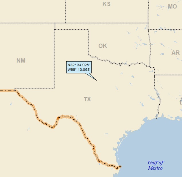
Dan:  Today’s lat/long (N40o 56.572’, W85o 13.741) puts me in northeast Indiana:

Here’s my local landing map:

My streams-only map shows that I landed in the watershed of Robinson Creek, on to the Little Wabash River (3rd hit); to the Wabash (32nd hit). 

Of course, the Wabash winds its way down to the southern tip of Indiana, where (after proudly serving for a time as the boundary between IL & IN), it discharges to the Ohio (161st hit); on, of course, to the MM (1015th hit).

Over on Google Earth (GE), I discovered a stream (OK, a ditch) more local to my landing than Robinson Creek:

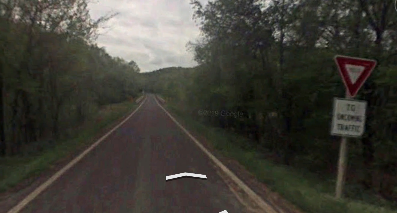
GE let me know its name is Bundle Ditch.  The OD was excited that he also got a good look at the big yellow arrow:

Speaking of the big yellow arrow, the OD could get even closer:

Why it’s now red, I have no clue.

And just around the corner, he got another look that includes the farmhouse of the likely owner of my landing spot:

I couldn’t help but notice that I landed quite close to an airport:

Zooming back, you can see that it’s the Fort Wayne International Airport. 

“International,” eh?  Me being me, I searched my Flight Radar 24 app for any flights to or from Canada, and could find none.  Maybe at some time in the past, there was a Toronto-Fort Wayne flight . . .

I’ve got some ground to cover, so I better get going.  I’ll start out with the far-and-away largest town in my landing area (once you exclude Fort Wayne), Huntington (pop  17,000).  Wiki let me know it is the hometown of Elizebeth (yes, that’s how she spelled her name) Friedman.  She has quite the bio.  I read several sources (including Wiki, of course), and here’s her story in my own words:

She was born (of course) in Huntington in 1892 (making her about the age of my grandparents).  She was a good student, and went to college where she majored in English Literature.  After graduating, she ended up working in Chicago for a rich guy – Colonel George Fabyan – who was obsessed with the notion that Sir Francis Bacon was the actual author of Shakespeare’s plays and poems.  He actually financed a “research laboratory,” with the main goal of investigating and substantiating his Baconian authorship claim. 

First some background.  Sir Francis Bacon was quite the man-about-town and bon vivant in early 17th century England.  He was a philosopher, statesman, scientist and author, well regarded amongst the educated upper crust. 

Well, it turns out he had a thing for cryptography, and he developed a cipher for placing hidden messages within a normal-looking string of text.  Key to his method was the use of two slightly-different typesets (resulting in two slightly different fonts) when printing a particular text.  Evidently, it wasn’t uncommon for 16th and 17th century printing to be a little random when it came to the use of various typesets.

When he wanted to include an encrypted message in a document (and he was involved with setting typeset), he used two typesets.  The text could be anything.  Here’s an example, where the black letters represent one typeset and the red letters another:

Letting “a” represent the black letters and “b” represent red letters, we have:

baaaa aaaa abbaa aaabb abbab ababb

Here’s the Baconian code:

Letter Code Letter Code
A aaaaa N abbaa
B aaaab O abbab
C aaaba P abbba
D aaabb Q abbbb
E aabaa R baaaa
F aabab S baaab
G aabba T baaba
H aabbb U, V baabb
I, J abaaa W babaa
K abaab X babab
L ababa Y babba
M ababb Z babbb

I’ll give you a moment to decipher the word.  As you can see, the encrypted word is a favorite (and a keystone) for this blog!  If you absolutely don’t have the patience to figure it out, I’ll spill the beans at the end of this post . . .

So, back to Elizebeth . . .

It turns out that some of the early Shakespeare plays and poems were printed using more than one typeset.  Knowing about Bacon’s cipher, advocates of the Bacon – Shakespeare connection assumed that Bacon would have been able to involved himself with typesetting and would encrypt some messages or clues about his authorship within the printed documents. 

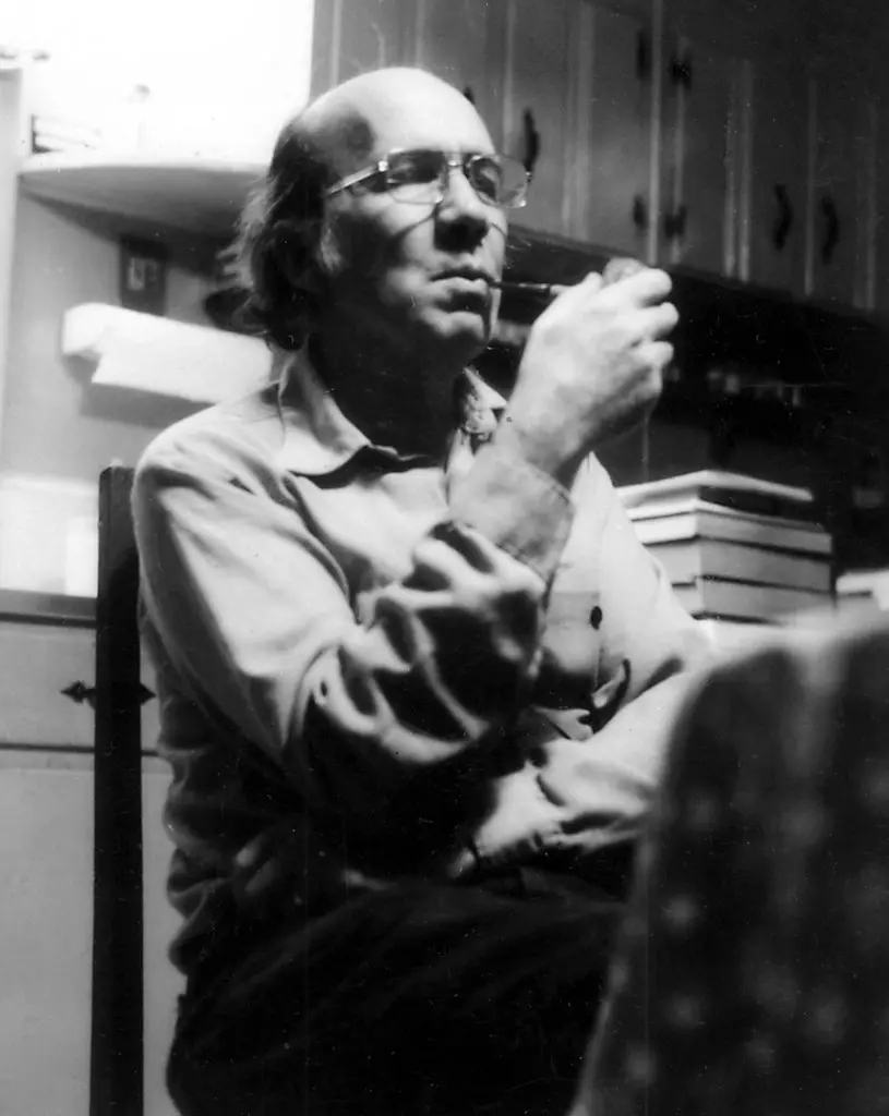
Elizebeth Smith spent several years working on this project.  While at the laboratory, she met a man also working on the project who would become her husband – William Friedman.

So.  World War I breaks out, and suddenly cryptographers were needed to break the codes that the Germans were using to hide their war maneuvers.  Up stepped Elizebeth and Bill, who were hired by the U.S. War Department as code breakers. 

During the Depression years, Elizebeth worked on breaking the codes of bootleggers as well as international smugglers and drug runners.   

World War II found the Friedmans once again working together for the U.S. Government to break German war codes.  Wiki let me know that “over the course of the war, the Friedmans decoded over 4,000 messages.”

After the war, they returned to the Bacon-Shakespeare issue, and collaborated on the definitive book on the subject:  The Shakespearian Ciphers Examined.  In it, they discounted any notion that Bacon wrote any Shakespearian plays or poems. . .

One of the Friedman’s favorite phrases was “Knowledge is power.”  They set up this photograph of the staff involved in the World War I codebreaking:

Using Bacon’s cipher (with the code based on which way the people were looking), the message “knowledge is power” is contained therein.

Here’s a shot of the Friedmans. Note the above picture behind the glass on the desk (lower right):

And as a final cipher, here’s William’s tombstone:

A close-up:

Note the two fonts used — for example, the flourishes on the G and on the final E, but not on other letters.  Without worrying about the details, the hidden message is “WFF,” William’s initials . . .

Moving down to Ossian.  Of course, if I had to put money on it, I’d bet that some railroad executive had the last name of Ossian.  And, to honor said executive (or to convince him to route the rail in a certain direction), the town was named Ossian.  Well, I’d lose my bet.  Wiki let me know that the town was named after Ossian, “the narrator and purported author of a series of epic poems published by the Scottish poet James Macpherson.”  Oh, really?

In the 1760s, this guy Macpherson (an already-well-known Scottish poet), published works that he claimed were ancient manuscripts of epic poetry penned by the aforementioned Ossian – a legendary bard in Irish (Scottish?) mythology.

The public bought into this, and the works were internationally acclaimed.  Of course, they didn’t have the internet to fact-check Macpherson’s claims.  Surprise, surprise, Macpherson made the whole thing up and wrote the poems himself.  Evidently, he kept this fact close to the vest, and the authorship of the poems spawned a controversy, with some critics slamming Macpherson for being a fraud.

Come on, dudes.  If it’s great epic poetry, it’s great epic poetry, and if written by Macpherson, good for him!  Anyway, it was good enough for the humble folks from northeast Indiana to name their town after the fictional author / hero.

Fingal is one of Macpherson / Ossian works.  Here’s the opening verse:

CUTHULLIN sat by Tura’s wall: by the tree of the rustling sound. His spear leaned against a rock. His shield lay on grass by his side. Amid his thoughts of mighty Carbar, a hero slain by the chief in war; the scout of ocean comes, Moran the son of Fithil!

I know I’d have trouble reading this.  We’re 0.2% of the way through the poem, and already five (count ‘em, five) characters have been introduced. 

OK.  One more verse:

“Arise,” says the youth, “Cuthullin, arise. I see the ships of the north! Many, chief of men, are the foe. Many the heroes of the sea-borne Swaran!”

“Moran!” replied the blue-eyed chief, “thou ever tremblest, son of Fithil! Thy fears have increased the foe. It is Fingal, king of deserts, with aid to green Erin of streams.”

“I beheld their chief,” says Moran, “tall as a glittering rock. His spear is a blasted pine. His shield the rising moon! He sat on the shore! like a cloud of mist on the silent hill! Many, chief of heroes! I said, many are our hands of war. Well art thou named, the Mighty Man; but many mighty men are seen from Tura’s windy walls.”

Three more characters, but I must admit, I kind of like the vibe.  Any chance I’ll take a shot at reading this?  Little to none.  I must say that I’ve often wondered why I have such a problem reading “classic” literature – I get bogged down in incomprehensible phrasing & references – but millions of folks who came before me can not only read the classics, but love them. 

Moving on to Roanoke (named after – you guessed it – Roanoke Virginia).  Wiki notes that Kiilhsoohkwa is a Notable Person.  Kiilhsoohkwa was Wiki-clickable:

Kiilhsoohkwa (1810 – 1915) was a member of the Myaamia Nation and granddaughter of Myaamia Chief Mihšihkinaahkwa.    She was one of the few Myaamia who was not removed from Indiana in 1846.

In her later years, she lived in Roanoke, Indiana, on the last forty acres that remained of her family’s and her nation’s territory.  She only spoke in her native language.

She was described in 1905 as “a big woman, of swarthy appearance, and…a devotee of the pipe, which she has with her almost incessantly.”

[Wow.  A devotee of the pipe, and she lived to be 105 . . . ]

In 1915, a Fort Wayne newspaper reported that, “if a stranger called, the old woman would grasp the hand and give a firm grip, and after looking you over she would in her quaint way and feeble voice mutter a few words in her native tongue, that if interpreted would be a hearty welcome and a wish for good health”  An estimated 15,000 attendees celebrated her 100th birthday in Roanoke and her centennial was well-documented in Indiana newspapers.

She died on 4 September 1915 at her home in Roanoke after spending a few weeks ill and confined to her bed. In a 1917 book by Calvin Young about the local Indians, her death was described as “without a struggle, for death was only a break in the well worn thread of life.”   The book also noted that she was “the last royal Miamis and the oldest resident of the State of Indiana, who had enjoyed a national reputation.”

What I like about Kiilhsoohkwa is that she achieved a significant measure of fame, with no apparent reason except that she was venerated as a warm and wise woman.  Here’s a picture of her and her son at her 100th birthday . . .

I’ll close with this shot of Wood Farm, posted on GE by Dan Wood.  Wood farm is just north of my landing, across the road from the airport:

I can just imagine Dan Wood saying something like this as he was getting ready to take the picture:  “Listen up, girls, it’s picture time!  That’s right – everybody line up!  Look at the camera!  And that means you, Isabel – there’ll be time for munching on grass after the photo.  OK, everyone – smile!”

Oh yea – I almost forgot – my encrypted word is: RANDOM.

That’ll do it . . .

KS

Greg

Posted in Uncategorized | Tagged: , , , , , , | 1 Comment »

Albany, Texas

Posted by graywacke on March 24, 2023

First timer? In this formerly once-a-day blog (and now pretty much a once-a-week blog) I use an app that provides a random latitude and longitude that puts me somewhere in the continental United States (the lower 48).  I call this “landing.”

I keep track of the watersheds I land in, as well as the town or towns I land near.  I do some internet research to hopefully find something of interest about my landing location. 

To find out more about A Landing A Day (like who “Dan” is) please see “About Landing” above.  To check out some relatively recent changes in how I do things, check out “About Landing (Revisited).”

Landing number 2616; A Landing A Day blog post number 1061

Dan:  Today’s lat/long (N32o 34.926’, W99o 13.863) puts me in central-north Texas:

Here’s my local landing map:

And my streams-only map:

I landed in the watershed of Hubbard Creek; on to the Clear Fork of the Brazos River (7th hit); on to the Brazos (38th hit), which flows south and discharges into the Gulf of Mexico.

Moving over to Google Earth, the Orange Dude could get a so-so look at my landing:

And here ‘tis:

He went a few miles north to get a look at Hubbard Creek:

And trust me:  the Texas DOT posted “Hubbard Creek” signs at either end of the bridge.

So just one titular town, eh?  So what’s up in Albany?  Named for Albany, Georgia (which was named for Albany NY, which was named for the Duke of Albany, the future King James II; Albany is a region in Scotland), Albany is the hometown of two notable World War II veterans. 

I wonder how the locals pronounce Albany? I’m reading Will Campbell’s book “Brother to a Dragonfly,” the same Will Campbell from LIberty MS that I featured a few posts ago. Anyway, it was pointed out to Will that the locals in Albany Georgia pronounce the name of their town: All-Benny. With nothing else to go on, I’ll assume that pronunciation made its way to Texas as well.

Anyway, f.From Wiki:

Lieutenant Colonel William Dyess, survivor of the Bataan Death March in the Philippines and namesake of Dyess Air Force Base, was born in Albany on August 9, 1916.

Major General Robert B. Williams, who led the World War II aerial bombing raid on Schweinfurt, Germany, was born in Albany on November 9, 1901.

I’ll start with Lt. Col. Dyess.  From Wiki:

As a First Lieutenant in the Army Air Corps, Dyess led his squadron to Nichols Field, Manila, Luzon, Philippines, in November 1941.  After the Pearl Harbor attack on December 7th, the Japanese mobilized to attack and overrun the Philippines, starting on Luzon at Manila.

Dyess’ squadron was outgunned and ill-prepared for the all-out Japanese assault, and suffered heavy casualties during the opening of the war with Japan in late 1941.  Allied forces (American and Filipino) strategically retreated to the Baatan Peninsula.  Dyess maintained his unit’s morale in the face of staggering losses. When his squadron ran short of aircraft, Dyess transitioned to an infantry officer, serving in this capacity during the Battle of Bataan.

When the Bataan Peninsula fell to the Japanese, Dyess, as a commanding officer, refused to abandon those of his squadron who could not be evacuated. 

Dyess was captured by the Japanese on April 9 near Mariveles, at the southern end of the peninsula.  The next morning, he and the others who surrendered at Bataan began the infamous Bataan Death March, where 76,000 Filipinos and Americans POWs were forced to walk 65 miles.    Only 54,000 arrived at the POW camp; most of the deaths were Filippino. 

 He was imprisoned at several POW camps on Luzon and then shipped to the Davao penal colony on Mindanao (an island south of Luzon),  arriving November 7. After months of planning and preparation, Dyess, along with 9 other American POWs  and two Filipino convicts escaped from Davao on April 4, 1943.

It was the only large-scale escape of Allied POWs from the Japanese in the Pacific Theater during World War II. Dyess and his group spent several weeks evading pursuit, then joined a group of Filipino guerrilla fighters for several months.  The group decided to split up, with seven joining organized guerrilla forces in northern Mindanao. Dyess and two others were evacuated by the U.S. Navy submarine Trout to Australia in July 1943.

Tragically, Dyess died in an air crash in December while training to return to active duty.

Phew.  World War II stories blow me away . . .

I’ll move now to Major General Robert Williams, who led the World War II aerial bombing raid on Schweinfurt, Germany.  The Schweinfurt Raid was part of a two-pronged simultaneous raid, the other target being Regensburg, Germany.  The raid took place in August 1943; the targets were aircraft manufacturing facilities, focused on ball-bearing facilities, a critical aircraft component.  The raid was the first major raid deep in Germany targeting major industrial infrastructure.  It was the first raid that went further into Germany than the escort fighter planes could go.   From Wiki:

Williams flew the mission as co-pilot of a B-17 in the lead group and manned a machine gun in the nose of the bomber, firing until the barrel burned out.

Here’s a statistical summary of the raids:

Regensberg

Bombers:                    146  (24 lost)
Fighter escorts:             87  (0 lost)

Schweinfurt

Bombers:                    230 (36 lost)
Fighter escorts:           184 (5 lost)

Airman missing after raid:  552 (about half becoming prisoners of war)

The raids were not considered successful:  obviously, losses in aircraft and personnel were staggering, and the damage to the facilities, while significant, was insufficient to materially interfere in the German war machine.  From Wiki:

Albert Speer (Hitler’s Minister of Armaments) reported an immediate 34 percent loss of aircraft production.  However, both the production shortfall and the actual loss of bearings were made up for by extensive surpluses found throughout Germany in the aftermath of the raid. The industry’s infrastructure, while vulnerable to a sustained campaign, was not vulnerable to destruction by a single raid.

Also from Wiki:

After the war, Major General Haywood S. Hansell wrote about Williams:

Bob Williams’s achievements are less well known, but his stature looms large in the eyes of his men and associates. Although he could exercise little command control during the mission, his contribution came in the months of training and indoctrination and inspiration leading up to the mission. His presence on the mission meant a lot to the crews and to the conduct of the operation.

Moving to a personal story:  The above piece reminds me of a story told to me by my ex-father-in-law, Jarvis Cooper.  He was in the Air Force during WWII, and flew in a B-17 bomber on a December 30, 1943 raid similar to what is described above.  He was the flight navigator, one of ten crewmen on board the B-17 “Judy.” 

Jarvis (I think) is the second from left in the first row.

This was crew’s first mission (perhaps the Judy’s first mission).  Over occupied France, the bomber was damaged by anti-aircraft “flak” fire, damaging the craft so that it could not keep up with other bombers in the formation.  Separated from the pack, it was attacked and hit by fire from German fighter planes,  The pilot gave the order to abandon the aircraft; seven crew members were able to deploy their parachutes, six (including Jarvis) survived.  Three crewmen went down with the plane. 

Jarvis was cared for and housed in secret by the French Resistance, with whom he remained for six months.  He was given papers, taught some French, disguised as a French peasant, and placed on a train to Spain where he would be able to escape. 

Near the border, he was questioned by a Gestapo agent who was fluent in French.  He noted that Jarvis was taller than the average Frenchman (he was 6’ 2”), and he began questioning him.  He noted his non-native French.  Jarvis was searched, and his American paperwork was found in one of his shoes.  The Gestapo agent literally said:  “For you, the war is over.”

Jarvis had a terrifying several days (including death threats), but ended up in a German POW camp where he remained until being liberated by the Russians in 1945.

Two post scripts:  In 2011, the small town in France near where the Judy went  down (Ully St. Georges) unveiled a town square memorial honoring the crew of the “Judy.” My son Ben (Jarvis’ grandson) was in attendance at the ceremonial unveiling.  He was immensely moved by the hospitality of the French people who organized the event and hosted his visit. 

Here’s a pic (Ben’s the young man nearest the monument on the left):

Second post script:  The Judy’s crew were reported as Missing in Action, with no word to family about their fate.  Months later, Jarvis’ sister Ina went to see a movie.  There was a “newsreel” shown before the movie; it included footage shot by the American Red Cross at a POW camp.  Ina saw her brother!  Just telling the story gives me shivers . . .

And back to Albany Texas I go, looking for a post-ending scenery shot.  I found a photo posted on GE by Brian Bechtol of a 1896 wooden-deck suspension bridge over the Clear Fork of the Brazos:

Here’s another shot of the bridge, from HIstoricBridges.org:

That’ll do it . . .

KS

Greg

© 2023 A Landing A Day

Posted in Uncategorized | Tagged: , , , , | 1 Comment »

Thistle, Utah (Revisited)

Posted by graywacke on March 17, 2023

First timer? In this formerly once-a-day blog (and now pretty much a once-a-week blog) I use an app that provides a random latitude and longitude that puts me somewhere in the continental United States (the lower 48).  I call this “landing.”

I keep track of the watersheds I land in, as well as the town or towns I land near.  I do some internet research to hopefully find something of interest about my landing location. 

To find out more about A Landing A Day (like who “Dan” is) please see “About Landing” above.  To check out some relatively recent changes in how I do things, check out “About Landing (Revisited).”

Landing number 2615; A Landing A Day blog post number 1060

Dan:  Today’s lat/long (N40o 5.942’, W111o 32.615) puts me in central-north Utah:

Here’s my local landing map:

Zooming back:

My streams-only map shows that I landed in the watershed of the Mapleton Lateral, on to Spanish Fork (6th hit):

As you know, I hesitate to use a man-made drainageway in my watershed analysis, preferring instead to figure out the God-intended path that leads water away from my landing.  I suspect that industrious Mormon farmers from nearby Mapleton altered a local stream, and named it after themselves.  Oh, well.

Anyway, zooming back:

Spanish Fork discharges into Utah Lake, which is drained by the Jordan River (7th hit), and then flows to the Great Salt Lake (23rd hit). 

Before moving on to Google Earth, I checked out the Wiki page for Utah Lake.  I was surprised to read this about the Timpagonots, a Native American tribe that lived at the lake before white men arrived:

The Timpagonots were ethnically cleansed from the area by Mormon settlers between the 1850s and 1870s.

Ouch.  Sounds like the author isn’t a fan of the Mormons.  To be fair, our entire western hemisphere was ethnically cleansed of Native Americans . . .

OK, I couldn’t resist.  I dug a little deeper, and found that the Mormons – upset that the Indians were stealing their cattle – launched a campaign to rid their valley of the Indians.  It’s a typically-tragic story; I won’t go into the details, except to say that there was a settlement called “Battle Creek,” near the site of the Battle Creek Massacre.  The settlement was renamed “Pleasant Grove.”  Yea, right . . .

As I mentioned above, Mormons are no worse than the multitude of other white people who mistreated the Indians.  But they were no better . . .

Geez.  And I’m still in my watershed analysis.  Yo Orange Dude – change the tone of this post, please.  He suggested that since I landed in some dramatic mountains, I should start off with some shots using the platform that is his reality:  Google Earth.  Here’s a shot looking east through the Spanish Fork Canyon (with my landing halfway up the mountain to the left):

And this, looking north along the Wasatch Front:

The yellow push pin has quite the view!

The OD had to look long and hard to find a bridge over the Mapleton Lateral.  He found one, near the Spanish Fork Canyon:

He then followed the Spanish Fork downstream towards Utah Lake, and finally found a bridge with yet another shot of Spanish Fork Canyon.  He liked this view much better:

Oh man. I almost forgot about my landing spot. The OD could actually get pretty close:

He was happy to get a nice clean look at the big yellow arrow, only about a mile and half away:

So there’s a major swath of urbanization along the eastern shore of Utah Lake that I’m going to ignore for this landing:

This strip of Americana (with a strong Mormon accent) extends north all the way to Salt Lake City.  All the towns were founded in the 1850s by . . . . Mormons!

It turns out that way back in December 2008 (blog post 16), I landed near the ghost town of Thistle.  In that post, I said very little about the history of Thistle. 

From the Deseret News (deseret.com, a Mormon news site):

Located about 15 miles up Spanish Fork Canyon at the junction of U.S. 6 and U.S. 89, the area was first called “Camp Thistle” in the early 1870s by railroad workers constructing the first rail line from Denver and eastern Utah’s coal country to Salt Lake City.

Helper engines were kept at Thistle to help trains make it up the steep grade at Soldiers Summit to the east. The area eventually developed into a major railroad maintenance stop, and workers settled in the area to be closer to their jobs.

By 1917, Thistle had more than 600 residents. It had three general stores, a pool hall, a saloon, a post office, a school and a barbershop. Residents held dances and parties in an abandoned tunnel that was drilled by early railroad workers in Billies Mountain to the north.

The town’s demise began in the early 1950s when more-powerful diesel engines replaced steam engines and helper engines were no longer needed. During the next 10 years, workers were relocated, and the railroad companies began tearing down abandoned structures. Only retired railroad workers and a few farmers stayed behind, most because they couldn’t make enough profit on their property to relocate to Utah Valley.

Reason enough for Thistle to be a ghost town.  But there’s even more of a reason that Thistle is a ghost town (from Wiki):

In April 1983, a massive landslide (specifically a complex earthflow) dammed the Spanish Fork (river).  Because the earthflow was slow-moving, there was time for the residents of Thistle to be evacuated before the river was dammed and a huge lake was created, flooding and destroying what remained of the town.

Before moving on to the landslide, I must say that I spent an inordinate amount of time looking for the origin of the town name.  I could find nothing, after looking at maybe 15 apparently-promising websites.  My conclusion is that the town was named after the common thistle, a plant native to the western United States.  It’s easy to imagine some early railroad workers, establishing a working camp, who were annoyed at the abundance of thistles.  Very informally, they began to call their camp “Camp Thistle.”  The name stuck . . .

Here are some back-in-the-day shots of the town:

From my 2008 post:

Thistle’s relative fame comes from its demise.  From the Utah Geological Survey:

 Record-breaking precipitation in the fall of 1982, followed by a deep winter snow pack, then warm spring temperatures and rapid snowmelt in 1983 set the stage for the Thistle landslide. Once triggered, the landslide moved at an average speed of about 2′ per hour, with a maximum speed of 3.5 feet per hour. It dammed Spanish Fork River within a few days.

The landslide ultimately reached 1000 feet in width, over 200 feet in thickness, and over one mile in length. The lower end of the slide formed a 220-foot-high dam where it abutted against a sandstone cliff.  Behind this dam, “Thistle Lake” reached a maximum depth of 160 feet before being drained by diversion culverts.

The Thistle landslide and “Thistle Lake” severed railroad service between Denver and Salt Lake City, flooded two major highways (U.S. 6 and U.S. 89), submerging and destroying the town of Thistle.

So, the landslide was slow-moving, but created one heck of a dam (200′ high!) and created one heck of a lake (160′ deep!). An army of construction workers with scads of heavy earthmoving equipment tried in vain to stabilize the slope.

From the USGS, here’s an aerial photo that shows the scene after the river was dammed by the slide.  The water behind the landslide is the new lake.  The town of Thistle is totally under water just up from the dam:

From the Utah Geologic Survey, here’s a shot from looking downstream towards the dam, after the lake was drained (note the lake shoreline is marked):

Also from the Utah GS, here’s a shot looking upstream at the dam:

Here’s a shot of the old school house just before the flood waters reached it:

And how it looks today:

And yes! Those are thistles in the foreground!

I’m going to close with this shot of a guy kite surfing on Utah Lake, posted on GE by Asi Yoked.  We’re looking east; you can see the Spanish Fork Canyon in the distance:

That’ll do it . . .

KS

Greg

© 2023 A Landing A Day

Posted in Uncategorized | Tagged: , , | Leave a Comment »

Woodville, Rosetta and Liberty, Mississippi

Posted by graywacke on March 10, 2023

First timer? In this formerly once-a-day blog (and now pretty much a once-a-week blog) I use an app that provides a random latitude and longitude that puts me somewhere in the continental United States (the lower 48).  I call this “landing.”

I keep track of the watersheds I land in, as well as the town or towns I land near.  I do some internet research to hopefully find something of interest about my landing location. 

To find out more about A Landing A Day (like who “Dan” is) please see “About Landing” above.  To check out some relatively recent changes in how I do things, check out “About Landing (Revisited).”

Landing number 2614; A Landing A Day blog post number 1059

Dan:  Today’s lat/long (N31o 9.853’, W91o 2.873) puts me in southwest Mississippi:

Here’s my local landing map:

My local streams-only map shows that I landed in the watershed of Tatum Creek, on to Beaver Creek:

Zooming back, Beaver Creek discharges to the Amite River (only my 2nd hit), which discharges to Lake Maurepas, which is connected to Lake Pontchartrain via the Pass Manchac:

Incidentally, my first Amite River landing was way back in June of 1999 (landing 49, way before my blog started), which was my first landing ever in Louisiana . . .

The Amite is a meandering river, with cut banks and point bars at every bend.  As you may know, point bars are sand bars deposited on the inside of river bends, and cut banks are erosion features on the outside of every bend.  Here’s a good Google Earth (GE) look at what I’m talking about:

The Orange Dude found a bridge maybe 20 miles downstream from my landing, just down stream from a cut bank (on the left) and a point bar (on the right):

Engineers realized that they needed to protect the cut bank, because continued erosion could threaten the road & bridge.  See all the rip rap?  The vertical stone wall in the middle distance is made of stacked gabions, which are rock-filled metal baskets . . .

Of course, the OD scoped out my landing spot:

Even though he could get pretty close (only 1/3 of a mile away), he couldn’t see anything past this house:

This GE shot shows the tracks of what appears to be many years worth of off-road vehicle traffic:

Zooming in:

And the tracks go all the way to my landing:

I wonder what the riders thought of that suddenly-appearing yellow pushpin?

I have three towns to visit.  I think I’ll start with Woodville.  It’s a really old town (founded in 1811, and unlike its midwestern small-town cousins, its founding (of course), had nothing to do with railroads.  It was founded along an old north-south road that paralleled the Mississippi River, and connected two old river towns:  St. Francisville LA to the south and Natchez MS to the north.  This road followed the historic Indian trail, the Natchez Trace (which has been replaced by US Route 61):

Wiki let me know that John James Audubon visited here in the 1820s, and he found “more than 26” of the species that he documented and painted for his Birds of America series.

I put “more than 26” in quotes, because the meaning of that phrase (and ones like it) is obscure.  Do we mean 27?  Something between 27 and 30?  On a resume, it always annoyed me when I’d read, “Mr. Johnson has more than 26 years of experience in the environmental field.” 

Of course, Mr. Audubon’s name was wiki-clickable, so I looked to see if I could find anything of particular interest about his visit here.  I couldn’t, but ran across a quote of his, describing his experience in Missouri during the 1811 New Madrid earthquake.  I’ve written about this massive earthquake before – it was perhaps the largest earthquake ever to strike the United States. Of course, the earthquake wasn’t local to my landing, but I love what Mr. Audubon had to say about it. From Wiki:

Audubon was working in Missouri and out riding his horse when the 1811 New Madrid earthquake struck. Audubon writes that while on horseback, he first believed the distant rumbling to be the sound of a tornado . . .

“. . . but the animal knew better than I what was forthcoming, and instead of going faster, he nearly stopped and I noticed that he placed one foot after another on the ground with as much precaution as if walking on a smooth piece of ice.  

I thought he had suddenly foundered, and, speaking to him, was on point of dismounting and leading him, when he all of a sudden began a-groaning piteously.  He hung his head, spread out his forelegs, as if to save himself from falling, and stood stock still, continuing to groan.

I thought my horse was about to die, and would have sprung from his back had a minute more elapsed; but at that instant all the shrubs and trees began to move from their very roots, the ground rose and fell in successive furrows, like the ruffled water of a lake. 

I became bewildered in my ideas, as I too plainly discovered that all this awful commotion was the result of an earthquake. I had never witnessed anything of the kind before, although like every person, I knew earthquakes by description. But what is description compared to reality! Who can describe the sensations which I experienced when I found myself rocking, as it were, upon my horse, and with him moving to and fro like a child in a cradle, with the most imminent danger around us?”

You may have figured out that the only reason I featured Woodville was to be able to feature the above quote by Mr. Audubon . . .

Anyway, moving on to Rosetta.  Wiki says essentially nothing about the town, but I can only assume that its naming was somehow related to the Rosetta Stone, and/or the Egyptian town of Rosetta (Arabic Rasheed), where the stone was found.  It’s located on the Nile Delta, along the Rasheed branch of the Nile near the Mediterranean Sea:

There’s an interesting story behind the Rosetta Stone.  Inscribed on the stone are three versions of a decree issued in 196 B.C. The first two texts are ancient Egyptian; the top is hieroglyphic script; and the middle text is more recent (but still classified as ancient Egyptian) and is known as Demotic.  The third text is Ancient Greek.

Because Ancient Greek was well known to scholars, the Rosetta Stone allowed the Ancient Egyptian scripts to be deciphered.  Here’s the stone:

And a close-up showing the two upper-most texts:

And the two lower-most texts:

The stone is a fragment, as shown in this artist’s reconstruction:

Fortunately, there are sufficient overlapping texts to allow linguists to use the Rosetta Stone as a key for translating other examples of Ancient Egyptian writings.

The stone was carved fairly soon after the 196 B.C. decree, and was likely displayed in a temple.  The temple was abandoned, and the stone was co-opted for use as a building stone in building Fort Julien – just north (down river) from Rosetta, and the location where the stone was found.  The fort was constructed around 1470.

In 1799, the dilapidated fort was visited by a French diplomat, who noted that it was “constructed of parts of old buildings; and that several of the stones of the embrasures* were of the fine free-stone of Upper Egypt, and still covered with hieroglyphics.”

*narrow slits in the structure of a fort to allow defenders to shoot arrows.

The diplomat took the stone to Alexandria, where it was extensively  copied using plaster casts, and circulated to European scholars.  When the British ousted the French from Egypt in 1801, the stone was transported to London, where it remains to this day (in the British Museum).

Moving on to Liberty.  I didn’t see a hook until I noticed an entry under “Notable People” for “Will B. Campbell – minister, author, civil rights activist.”  It turns out that remarkably, I have just two degrees of separation from Will Campbell (although I probably would have checked into him as a matter of potential interest).   So, here’s the story:

My wife Jody and I have some dear friends in New Orleans – Susan & Kelly, (parents) and Rachel & Joel (kids, now married adults with their own kids).  Susan and Jody go way back to hippie days in San Francisco in the early 70s.

Through the years, we’ve become aware of (and met) Susan’s friend Penny Campbell, a daughter of none other than Will Campbell.  Susan and Penny met years ago as New Orleans social workers and became close friends.  Susan went with Penny to the Campbell household in Mount Juliet Tennessee (near Nashville) many times, and got to know the family well, including Will. 

Before relating some of Susan’s first-hand experiences, here are a few excerpts from Will’s June 2013 NY Times obituary:

The Rev. Will D. Campbell, a renegade preacher and author who joined the civil rights struggle in the 1950s, quit organized religion and fought injustice with nonviolent protests and a storyteller’s arsenal of autobiographical tales and fictional histories, died on Monday night in Nashville. He was 88.

A knot of contradictions himself, he was a civil rights advocate who drank whiskey with Klansmen, a writer who layered fact and fiction, and a preacher without a church who presided at weddings, baptisms and funerals in homes, hospitals and graveyards for a flock of like-minded rebels that included Johnny Cash, Willie Nelson, Dick Gregory, Jules Feiffer (famed cartoonist) and Studs Terkel (Pulitzer prize-winning author).

 Most of his scattered “congregation,” however, were poor whites and blacks, plain people alienated from mainstream Christianity and wary of institutions, churches and governments that stood for progress but that in their view achieved little.

After a fashion, he was also an eccentric voice of wisdom in the funny papers — the model for the Rev. Will B. Dunn, the bombastic preacher with the broad-brimmed clerical hat in “Kudzu,” Doug Marlette’s syndicated comic strip about rural Southerners.

[more about Kudzu in a bit]

Followers and friends called Mr. Campbell hilarious, profound, inspiring and apocalyptic, a guitar-picking, down-home country boy who made moonshine and stomped around his Tennessee cabin in cowboy boots and denim uttering streams of sacred and profane commentary that found their way into books, articles, lectures and sermons.

“Brother Will, as he was called by so many of us who knew him, made his own indelible mark as a minister and social activist in service to marginalized people of every race, creed and calling,” former President Jimmy Carter said.

[more about Jimmy Carter in a bit]

The son of Mississippi cotton farmers, Mr. Campbell grew up in a backwater of segregated schools, churches and cracker-barrel country stores where men chewed tobacco and spat bigotry. He was ordained a Baptist minister at 17 and attended three colleges and Yale Divinity School before embarking on an unsatisfying life as a small-town pastor and then chaplain at the University of Mississippi. He left Ole Miss amid death threats over his integrationist views

As a race-relations troubleshooter for the National Council of Churches from 1956 to 1963, he joined the Rev. Dr. Martin Luther King Jr., the Rev. Ralph Abernathy, James Farmer, Bayard Rustin, John Lewis and other civil rights luminaries in historic confrontations across the South.

Mr. Campbell was the only white person invited by Dr. King to the founding of the Southern Christian Leadership Conference at Ebenezer Baptist Church in Atlanta in 1957. Months later, Mr. Campbell helped escort black students through angry crowds in an attempt to integrate Central High School in Little Rock, Ark.

His belief that Christ died for bigots as well as devout people prompted his contacts with the Ku Klux Klan, and he visited James Earl Ray in prison after the 1968 assassination of Mr. Campbell’s friend Dr. King. He was widely criticized for both actions.

Here’s a picture of Will (perhaps at the same hotel in Memphis where King was shot), grieving with Ralph Abernathy soon after Dr. King was murdered:

I stumbled on a post by Eric Kerl where he presented an excerpt from his book “White Bred: Rednecks, Hillbillies, and White Trash Against White Supremacy” (in the chapter entitled “Everything But Country.” Here are some excerpts from his excerpt:

“I’m here to integrate this joint.”⁠ That’s how Mohammed Ali – three-time heavyweight boxing champion, Vietnam War resister, and Black Muslim explained his presence to an unlikely gathering of while folks in Nashville, TN in 1979. Ali was there to celebrate the christening of Shooter Jennings, the new son of outlaw country musician Waylon Jennings, with whom he had developed a close personal friendship. Shooter’s godfather Johnny Cash, along with Willie Nelson and Kris Kristofferson were there as well.

Here’s a photo from that gathering, with Ali, Waylon and Shooter:

You’ll never guess who also was at that gathering . . .

Sitting with Ali at this remarkable gathering was a white, tobacco-chewing, renegade southern Baptist “bootleg preacher” and amateur country musician named Will Campbell. One journalist described him as one of the South’s leading preachers—an earthy, erudite theologian and author who takes satisfaction in giving offense, in proclaiming a kind of scandalous, radicalized vision of the faith, producing shock and astonishment nearly anywhere he goes.⁠

Two decades before this gathering, Campbell helped escort nine young Black students to school in Little Rock, Arkansas while foaming racists hurled abuse.⁠ That same year, Campbell was the sole white person in attendance at the founding of the Southern Christian Leadership Conference. While some activists opposed his presence, Bayard Rustin demanded, “Let this man in. We need him.”⁠

So.  Back to our friend Susan.  She remembers many stories relating to Penny and Will. Here are a few… 

Susan recalled the time when Will and family were traveling from their home in Mt. Juliet TN to southwest Louisiana (near Lake Charles), for a visit to Will’s wife Brenda’s hometown.

Will managed to convince Lucinda Williams (another country music star) to loan him her band bus (with driver) to drive the family to Louisiana for a quick visit and then return to Nashville.  They stopped in New Orleans to pick up Susan and her son Joel.  It was a memorable trip for Susan – she was regaled with vintage Will stories; but also memorable for Joel, who rode up front with the driver – who had driven many band buses, not just for Lucinda Williams.  Joel (aged 15) paid rapt attention to stories of rock and roll and country singers and their life on the road . . .

Another road trip story: Susan and Penny were on a drive from New Orleans to Mt. Juliet when Susan’s car was passed by a large contingency of motorcycles. “Seeing that motorcycle gang reminds me of story,” said Penny. She recalled that her father was counseling a local woman who was suffering physical abuse at the hands of her husband. Realizing that this woman needed more help than just counseling, Will made a call to the leader of a local motorcycle gang. “Could you boys help me out? I need you and your friends to show up at a house of a couple I know. You’ll need to let the man of the house realize the error of his ways.” The not-so-friendly visit was performed, and the abuse abruptly stopped. It pays to have friends in various lines of work . . .

Another story: Will Campbell was vehemently against the Vietnam War, and during the height of the draft, he figured out a way to help young anti-war activists avoid the draft. Evidently — at least in Tennessee at that time — if you were an ordained minister, you could obtain a deferment for the draft. So of course, Will had no problem (and evidently had the authority) to legally ordain these activists as ministers.

Along those lines – Susan’s daughter Rachel was engaged to be married, and she and Adam wanted Penny to officiate their wedding. To do so, Penny needed to be an ordained minister. No problem! Will stepped up and ordained Penny so that she could legally marry Rachael and Adam. Jody and I attended the wedding, held at the New Orleans Wax Museum – a great venue. I had the honor of playing a keyboard rendition of the Beatles’ Here, There and Everywhere for their processional.

It was a truly wonderful (and at times hilarious) ceremony, certainly the most memorable wedding I’ve ever attended.

Tragically, soon after her father’s death in 2013, Penny Campbell was suffering a serious recurrence of a previously-diagnosed cancer.  Susan organized a bucket list road trip for Penny, with Susan as the driver and guide.  She knew that Jimmy Carter had a strong connection with Penny’s father, so she thought that a trip to Plains Georgia to attend one of Jimmy’s famous Sunday School classes should be on the itinerary.

Susan managed to reach one of Jimmy’s handlers.  She told him about Penny and their planned trip.  He was totally on board, and they scheduled a particular Sunday when Jimmy would be teaching. 

At some point along the road trip, Susan mentioned their upcoming stop in Plains.  Penny thought it was a good idea, but she emphatically wanted no fuss, no recognition of who her father was.

“Oh oh,” thought Susan, “this could be a problem.”

Susan distinctly remembers how out-in-the-middle-of-nowhere Plains is (coming from the west, it’s nearly 100 miles off the interstate).  Plains is teeny (pop 800), and she remembers parking behind the church in a field, practically in the woods.

Any chance of keeping Penny’s identity under wraps was quickly blown, as Jimmy’s handler met them, saying, “Penny Campbell?  Susan?”  Identities confirmed he said, “follow me.”

He had saved two seats near the front, and introduced them to Jimmy.  Jimmy said what a pleasure it was to meet Penny, and how much he respected and loved her father. He incorporated a tribute to Will as part of his sermon, and had Penny stand up.

After Sunday School, the handler had arranged that Susan and Penny would eat lunch with Jimmy and Rosalind – just the four of them (well, six if you count the Secret Service agents).  Susan’s primary memory of the lunch is just what a wonderful man Jimmy was, and what a loving couple Jimmy and Rosalind were. 

Post script:  Penny thoroughly enjoyed their stay in Plains, and put aside her early misgivings about getting extra attention…

One other quick story:  In 1994, Will gave the commencement address to a graduating class at the University of Southern Mississippi.  Susan & Penny attended the ceremony.  Susan’s most vivid memory was Will saying “God Bless Mississippi.”  She teared up when she heard those words, and teared up again while relating the story to us. 

Will was obviously vehemently opposed to racism, and perhaps was the most prominent white person in the country with a legitimate claim to that position.  But as mentioned previously, Will fervently believed in ministering to (and blessing) everyone, sinners and all.  And of course, Will knew many people from Mississippi, and was fully aware of the goodness that can be found throughout the state. As a southerner herself, Susan lives with the same paradox of loving the South, relishing that same goodness that abounds, while being painfully aware of the stain of slavery, Jim Crow and on-going racism.

Will was featured in a 1990 Rolling Stone article entitled “The First Church of REDnecks, WHITE socks and BLUE Ribbon Beer.”  Here’s the picture that accompanied the article:

To check out the article, click HERE.  It’s a highly-entertaining piece – well worth the read.

Anyway, Will actually wore the smock and wide-brimmed hat on a regular basis:  part of his image as a country preacher.  As mentioned above,  Will was the model for the preacher Will B. Dunn (as in the biblical “thy will be done”) on the long-running comic strip Kudzu (by Doug Marlette, running from 1990 – 2007).  Here are a few strips:

I’m going to close down this post with a look back at my watershed.  The Amite river discharges to Lake Maurepas, adjacent to (and hydraulically connected to) Lake Pontchartrain in the greater New Orleans area.  Here’s a GE shot:

Zooming in on Lake Maurepas:

As you can see, it is totally undeveloped; the shorelines are mostly cypress swamps.  A photographer – Andy Crawford – posted some cool pictures of the lake shore:

Before shutting down, I feel I must share a most peculiar mystery I stumbled on. Here’s a Street View shot looking east from the highway bridge over Pass Manchac – the waterway that connects Maurepas with Pontchartrain:

The above shot was taken in February 2021. I wanted to see if I could find an earlier GE Street View shot with the bridge open, which I was able to do in this January 2019 shot:

Note that under the drawbridge on both photos is a peculiar image in the water. I’ll zoom in on the open drawbridge shot:

What the heck is that? It’s there in both 2019 and in 2021! And it’s not visible on any overhead GE shots! I assume it’s something virtual added by Google, but I have no clue what or why . . .

I apologize to those of my readers who may be put off by this seemingly pointless digression. Sometimes I just can’t help myself . . .

I’ll close with this cool shot of the same highway bridge over Pass Manchac (the railroad drawbridge is off the photo to the right), posted on GE by Chad J Palardy:

That’ll do it . . .

KS

Greg

© 2023 A Landing A Day

Posted in Uncategorized | Tagged: , , , , , , | Leave a Comment »

Mine LaMotte and Zion, Missouri

Posted by graywacke on March 3, 2023

First timer? In this formerly once-a-day blog (and now pretty much a once-a-week blog) I use an app that provides a random latitude and longitude that puts me somewhere in the continental United States (the lower 48).  I call this “landing.”

I keep track of the watersheds I land in, as well as the town or towns I land near.  I do some internet research to hopefully find something of interest about my landing location. 

To find out more about A Landing A Day (like who “Dan” is) please see “About Landing” above.  To check out some relatively recent changes in how I do things, check out “About Landing (Revisited).”

Landing number 2613; A Landing A Day blog post number 1058

Dan:  Today’s lat/long (N37o 27.062’, W90o 18.925) puts me in southeast Missouri:

Here’s my local landing map:

My streams-only map shows that I landed in the watershed of that perennial favorite, Stream Perrenial, on to the Twelvemile Creek, on to the St. Francis River (6th hit).

Zooming back:

The St. Francis heads south, where it proudly acts as the boundary between MO and AR (helping to define Missouri’s “Bootheel”) before discharging into the MM (1014th hit).

I’ll jump over to Google Earth (GE) to try to get a look at my landing:

My landing is a ways off, and there are woods everywhere.  The OD dutifully looked towards my landing:

Hmmm.  A funky-looking building, eh?  Zooming in:

Looks like a 1960s-modern-architecture restaurant that fell on hard times.  But evidently, the windows were recyclable . . .

The OD headed southwest about 9 miles to get a look at Twelvemile Creek:

And here’s his upstream view:

He noted that this bridge carries just one lane:

And yes, there’s a sign at either end of the bridge warning drivers to yield:

Bur alas, no sign identifying Twelvemile Creek . . .

So.  It turns out that I landed near Mine La Motte back in April 2014.  From that post:

No offense to Frederickstown, but I couldn’t find a hook.  Of course, I saw the “town” with the intriguing name of Mine LaMotte.  I had to check that out.  From Wiki:

Mine La Motte dates back to the 1600’s when the Indians mined galena (a lead-containing mineral).  Europeans then discovered lead here, and Antoine de la Mothe Cadillac brought several hundred workers, including slaves from Santo Domingo, to develop mines in 1717 making it one of the oldest settlements west of the Mississippi River.

La Mothe named the mine after himself, and the town that grew up nearby was named after the mine. In 1804 the village had a population of 150 inhabitants.

Old Monsieur de la Mothe Cadillac got around.  He built a fort at what is now Detroit, and the Cadillac automobile was named after him, as was Cadillac Mountain in Maine.

 Anyway, it’s amazing to me that this early French explorer found lead deposits out in the middle of nowhere and had the technical abilities to mine the stuff.  I wonder how he managed to find the place?  Maybe he had an Indian guide who learned French who could tell him about the lead deposits (since evidently the Indians mined the lead themselves).

 I imagined fairly subtle lead deposits – maybe not obvious to the naked eye.  But I’m wrong about that.  From Wiki about the Southeast Missouri Lead District:

 The Southeast Missouri Lead District contains the highest concentration of galena (lead sulfide) in the world. Mineral specimens from here are highly prized by gem and mineral collectors and are found in museums worldwide.

 Exactly why lead ended up being deposited here is a little esoteric, so I’ll skip it.  But here’s a Wiki picture of galena and a calcite crystal (from southeast Missouri):

And another shot, a close-up showing the crystal structure (also from Wiki):

You can see why the Indians and Monsieur de la  Mothe Cadillac knew there was lead around . . .

If anyone had any doubt that it was lead, all they had to do was pick it up.  Galena’s specific gravity is 7.5, which means it’s 7.5 times has heavy as water, or almost three times as heavy as an “ordinary” rock.

 From MyLearning.org, this about historical processing (“smelting”) of galena:

The smelting process is essentially very simple. Pellets of galena are heated until they reach melting point. Because lead has a low melting point any impurities are not melted and are left as waste. Because non-lead impurities will float, the molten lead can be allowed to drain out the bottom of the melting pot into a collecting pot and then poured into molds to form blocks of pure lead metal.

To achieve the temperatures necessary (600-800ºC) to melt the lead from the Galena requires a source of fuel. These temperatures can be achieved with a wood fire along with a constant stream of air to aid combustion.  The air was historically provided by the use of hand bellows.        

The smelting process seems simple enough, which explains how it was done in the early 1800s out in the middle of nowhere.  I doubt that the Indians mined the galena to obtain elemental lead.  I found an AtlasObscura article about the Indians’ use of galena:

Anthropologists have long known that the Mississippian culture (circa 1000 – 1400 CE), centered on the city of Cahokia, in today’s southwestern Illinois, [about 100 miles north of Mine LaMotte] used powdered galena and other minerals in rituals and as decoration.  According to Broxton Bird, archeologist at Indiana University-Purdue University Indianapolis (IUPUI), “they would mix it with pigments, ochres and reds and yellows, or leave it by itself as a silvery powder.  It was a shiny metallic substance that imbued beauty and made ceremonial items special.”

Broxton Bird!!  Great name, and he’s from IUPUI! It has a large student body – about 28,000 – and yes, students, faculty and alumni call it “Ooey-Pooey.”

Moving down to Zion.  Of course, the first thing I did was google Zion Missouri.  Here’s the Google search page:

The first entry is Wiki, which tells us that Zion MO is an unincorporated town that had a post office from 1880 – 1964. It was named after Mount Zion in Israel (a high hill in Jerusalem loaded with historic sites).   

But every other Google entry (including the “People Also Ask” section) references Mormons (aka Latter Day Saints aka LDS aka Church of Jesus Christ) in Missouri.  Why? As my regulars know, I have discussed the Mormons many times inn this blog, mainly because their geographic footprint is huge – so I’ve landed within that footprint many times. So, here I go again . . .

Wow.  I started to dig into the history of Joseph Smith and Mormon settlements in Missouri, but was overwhelmed (not with awe, but with the sheer volume of material).

Bottom line:  While in Ohio (in 1831), Joseph Smith received revelations to set up “Zion” in Missouri; Zion being the name for a settlement of the holy.  According to the revelation, Zion was supposed to be in the town of Independence.  From a Latter Day Saints website:

This revelation specified that Missouri was the place intended by the Lord for the gathering of the Saints, and that “the place which is now called Independence is the center place; and a spot for the temple is lying westward, upon a lot which is not far from the courthouse.” The Saints were to buy every tract of land lying west of that city to the line separating the state of Missouri and Indian territory.

On the following day [after Joseph Smith’s arrival], a number of the brethren gathered at an elevated point one-half mile west of the Independence courthouse. The Prophet Joseph Smith set in place the cornerstone for the contemplated temple and dedicated it in the name of the Lord.

Well, the locals didn’t take a cotton to the Saints, and violently drove them from Independence; they then founded various settlements in other parts of Missouri. I discussed one of these settlements near Gallatin (type “Gallatin” in the search bar to check it out).

During the 1838 “Mormon War,” 21 Mormons (and one non-Mormon) were killed as the Mormons were driven out of Missouri altogether.  They headed east, and settled in Illinois.  Making an incredibly long story short, Joseph Smith (and his brother Hyrum) were killed in Illinois, and Brigham Young took up the banner and led his flock west to Salt Lake City.

Summarizing the Mormon beliefs about America (from ABC News):

Unique to the Mormon faith, it is believed that a tribe of ancient Israelites came to America 600 years before Christ.  After Jesus’ resurrection, according to the Book of Mormon, he visited America. In fact, America plays a special role in Mormonism. Mormons believe that when Jesus returns to Earth, he will first go to Jerusalem and then to Missouri.

Actually (I think), during the second coming, Jesus will establish Zion centered in Independence. Today, Independence, with a population of 125,000, is a part of the Kansas City metropolitan area. 

That would be something to behold . . .

Also – I wonder if the town of Zion near my landing had something to do with the Mormons, and not Mount Zion?

I’ll close with this shot from my previous post (photo credit – Studio 222), showing the road from Fredericksburg to Mine LaMotte:

That’ll do it . . .

KS

Greg

© 2023 A Landing A Day

Posted in Uncategorized | Tagged: , , | 1 Comment »