Clovis and the Blackwater Draw, New Mexico
Posted by graywacke on May 21, 2024
First timer? In this formerly once-a-day blog (and now pretty much a once-a-week blog) I use an app that provides a random latitude and longitude that puts me somewhere in the continental United States (the lower 48). I call this “landing.”
I keep track of the watersheds I land in, as well as the town or towns I land near. I do some internet research to hopefully find something of interest about my landing location.
To find out more about A Landing A Day (like who “Dan” is) please see “About Landing” above. To check out some relatively recent changes in how I do things, check out “About Landing (Revisited).”
Landing number 2665; A Landing A Day blog post number 1111
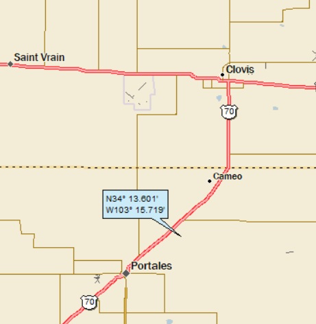
Dan: Today’s lat/long (N34o 16.301), W103o 15.719) puts me in east-central New Mexico:

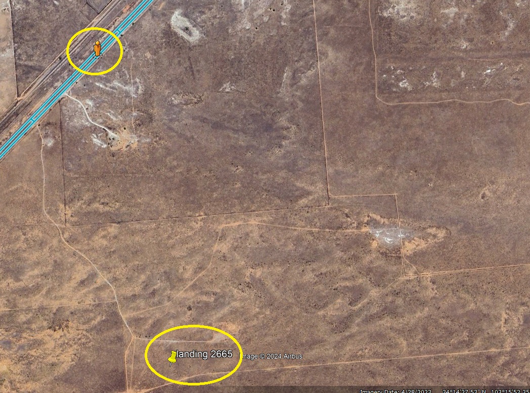
Here’s my local landing map:
My watershed situation is obscure. Although the land slopes generally to the southeast, there are no obvious stream channels for many tens of miles. I’ve landed in this general vicinity before, and recall the lack of defined waterways. So here’s the story as to how I figured out my watersheds:
I landed near Clovis, and as I’ve written before in this blog, Clovis is the type-locale for the Clovis culture – long thought to be representative of the earliest Native American population (about 12,000 years ago). The Clovis folks arrived from Asia across the Bering strait, which was dry land, thanks to the lowered sea level because of all of the ice wrapped up by continental glaciation prevalent at the time.
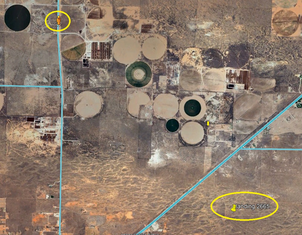
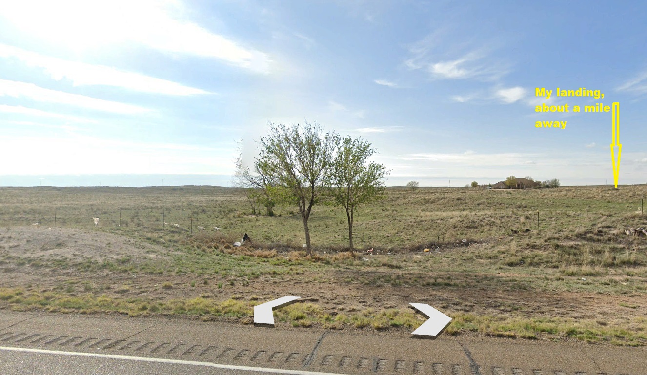
Near Clovis is a site where archeologists found many distinctive spear points (called Clovis points) along with the bones of their prey. So, I realized that the site (termed the “Blackwater Draw”) was very close to my landing. Here’s a GE shot with the OD at the entrance to the Blackwater Draw location:
And here’s what the Orange Dude sees:
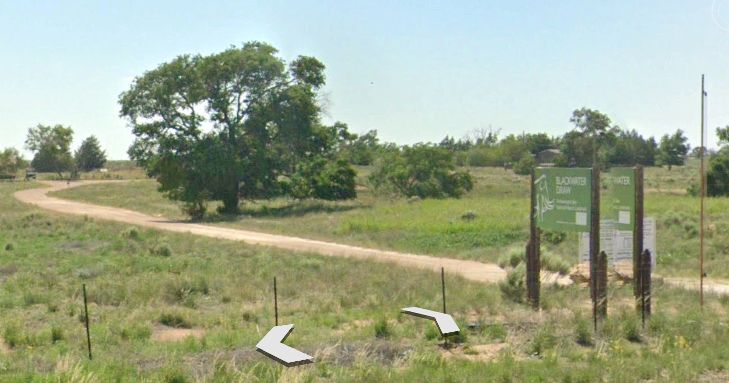
It’s a little hard to read, but the sign in fact says “Blackwater Draw.”
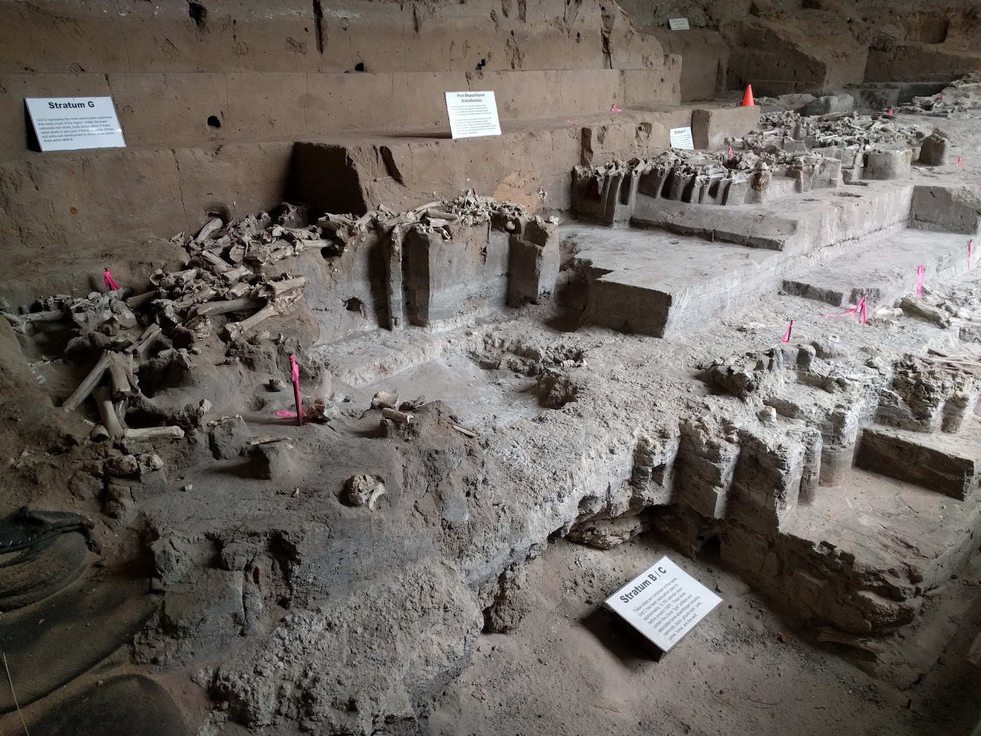
Here’s a shot posted on GE by Angela Kristin VandenBroek of the major archeologic site located just down the dirt road:
The actual Blackwater Draw seems to hardly exist. The land here is very flat, and here’s no apparent “draw.” Anyway, the OD found a low spot along the highway:
And here’s what he could see:
The two trees are in the middle of the draw . . .
Of course, I Googled “Blackwater Draw,” and actually found a detailed watershed description:
Blackwater Draw is an intermittent stream channel about 87 mi long, with headwaters about 11 mi southwest of Clovis, New Mexico [right near my landing and the archeological site]. It flows southeastward across the Llano Estacado toward the city of Lubbock, Texas, where it joins Yellow House Draw (6th hit) to form Yellow House Canyon at the head of the North Fork Double Mountain Fork Brazos River (7th hit).
The reason there’s essentially no draw is that this is the headwaters of the Blackwater Draw watershed.
I’ll pick it up from here.
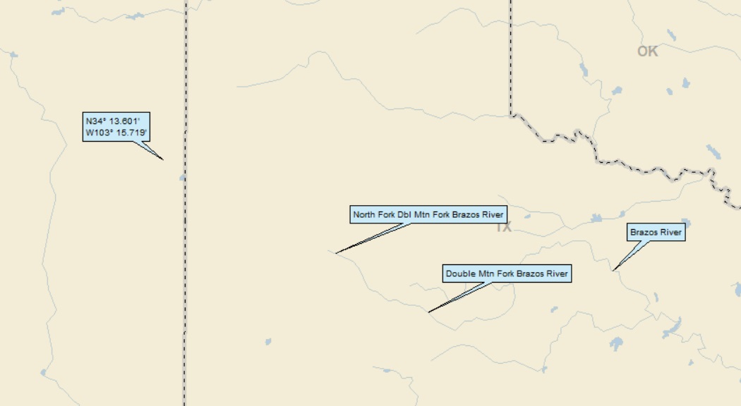
The N Fk Dbl Mtn Fk discharges into the Dbl Mtn Fk (9th hit), on to the Brazos (39th hit).
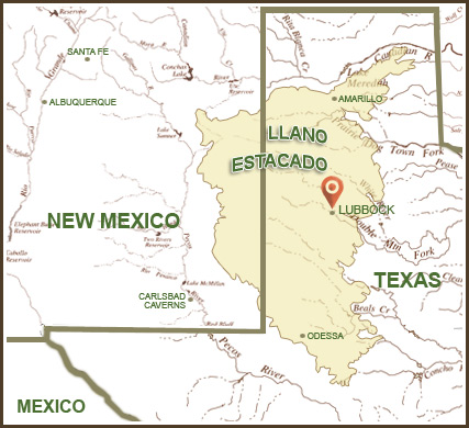
If you noticed, in the Blackwater Draw Wiki piece, it mentions “Llano Estacado.” Here’s a map (by Meredith McClain):
And this, from MySite.du.edu (University of Denver):
The Llano is a very flat, semiarid plateau, ranging in elevation from 5000′ on the northwest to less than 3000′ on the southeast, sloping more or less uniformly to the east-southeast at a rate of at least 10′ per mile. The slope is imperceptible to an observer on the plateau. The Llano is dry and treeless, the prevailing wind is from the southwest, and mirages are a frequent occurrence under the hot sun.
The surface of the Llano is remarkably flat, reminding one of the sea, and it is conceivable that the curvature of the earth could be perceived as it is on the sea. The area around Levelland, Texas, would be a good place to look for grain elevators sinking beneath the horizon.
As my regulars know, with any mention of Levelland I must post this James McMurtrie song. This is the fourth or fifth time it has made an appearance in this blog (as always, the words are posted below the video):
Flatter than a tabletop
Makes you wonder why they stopped here
Wagon must have lost a wheel or they lacked ambition one
In the great migration west
Separated from the rest
Though they might have tried their best
They never caught the sun
So they sunk some roots down in this dirt
To keep from blowin’ off the earth
Built a town right here
And when the dust had all but cleared
They called it Levelland, the pride of man
Levelland.
Granddad grew dryland wheat
Stood on his own two feet
His mind got incomplete and they put in the home
Daddy’s cotton grows so high
Sucks the water table dry
As rolling sprinklers circle by
Bleedin’ it to the bone
And I won’t be here when it comes a day
It all dries up and blows away
I’d hang around just to see
But they never had much use for me in Levelland, Levelland
They don’t understand me out in Levelland, Levelland
And I watch those jet trails carving up that big blue sky
Coast to coasters – watch ’em go
And I never would blame ’em one damn bit
If they never looked down on this
Not much down here they’d wanna know
Just Levelland
Far as you can point your hand
Nothin’ but Levelland
Mama used to roll her hair
Back before the central air
We’d sit outside and watch the stars at night
She’d tell me to make a wish
I’d wish we both could fly
Don’t think she’s seen the sky
Since we got the satellite dish and
I can hear the marching band
Doin’ the best they can
They’re playing “Smoke on the Water”, “Joy to the World”
I’ve paid off all my debts
Got some change left over yet and I’m
Gettin’ on a whisper jet
I’m gonna fly as far as I can get from
Levelland, doin’ the best I can
Out in Levelland
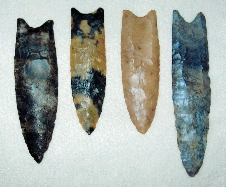
From Encyclopedia Brittanica, here are some Clovis Points:
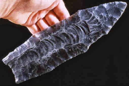
From the Archeology News Network, here’s a shot of a large Clovis point that was expected to be sold for $400,000 at auction:
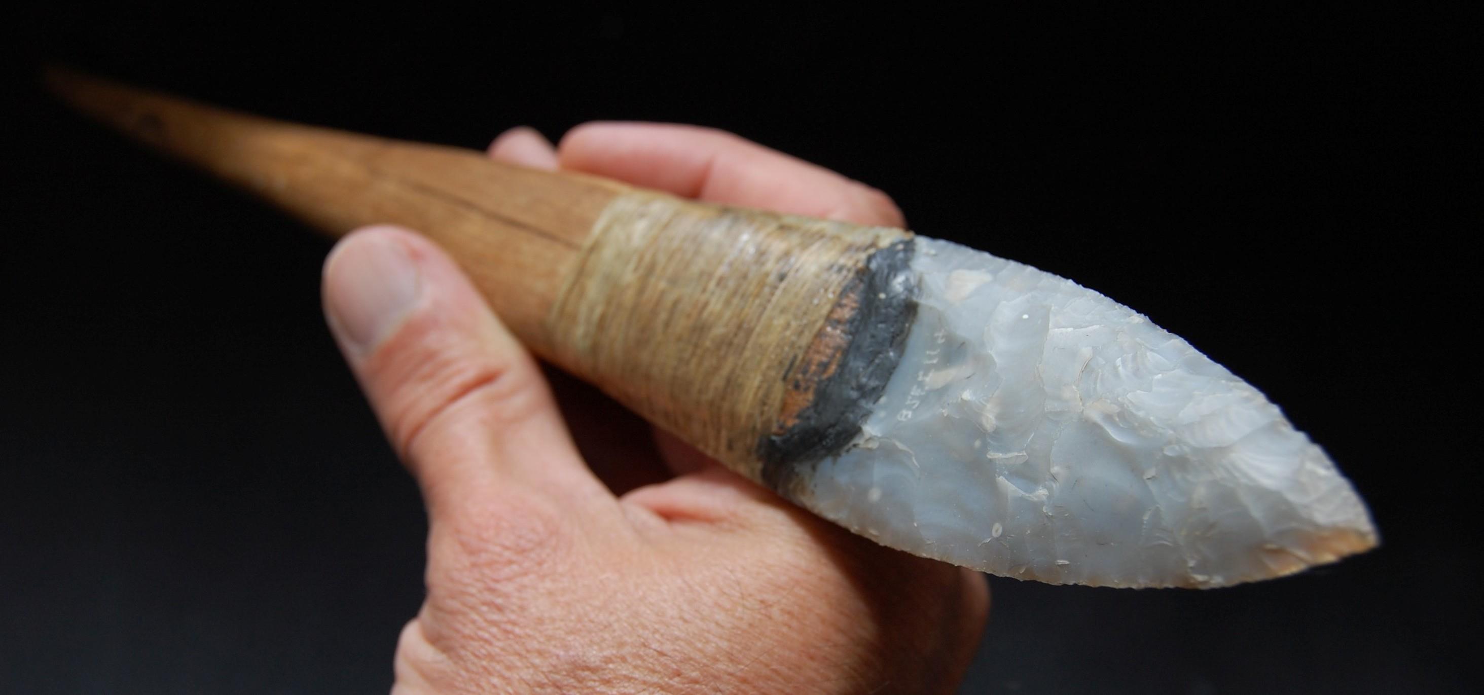
The characteristic notch at the bottom was designed to make it easier to attach the point to a spear (from Occoquan Paleotechnics, LLC):
Since the age of Clovis points was established (in the 1930s), conventional wisdom has it that the Clovis people were the first people to make the migration from Asia. But the conventional wisdom has begun to crumble (has crumbled?)
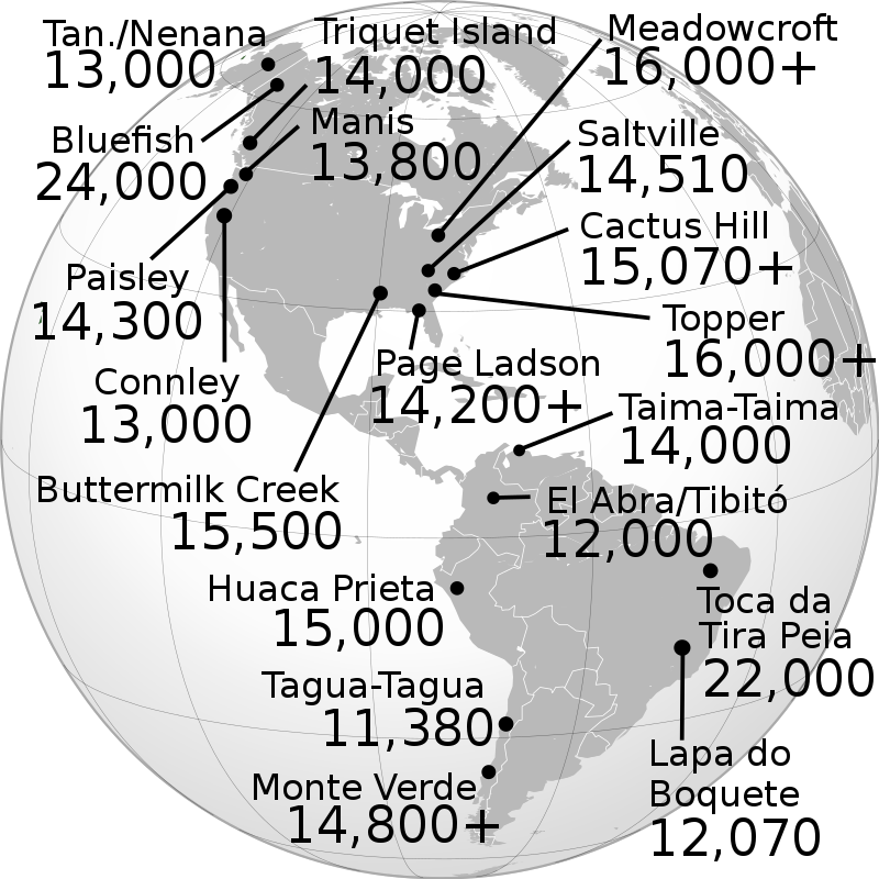
Here’s a map showing well-established pre-Clovis sites (from Wiki):
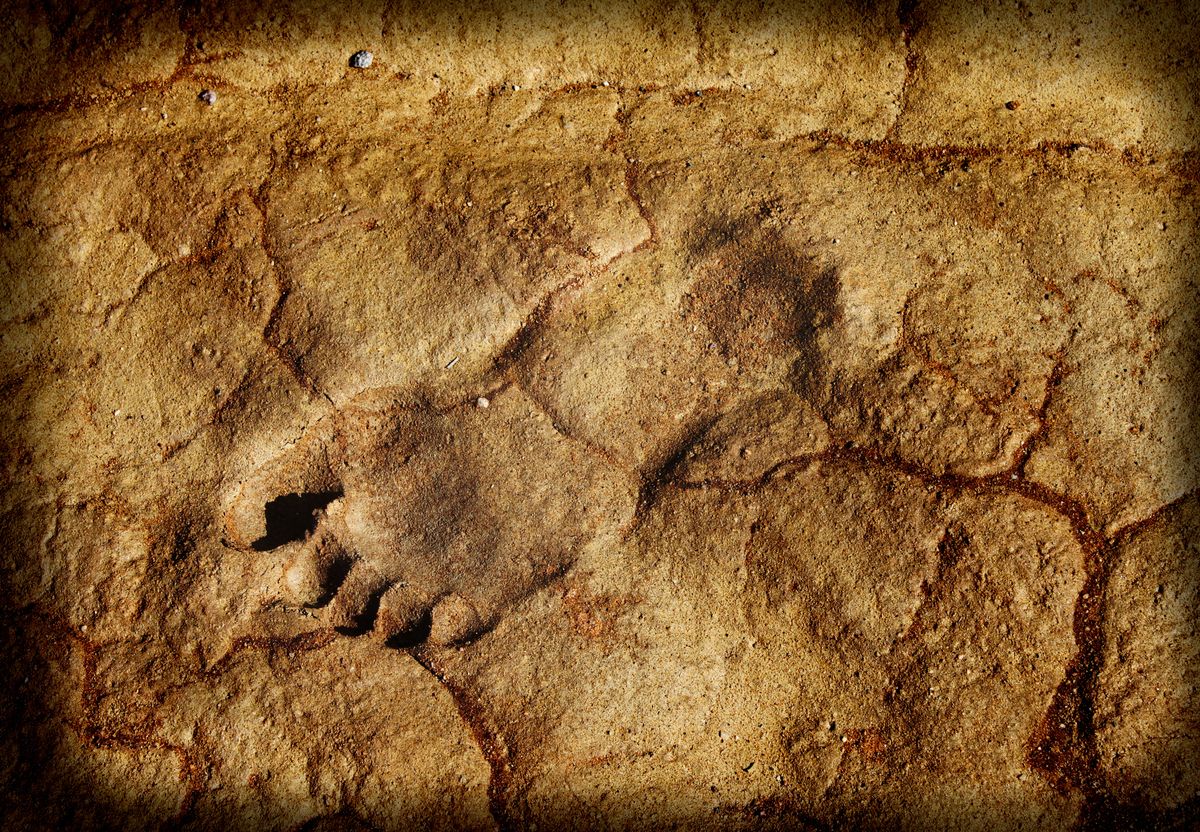
Interestingly, two articles just came across my news feed that tell me that two additional pre-Clovis locations should be added to the above. First, there’s a Popular Mechanics article about human footprints found at White Sands NM, confidently dated at 23,000 years ago. Here’s a shot of one of the footprints:
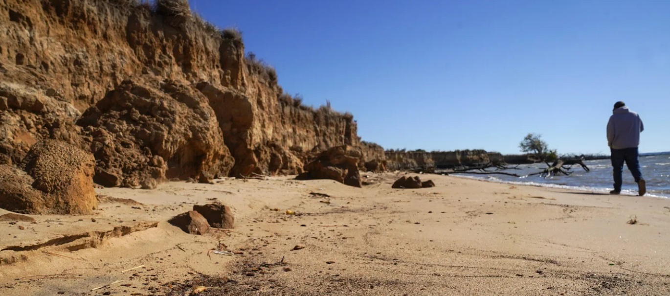
And then, from the Washington Post is an article about Parsons Island, in Chesapeake Bay:
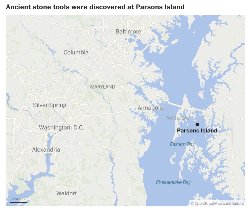
There are some bluffs on the island where ancient tools were found that have been confidently dated at 20,000+ years ago:
So how did these pre-Clovis folks get to the Americas? Here are some possible migration routes (from New Scientist):
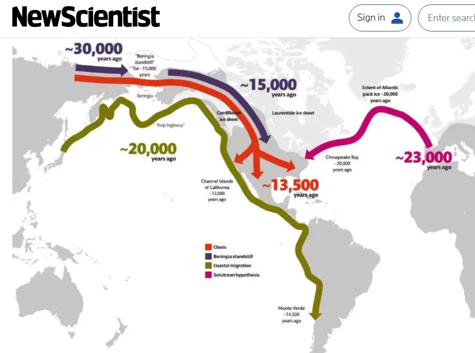
Here’s my take: Far and away the most successful culture was Clovis. Clovis points have been found throughout the Americas, and DNA analysis shows that the Clovis people are related to most modern Native Americans. I suspect that earlier migrations resulted in cultures that were not successful in establishing larger populations throughout the Americas (as were the Clovis folks).
Located just five miles from my landing (and not far from the Blackwater Draw site) is Oasis State Park. Henry Davis posted on GE this picture of the lake there:
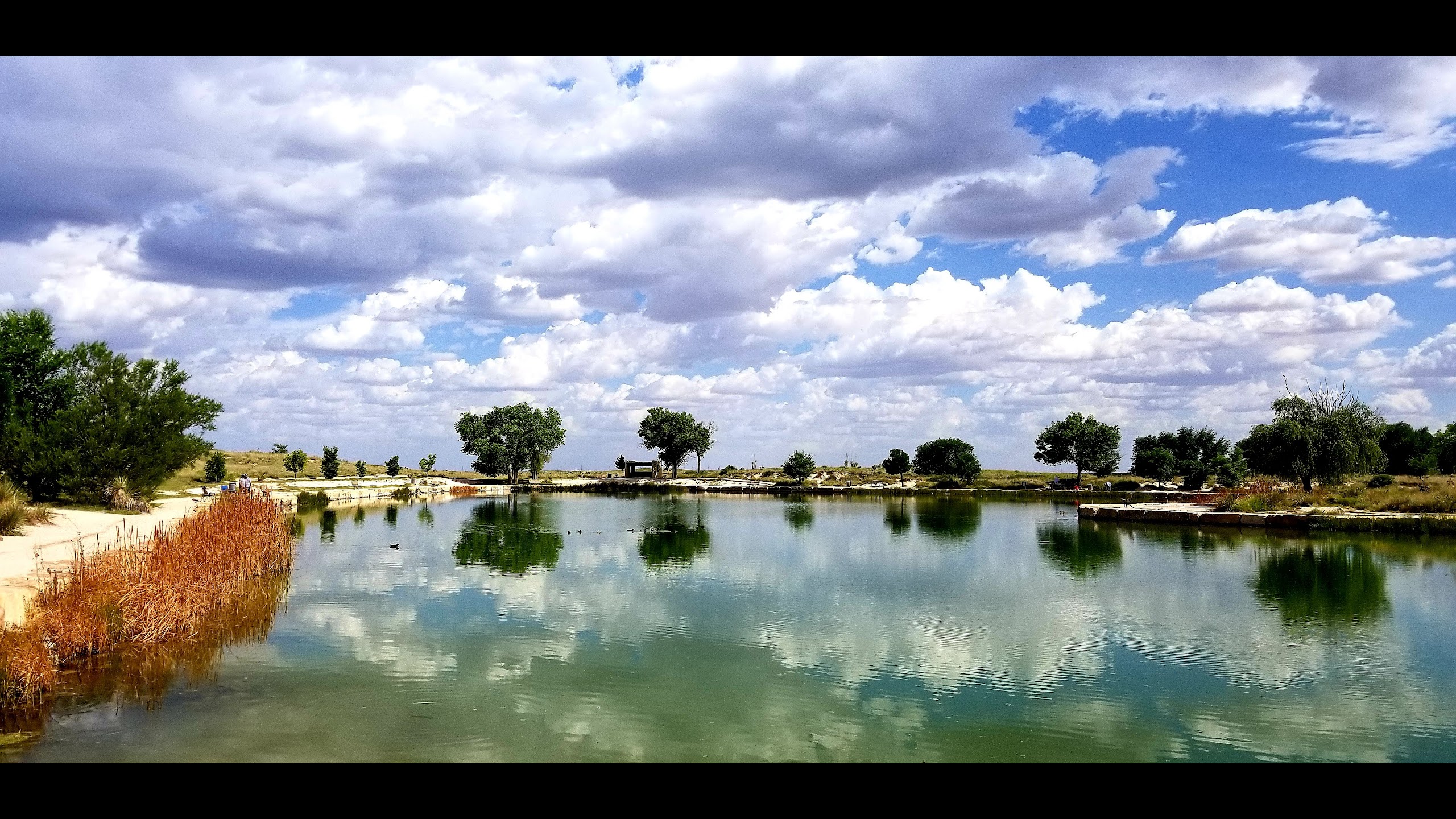
I did a fair amount of research attempting to confirm my suspician that this is a man-made lake, inspite of the name “Oasis Lake.” I could find no such confirmation; but I can only assume that if it were a natural lake and if it were around 12,000 years ago, it would have prominantly figured in discussions of the Blackwater Draw site (it’s not mentioned at all, except as a nearby tourist site).
That’ll do it
Greg
© 2024 A Landing A Day

Pete Wagner said
When you think about it, the only way (I can imagine) that a footprint could turn into rock is if it froze and was buried in ice/snow for a LONG TIME, which suggests that it happened at the very start of the Ice Age, circa 115k BC. Otherwise, it would have eroded.