Nashville and Tokio, Arkansas
Posted by graywacke on June 25, 2024
First timer? In this formerly once-a-day blog (and now pretty much a once-a-week blog) I use an app that provides a random latitude and longitude that puts me somewhere in the continental United States (the lower 48). I call this “landing.”
I keep track of the watersheds I land in, as well as the town or towns I land near. I do some internet research to hopefully find something of interest about my landing location.
To find out more about A Landing A Day (like who “Dan” is) please see “About Landing” above. To check out some relatively recent changes in how I do things, check out “About Landing (Revisited).”
Landing number 2667; A Landing A Day blog post number 1113
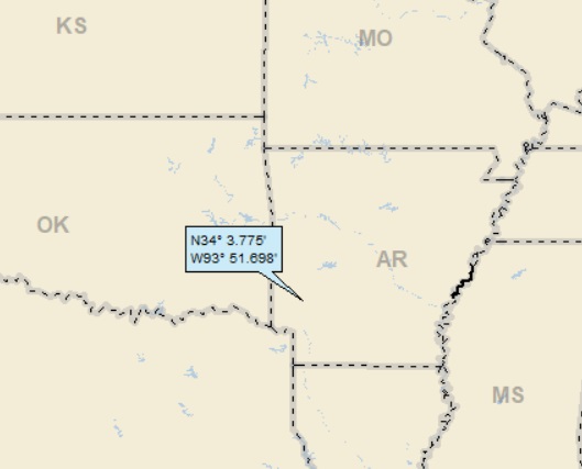
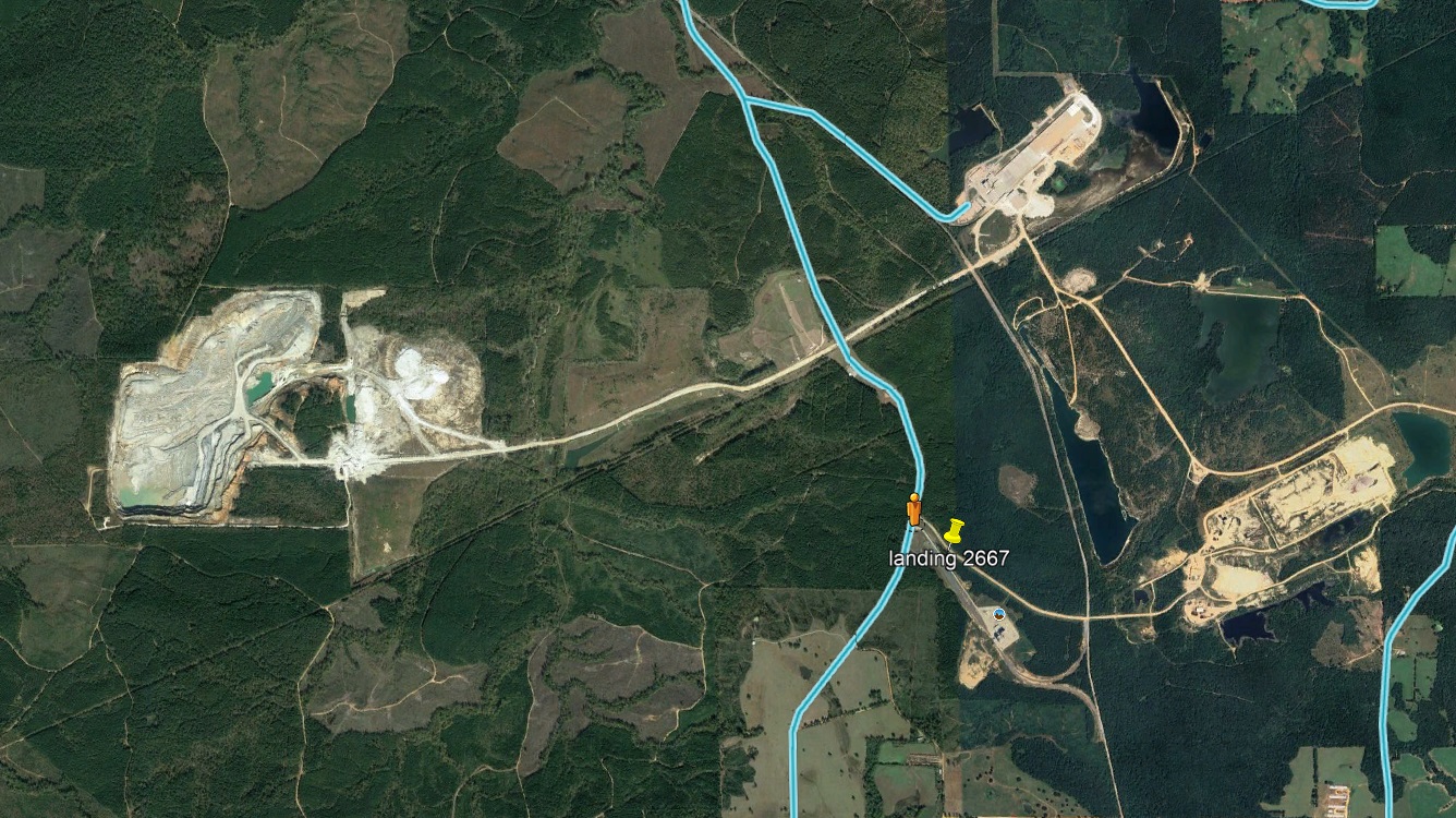
Dan: Today’s lat/long (N34o 3.775), W93o 51.698) puts me in southwest Arkansas:
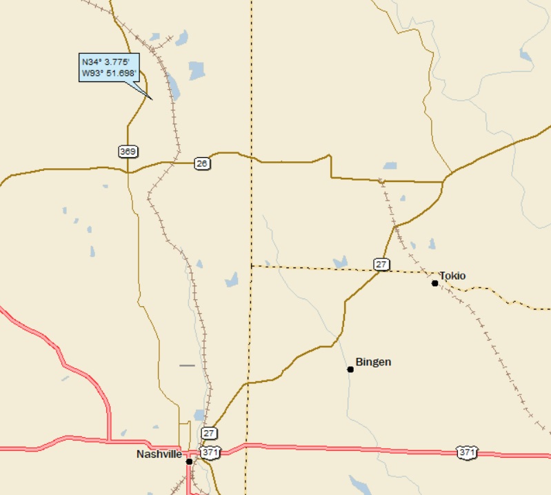
Here’s my local landing map:
My streams-only map shows that I landed in the watershed of Bluff Creek:
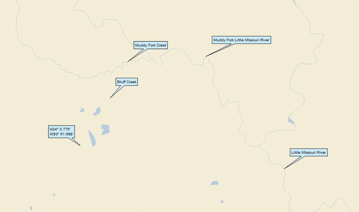
Bluff Creek to Muddy Fork Creek to Muddy Fork Little Missouri River (1st hit ever!); to Little Missouri River (1st hit ever!). The Little Missouri makes its way to the Ouachita (18th hit):
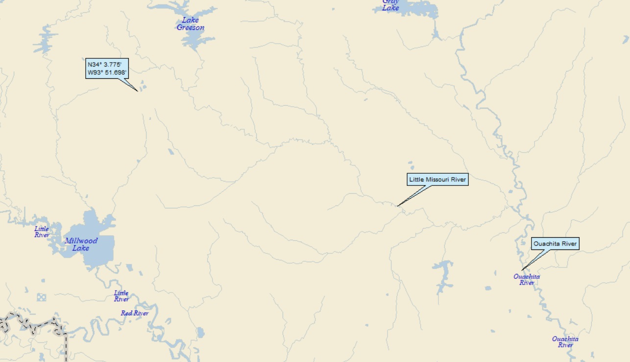
Although not shown, the Ouachita heads south to the Red River of the South (77th hit), on to the Atchafalaya (85th hit).
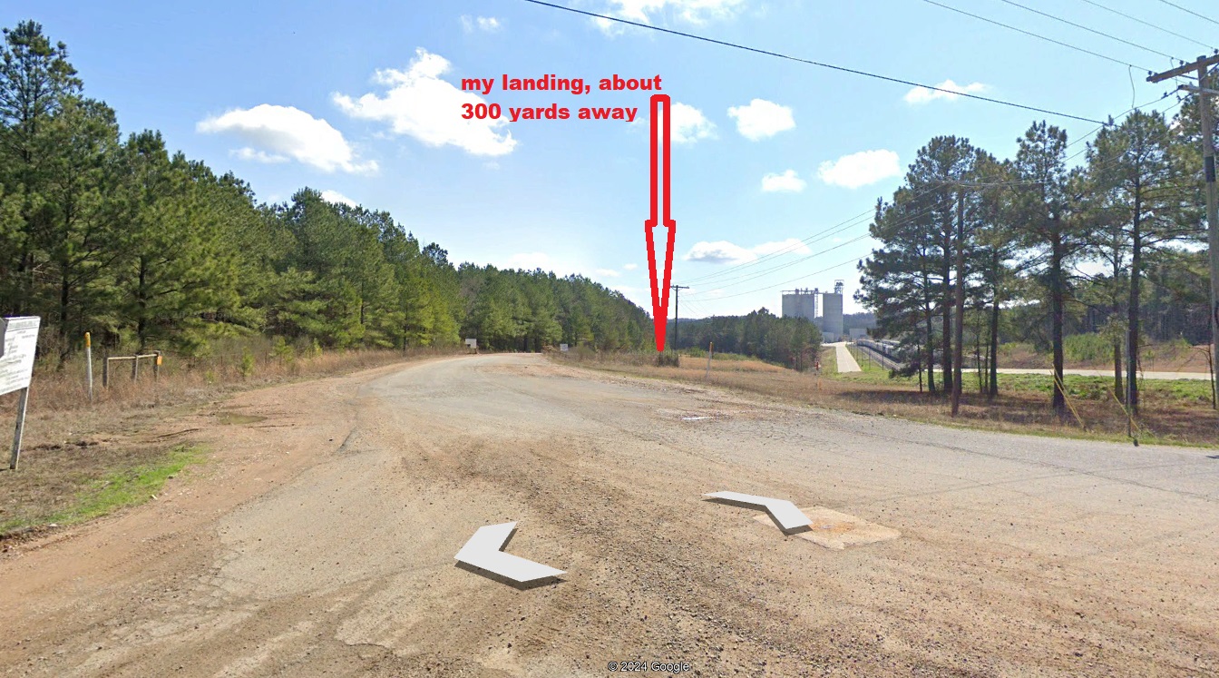
The Orange Dude found that he could get close to my landing:
Hmmm. I landed near some kind of industrial complex. Anyway, here’s what the OD sees when he looks towards my landing:
The OD went down the road a little and found out what the industrial complex is:
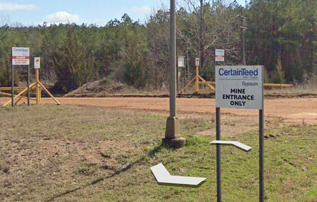
So, this is a gypsum mine. Gypsum is a mineral that is widely mined and used as a fertilizer and as a component of plaster, drywall and chalk. It is an evaporite mineral that forms when mineral-laden water evaporates from lakes and ponds.
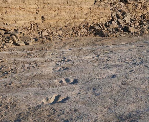
And it turns out that thousands of dinosaur footprints were found at this very quarry! From Only in Arkansas:
In 1983, dinosaur footprints were discovered at a gypsum mine near Nashville, Arkansas. Jeffery G. Pittman was at the mine doing research for his master’s degree in geology at Southern Methodist University. He drove his truck across the potholed, limestone floor of the quarry every day.
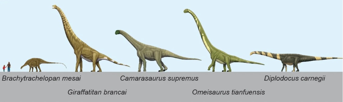
After seeing preserved dinosaur footprints in Colorado and New Mexico, Pittman returned to Nashville to study these “potholes”. He realized they were actually part of a vast dinosaur trackway that included thousands of footprints. The prints belonged to sauropods, enormous dinosaurs with long necks and tails and thick legs. The tracks were made about 100 million years ago, and the sheer amount of tracks points to this area being a migration path.
[Here’s a picture of some sauropods from Scientific American:]
The tracks were already deteriorating when the discovery was made and the area with the tracks was scheduled to be mined in January 1984.
A quick, six-week excavation took place. Scientists made silicone rubber molds of the tracks, took photographs, made sketches and also preserved some of the original tracks.
As expected, the Nashville Sauropod trackway was then destroyed in the mining operations. Preservation would have been difficult, but the information that researchers gathered allowed them to continue to study the tracks. The molds of the footprints can still be found at several Arkansas museums.
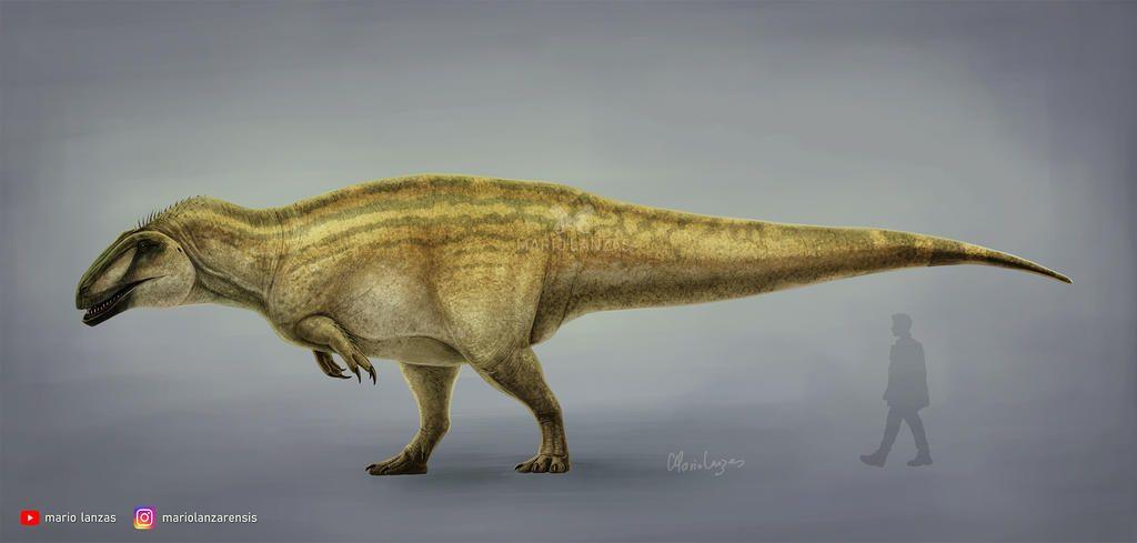
In 2011, tracks were again discovered in the same mine. These tracks belonged to Acrocanthasaurus, a large carnivorous dinosaur that also dates back to the early Cretaceous period. Sauropod tracks were also discovered.
These tracks (although also destroyed by the mining operation) were initially well-preserved:
And here’s the critter that made them:
And while I’m in a dinosaur mode, here’s a picture of an Arkansaurus:
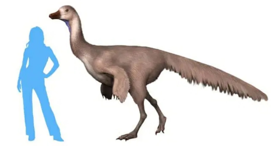
Two things to say here: 1. “Arkansaurus” is the official dinosaur of Arkansas – fossils of the beast were found elsewhere in Arkansas (and only in Arkansas) and was named after the state. 2. And that blue silhouette. Is this really necessary?
Moving on to Tokio (pretty much a ghost town that doesn’t exist anymore). I found a blog about the Stueart family, a branch of which is from Tokio. From that blog:
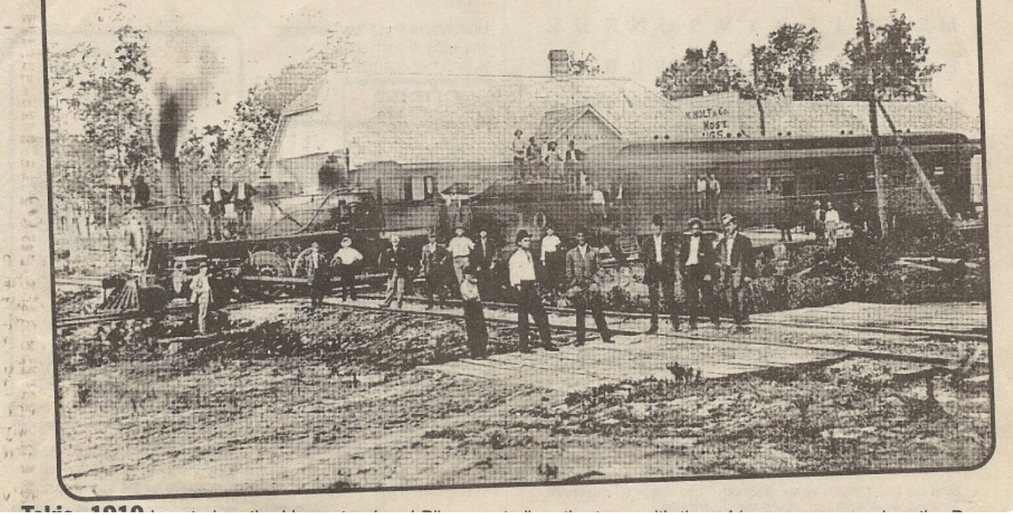
Tokio prospered on the Prescott and Northwestern Railroad as a peach-production and shipping center, as shown here in 1910 from an “Arkansas Postcard Past.” The last tracks were pulled up in 1952.
Back in the day, peaches were a big business around here, as discussed in the Wiki article about nearby Nashville, which had a section entitled “Peach Farming.” From the article:
Peach farming sustained Nashville during the Depression. The peach industry came to the Nashville area in the late nineteenth century. Peak years of production lasted from the 1920s until the 1950s. Nashville’s peak peach production was 1950, with over 400,000 bushels collected from 425 orchards. “Up to 175 boxcars, each carrying 396 bushel baskets, were shipped from Nashville each day during peak production years.”
Late freezes and early thaws in 1952 and 1953 led to the devastation of the peach harvests. “The Arkansas growers lost the market, and the impact was devastating. For Howard County growers, the only option was to pull up the trees and convert the land for other purposes, often pasture for cattle, or to raise chickens,” which remain the dominant agricultural products in the Nashville area to this day.
OK. Back to Tokio. I’d like to direct your attention back up to the fuzzy 1910 picture that shows a train in Tokio, with a bunch of people probably loading peaches. Note that it looks like two sets of train tracks cross at right angles. Hmmm. Seems a little strange. So, me being me, I dug in a little.
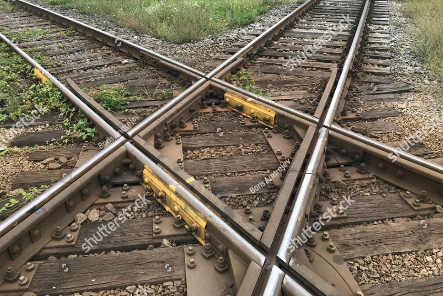
I found a Quora where the question was “How do railroad tracks cross each other when both tracks are at ground level?” Steve Dutch (a geologist!) and professor at U of Wisconsin, answered thusly:
This way:
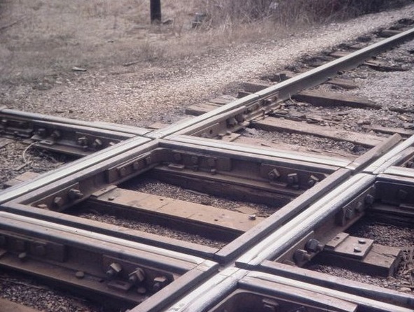
This is a “crossing diamond,” a favorite fixture on model train layouts but fairly uncommon in real life. Morr commonly, lines merge and split with switches. Trains can roll straight on through with no action needed from outside. Just make sure there isn’t another train on the other line.
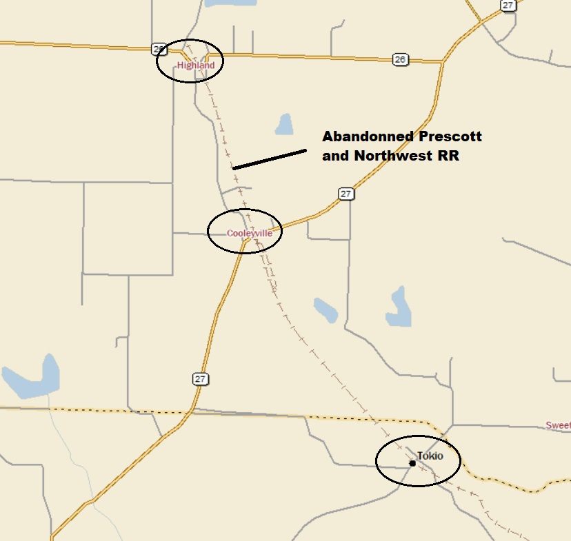
The rail line that ran through Tokio (as mentioned above) was the Prescott and Northwestern Railroad. It shows up on StreetAtlas:
And on GE:
So, Prescort and Northwest Railroad has its own Wiki page, which said this:
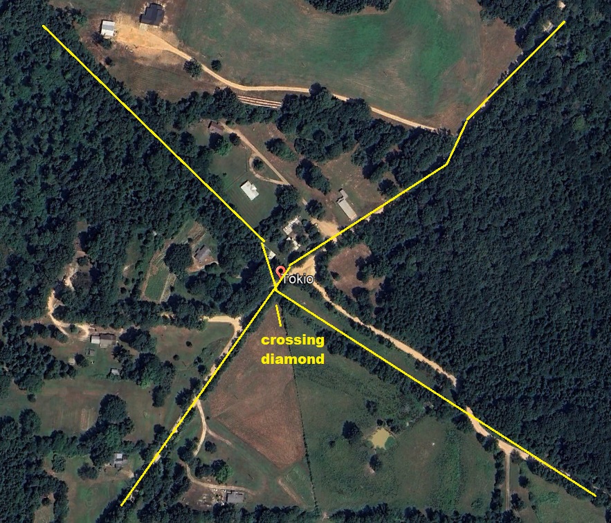
The railroad connected at Tokio with the line of the Memphis Dallas and Gulf Railroad which operated between Ashdown, Arkansas and Hot Springs. For many years the unused crossing diamond lay in the weeds next to the mainline of the PNW in Tokio.
Oh my! There’s the phrase “crossing diamond” again. So it can be concluded that the location of the crossing diamond is shown in the the fuzzy 1910 picture.
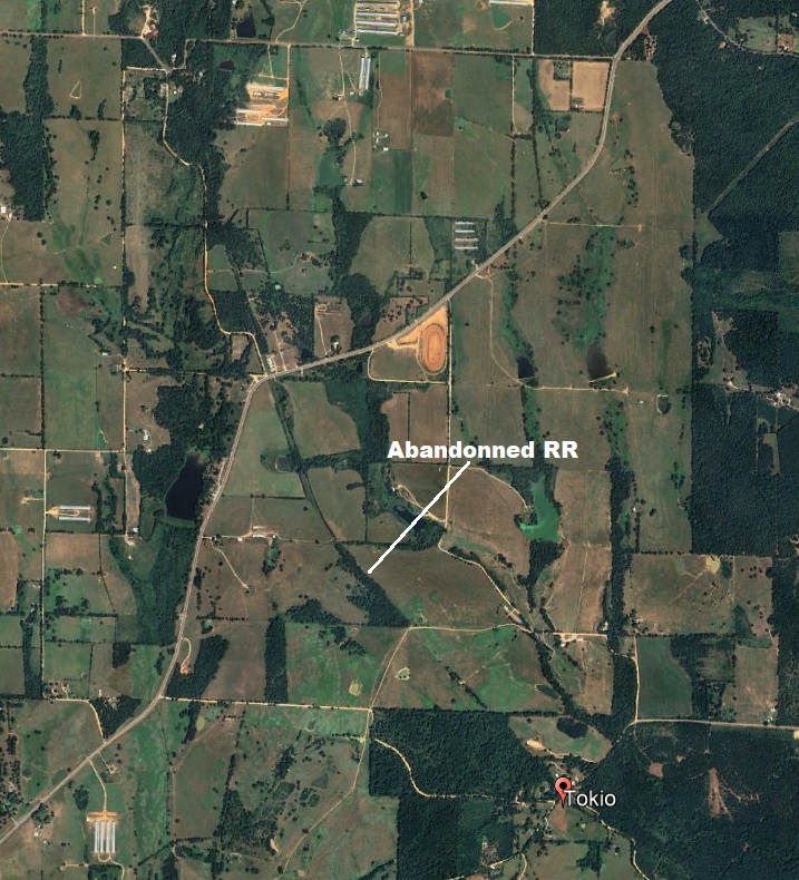
Here’s a closer view of Tokio, showing the probable location of the crossing diamond:
The reason the crossing is called “diamond” is more apparent when the rails aren’t perpendicular:
Look back up at the Street Atlas map that shows the abandonned railway. Up north, you can the “town” of Highland, where the railroad ends. It turns out that there was a small gypsum mine in Highland that was served by the railroad:
Here’s a closer view, where, if you look closely, you can still see the scar of the old railroad:
And, by the way, I have no idea why the east-west road jogs to the south instead of simply cutting straight across. Here’s a Street Atlas map showing the peculiar job south:
Between Highland and Tokio is Cooleyville. I had the OD check out where the abandonned railway crossed the road. He saw this (and obviously, I added the tracks):
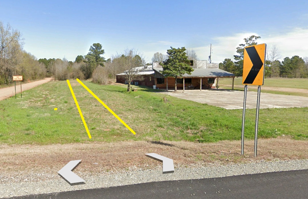
Here’s a closer look at the building:
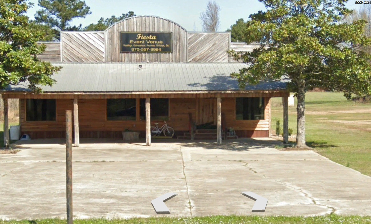
Cooleyville is truly out in the middle of nowhere. I’m not surprised that the Fiesta Event Venue is not a thriving business, and has absolutely no internet presence . . .
That’ll do it
Greg
© 2024 A Landing A Day

Leave a comment