Earling, Iowa
Posted by graywacke on May 8, 2013
First timer? In this formerly once-a-day blog (and now pretty much a twice-a-week blog), I have my computer select a random latitude and longitude that puts me somewhere in the continental United States (the lower 48). I call this “landing.” I keep track of the watersheds I land in, as well as the town I land near. I do some internet research to hopefully find something of interest about my landing location. To find out more about A Landing A Day (like who “Dan” is and what the various numbers and abbreviations mean in the first paragraph), please see “About Landing,” (and “Abbreviations” and “Cryptic Numbers”) above.
Landing number 2011; A Landing A Day blog post number 429.
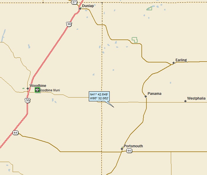
Dan – My 43rd landing in this OSer puts me at 1/6 . . . IA; 43/37; 5/10; 11; 153.2. Here’s my regional landing map:
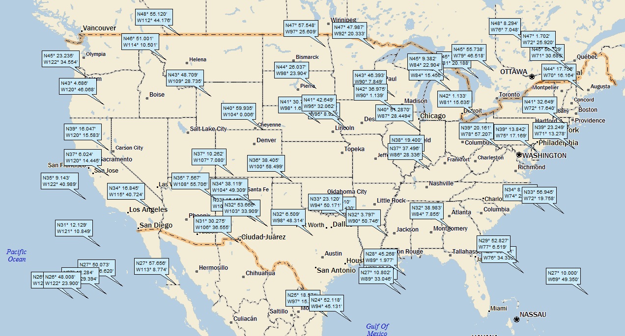
And, what the heck, here’s a big picture map showing all my landings (including the foreign landings and the water “landings”), since I started using StreetAtlas 2013 in January:
Today’s landing is part of the tight little cluster of three landings around western IA and eastern NE (the more northern IA landing. You can also see the NM cluster (4 landings).
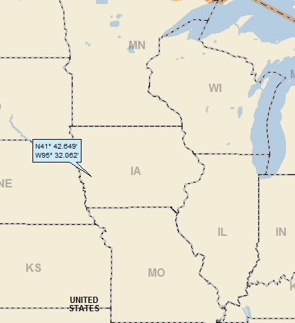
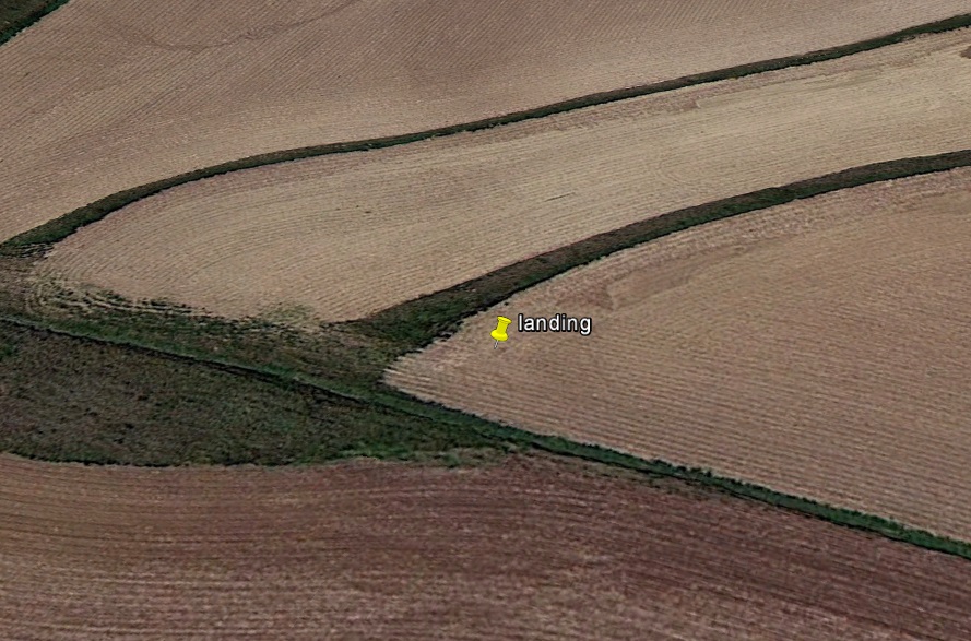
Here’s my closer-in landing map, showing that I landed in the middle of a bunch of small towns:
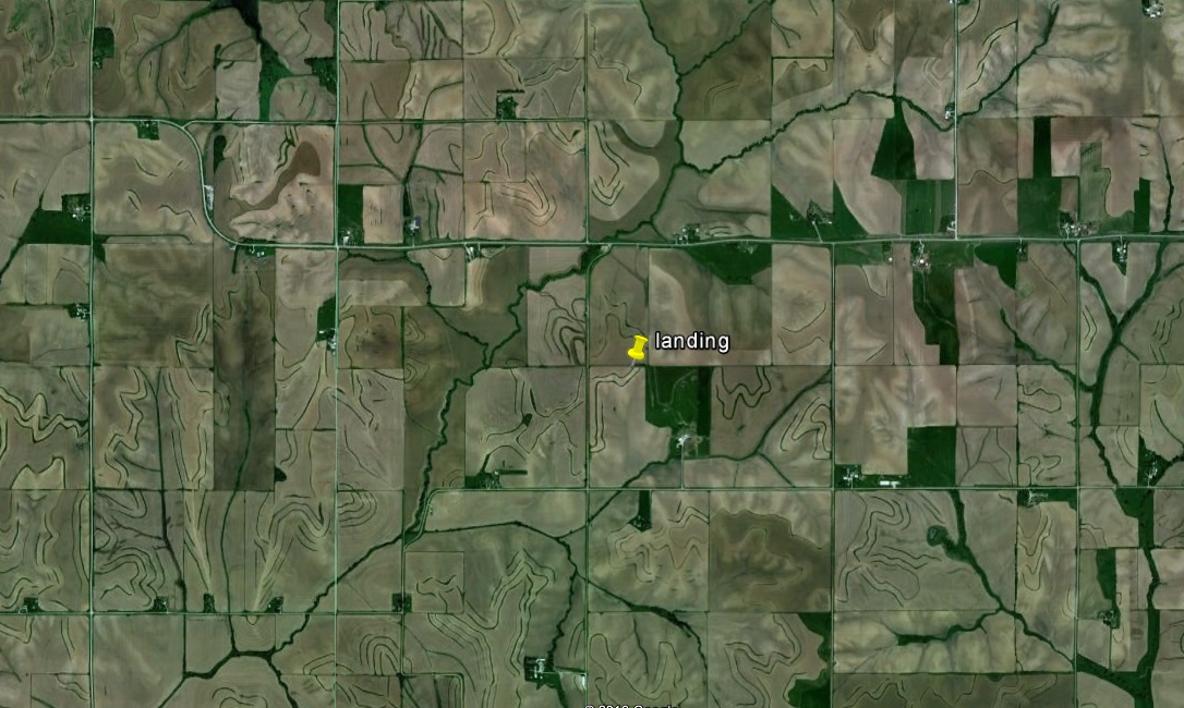
My Google Earth (GE) shot shows a lovely palette of green and beige:

Stepping back, the loveliness of the palette remains:
Here’s a GE StreetView shot looking south towards my landing, which is about a half mile away:
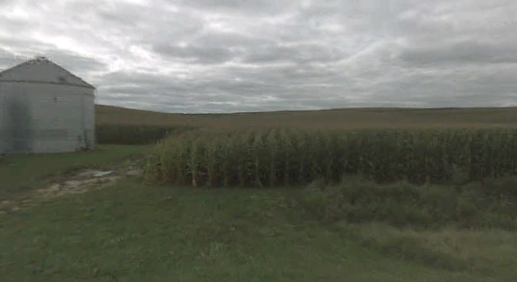
Looks like I probably landed in a cornfield, eh? But I think that the GE aerial shot is a springtime shot when the land is plowed, but the corn hasn’t come up yet – as evidenced by this close-in oblique shot of my landing (looking south):
Anyway, drainage leading away from my landing heads west into Pigeon Creek, which flows southwest directly into the Missouri (371st hit); and on to the MM (791st hit).
As is my wont, I did a quick Google search to see which town has the best hook. It was pretty slim pickings, but the winner is (as you know by the post title) – Earling. As you’ll soon see, what went on in Earling is a little . . . different.
But first, this GE shot, showing that Earling is carved out of the same lovely palette:

From Wiki, about how the town got its name:
The town was platted in 1882 and was named Marathon. However, when the Post Office informed the town that Marathon was already taken, the name of the town was changed to Earling, in honor of Albert J. Earling who was division superintendent of the Chicago, Milwaukee and St. Paul Railway.
I think there are hundreds of Midwestern towns named after railroad executives. I mean, what better way to make sure the railroad passes by your little settlement? But really: Earling??
OK, enough of that. But here’s the juicy story about Earling, from Wiki:
Earling is well known in paranormal circles for being the site of a 1928 exorcism. Over 23 days in 1928, a Roman Catholic Capuchin named Theophilus Riesinger worked to exorcise demons from Emma Schmidt at the local Franciscan convent. During the exorcism Schmidt reportedly flew across the room, landed high above the door, and clung tightly to the wall. Despite attempts by church officials to keep the exorcism secret, townspeople soon began hearing strange noises coming from the convent as well as horrid odors. Finally after 23 days the demons in Schmidt’s body gave up after Father Riesinger commanded, “Depart, ye fiends of hell! Begone, Satan.” After the exorcism Schmidt reportedly led a fairly normal life.
The reference for the Wiki piece is a 2008 article from the Dubuque Telegraph Herald. Unfortunately, I can’t find the newspaper article. However, there are many internet sites that reference the famous Earling exorcism. A couple of them quote a pamphlet published soon after the exorcism (and make sure you read every word):
“Outpourings that would fill a pitcher, yes, even a pail, full of the most obnoxious stench were most unnatural. These came in quantities that were, humanly speaking, impossible to lodge in a normal being. At that the poor creature had eaten scarcely anything for weeks, so that there had been reason to fear she would not survive. At one time the emission was a bowl full of matter resembling vomited macaroni. At another time an even greater measure, having the appearance of sliced and chewed tobacco leaves, was emitted. From ten to twenty times a day this wretched creature was forced to vomit though she had taken at the most only a teaspoonful of water or milk by way of food.”
Wow. Pretty intense stuff. Would have been fascinating to have been a fly on the wall of the Franciscan Convent in Earling in 1928 . . .
The websites that discuss this can be basically divided into two camps: 1) religious sites that present the exorcism as a (not surprisingly) religious event, and 2) psychic / paranormal sites, where you can imagine that the soundtrack (if there was one) would be campy spooky music . . .
Moving right along – Route 30, which you can see on my landing map just west of my landing, follows the route of the old Lincoln Highway. In fact, here’s a picture of an old brick-paved portion of the highway where is goes through Woodbine (Panoramio shot by Fred Henstridge):

Although I’ve landed near the Lincoln Highway before and have featured it before in ALAD posts, here’s a little history about the highway, from Wiki:
The Lincoln Highway is one of the first transcontinental highways for automobiles across the United States of America. The highway turns 100 years old in 2013. It spans coast-to-coast from Times Square in New York City to Lincoln Park in San Francisco.
Conceived in 1912 and formally dedicated October 31, 1913, the Lincoln Highway is America’s first national memorial to President Abraham Lincoln, predating the 1922 dedication of the Lincoln Memorial. As the first automobile road across America, the Lincoln Highway brought great prosperity to the hundreds of cities, towns and villages along the way and became affectionately known as “The Main Street Across America.”
I’ll close with a couple of scenic Panoramio shots, both located about 10 miles west of my landing. First one entitled “Larry’s Aircoupe” (tonywlbr):

And then, this cool train shot by rbenkovitz:

That’ll do it.
KS
Greg
© 2013 A Landing A Day

Leave a comment