First timer? In this formerly once-a-day blog (and now pretty much a once-a-week blog) I use an app that provides a random latitude and longitude that puts me somewhere in the continental United States (the lower 48). I call this “landing.”
I keep track of the watersheds I land in, as well as the town or towns I land near. I do some internet research to hopefully find something of interest about my landing location.
To find out more about A Landing A Day (like who “Dan” is) please see “About Landing” above. To check out some relatively recent changes in how I do things, check out “About Landing (Revisited).”
Landing number 2603; A Landing A Day blog post number 1048

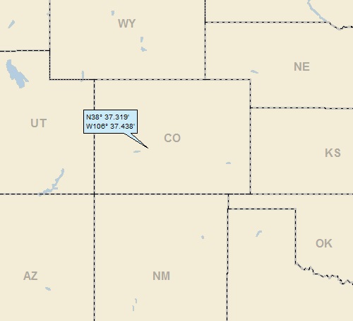
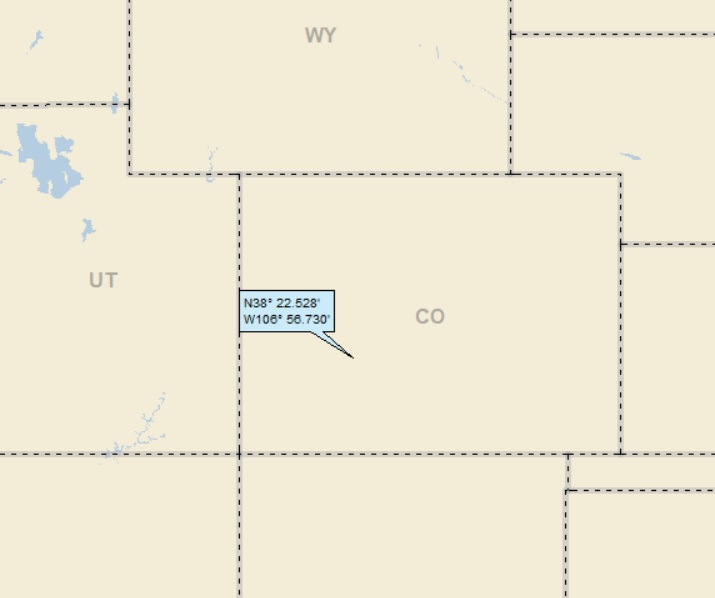
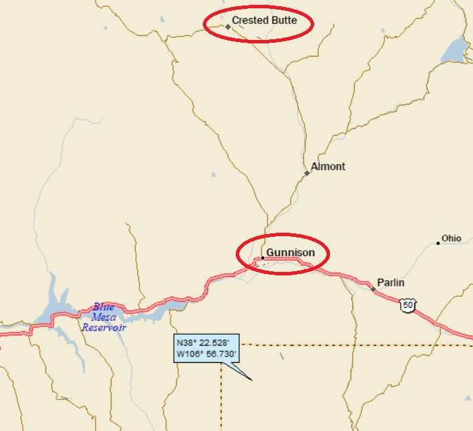
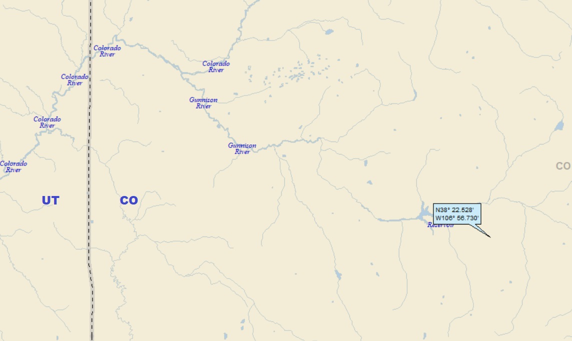
Dan: Today’s lat/long (N38o 22.528’, W106o 56.730) puts me in southwest Colorado:
But before I get into the meat of this Colorado landing, I have some old business associated with my most recent landing (Valley, Wyoming). If you haven’t read it, do not pass Go, do not collect $200, go directly to my previous post (simply scroll down). If, on the other hand, you read it (and remember it), you are allowed to read on:
The ink had hardly dried on my Valley post, when I stumbled on some information that I couldn’t ignore.
As you no doubt recall, I googled “town of Valley Wyoming” and found a humorous Yale class of 1915 write-up about their first reunion, featuring one Win Brooks. Win was touted as being the “mayor, sheriff and accepted wit of the prosperous town of Valley, Wyoming.” I speculated that Win was originally from Valley, and then went back home after he graduated from Yale.
I went on:
“Just for the record (in case you’re not convinced that Win is actually from this particular Valley, Wyoming), I found the index for an obscure collection of telegraphs and letters associated with the Valley Ranch, located along the South Branch. The index contained dozens of references to neighbor Win Brooks.”
I noticed that the owner of Valley Ranch was a gentleman named Larry Larom, and that he was a Princeton grad. I toyed with adding that information to my post, but didn’t bother.
After posting (and evidently with nothing better to do), I idly googled Larry Larom, and discovered he had his own Wiki page, which contained this salient information about Win Brooks:
Born in New York City, Larom’s father was a prominent merchant there. Larom attended Buffalo Bill’s Wild West Show in Madison Square Garden in New York City and became inspired to travel to Cody in northwestern Wyoming the following year for a summer vacation on Valley Ranch (owned by Jim McLaughlin). After three more summer visits there, he decided to become a dude rancher.
He persuaded a fellow New Yorker, Winthrop Brooks, to become his partner in the purchase and operation of Valley Ranch on the south fork of the Shoshone River, located 40 miles down a dirt road from Cody.
Larry and Brooks, scions of wealthy New York families and educated at Princeton and Yale Universities, had an advantage in selling the concept of a dude ranch vacation to members of their social class.
As mentioned above, I speculated that Win was originally from Valley, WY. Wrong!
So Larry and Win were a couple of rich New York City kids whose families likely moved in the same social circles. Larry was hooked on a western lifestyle and the idea of owning a dude ranch. They probably stayed in touch while in college (at least connecting during breaks from school), and Larry needed a partner to share in the cost of buying and running a dude ranch.
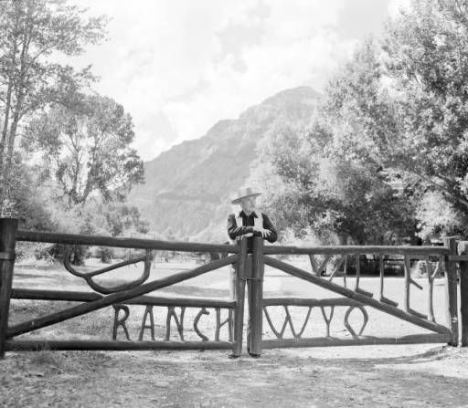
Here’s a picture of Larry at the gate to Valley Ranch:
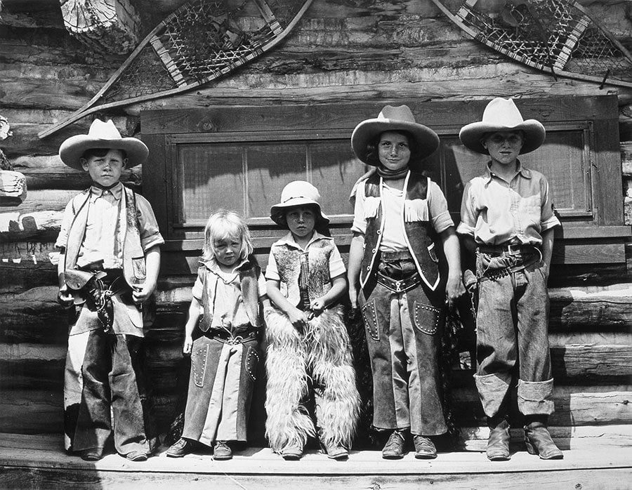
And this, of some New York City rich kids all duded out at the dude ranch. (OK, so I don’t know if they’re from New York City):
Of course, I googled Winthrop Brooks, and found that he was a direct descendent (great-great-great grandson) of Henry Sands Brooks, who, in 1818, founded the clothing store that became Brooks Brothers. I suspect that most of my readers are familiar with Brooks Brothers. If not: it is (actually, it was) a top-drawer men’s clothing store, with a reputation for conservatively-oriented business and business-casual attire.
Anyway, Win left Valley, Wyoming (and his partner Larry) in 1926 and went on to serve as president of Brooks Brothers from 1935 – 1946. He was the last family owner, and he sold the company in 1946.
I seemed to remember that I owned a Brooks Brothers shirt (passed down from my deceased father-in-law). The shirt’s at least 30 years old – it must be high quality, and I continue to wear it fairly frequently. Anyway, here’s a picture of the tag:
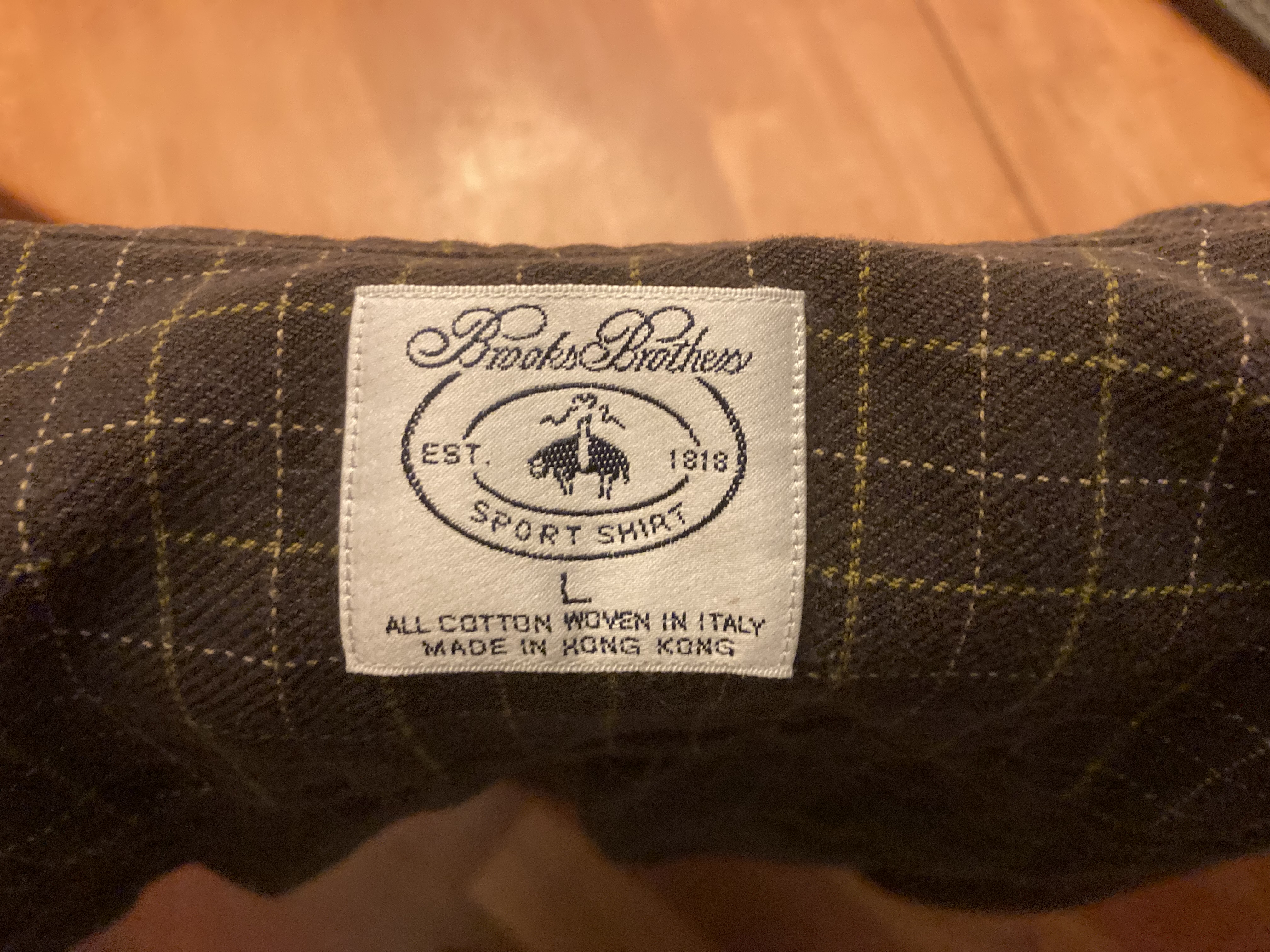
So the cotton was “woven in Italy” – that sounds classy. But then, the shirt is “Made in Hong Kong.” Boy – it has been a long time since “Made in Hong Kong” was common on a tag.
I had never noticed the critter on the tag. A little research indicates that the picture is of a sheep suspended by a ribbon. In the fifteenth century, this image came to represent fine wool, and has been the Brooks Brothers logo since 1850.
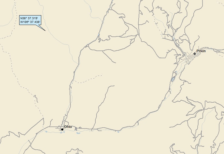
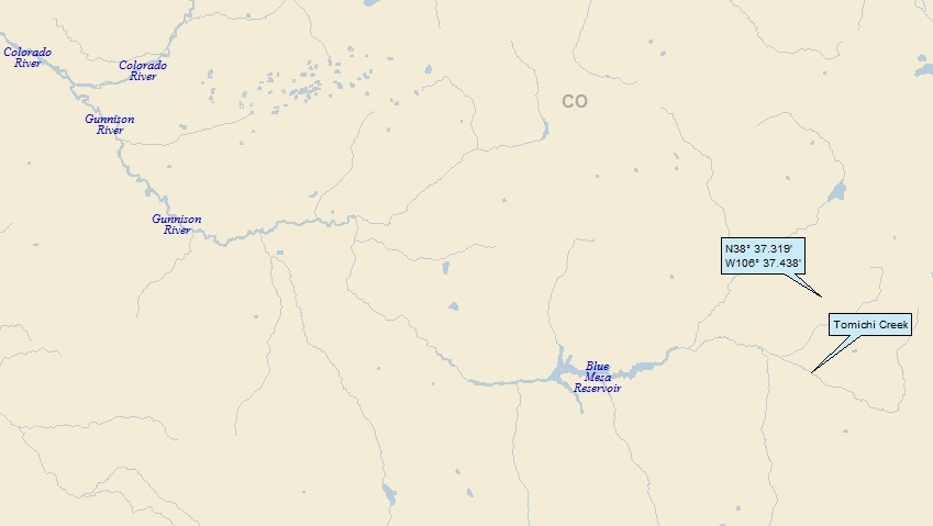
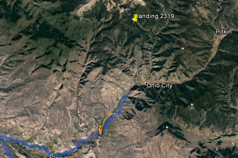
OK. Now that that’s all cleared up, it’s time to get back to Colorado. Here’s my local landing map:
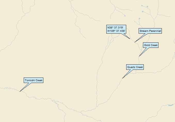
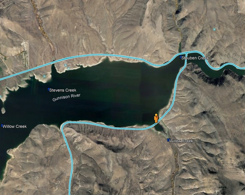
I’ll head over to Google Earth (GE) for my watershed analysis:
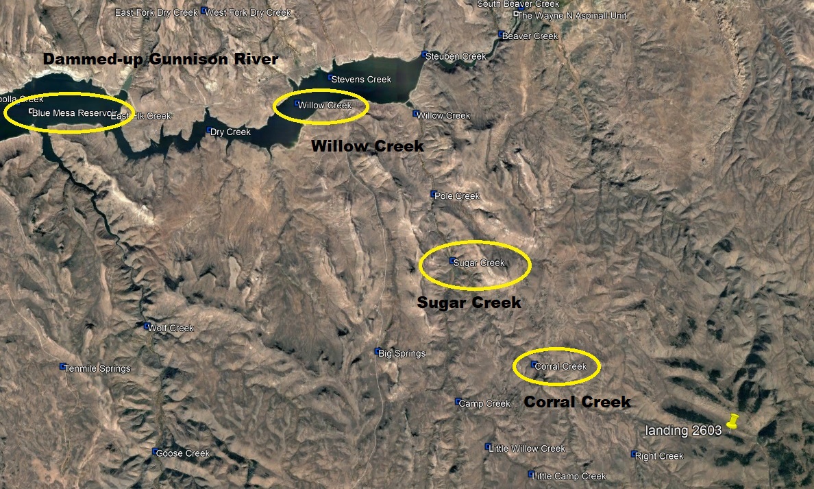
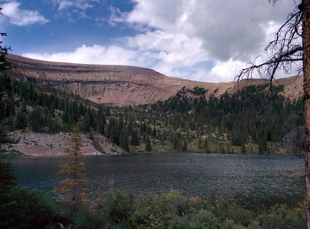
I landed in the watershed of Corral Creek; on to Sugar Creek; on to Willow Creek. Willow Creek discharges in the Blue Mesa Reservoir, which is a dammed-up portion of the Gunnison River (7th hit). Moving over to Street Atlas:
The Gunnison makes its way to the Colorado (198th hit).
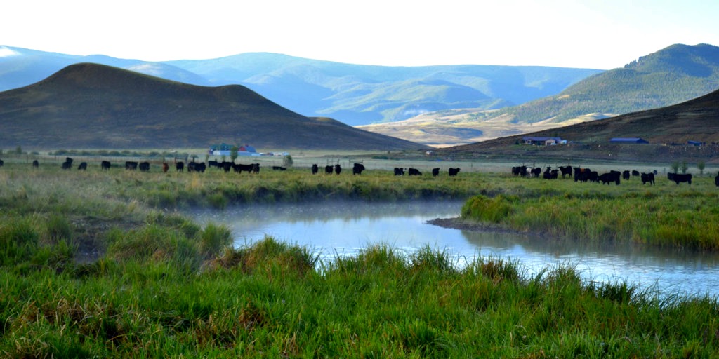
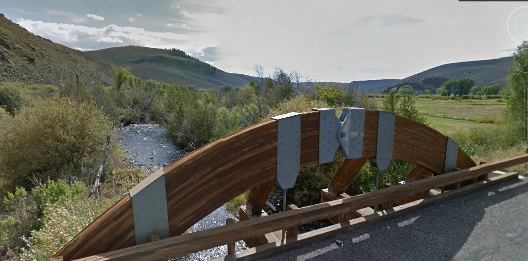
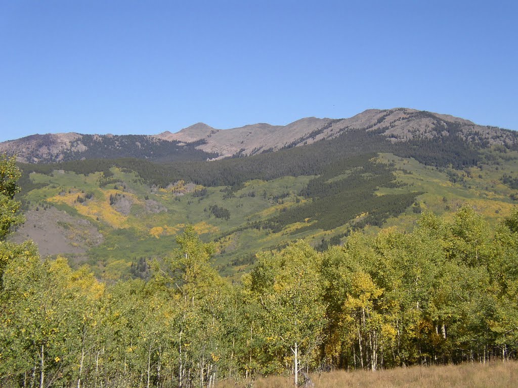
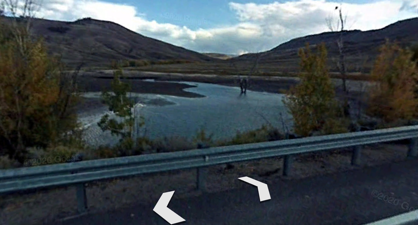
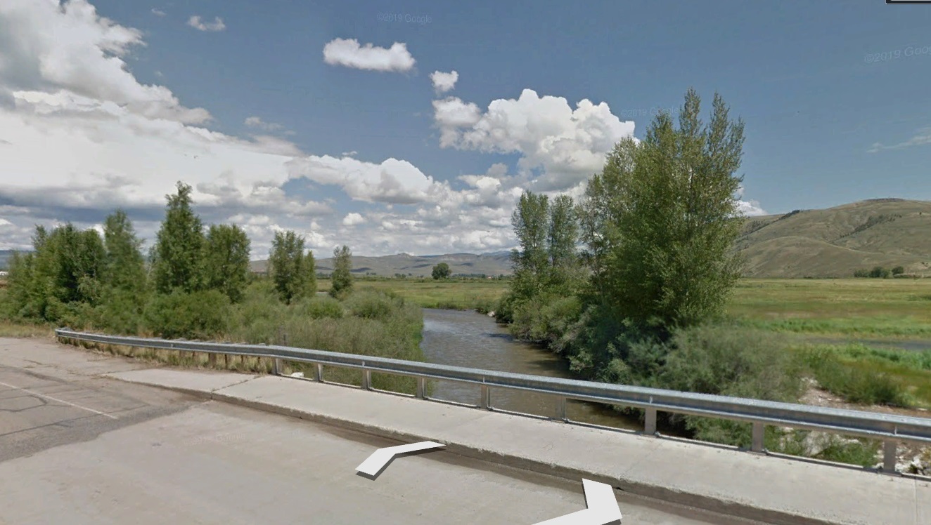
The Orange Dude found a bridge over the mouth of Willow Creek:
He looked upstream:
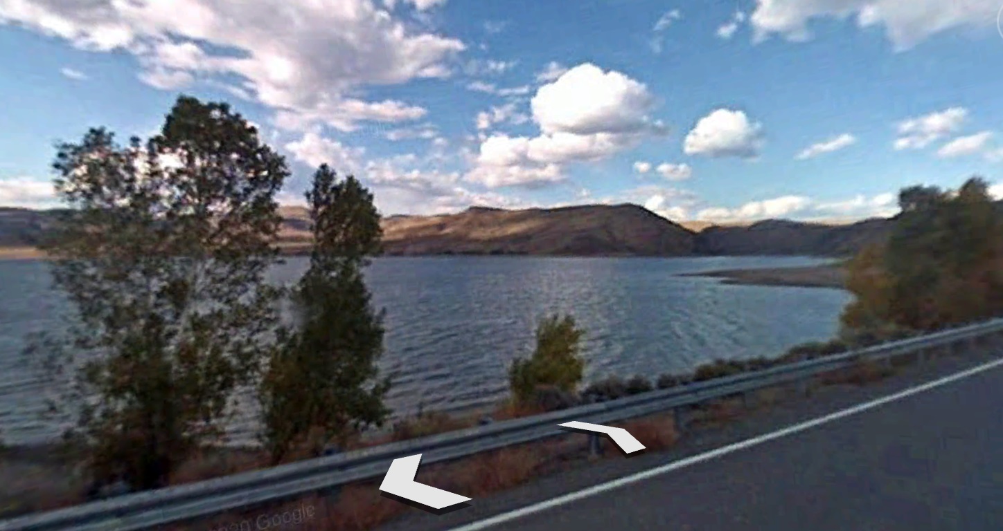
And downstream (the Reservoir):
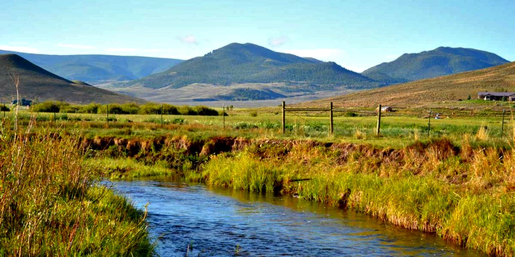
He went upstream to the town of Gunnison, and found this view from a bridge over the river:
Speaking of Gunnison, Wiki had this point of interest:
Gunnison residents isolated themselves from the surrounding area during the Spanish Influenza epidemic for two months at the end of 1918. All highways were barricaded near the county lines. Train conductors warned all passengers that if they stepped outside of the train in Gunnison, they would be arrested and quarantined for five days.
This served as partial inspiration for the novel The Last Town on Earth (2006) by Thomas Mullen. The isolation was ultimately unsuccessful, as townspeople became restless after a few months, and the isolation was lifted in February 1919 only to have the flu arrive a month later, killing several.
I just downloaded The Last Town on Earth to my Kindle; it’s my current read. The historic novel is about a town in the State of Washington that, during the 1918 pandemic, also decided on a draconian isolation.
I found an interesting disconnect between the Wiki article, and other references about the Gunnison Spanish Flu isolation. All of the articles I could find (including the primary two used by Wiki) talk about the success of the isolation policy! The Wiki piece implies that the policy was an abject failure. Well, check this out from two of the articles referenced by Wiki.
One was from The Guardian; it was entitled “ Gunnison, Colorado: the town that dodged the 1918 Spanish flu pandemic.” The other was from 9News.com, and was titled “”The 1918 Spanish flu killed 8,000 people in Colorado, but Gunnison only had 2 cases. Here’s why.”
Wow. Quoting from Wiki: “The isolation was ultimately unsuccessful . . .” It seems inexcusable that Wiki put such a negative spin on the story! Bad Wiki; bad Wiki; bad! bad!
From the Guardian article:
In late 1918 the world’s greatest killer – Spanish flu – roared towards Gunnison, a mountain town in Colorado.
The pandemic was infecting hundreds of millions of people in Europe, Africa, Asia and across the United States, overwhelming hospitals and morgues in Boston and Philadelphia before sweeping west, devastating cities, villages and hamlets from Alaska to Texas.
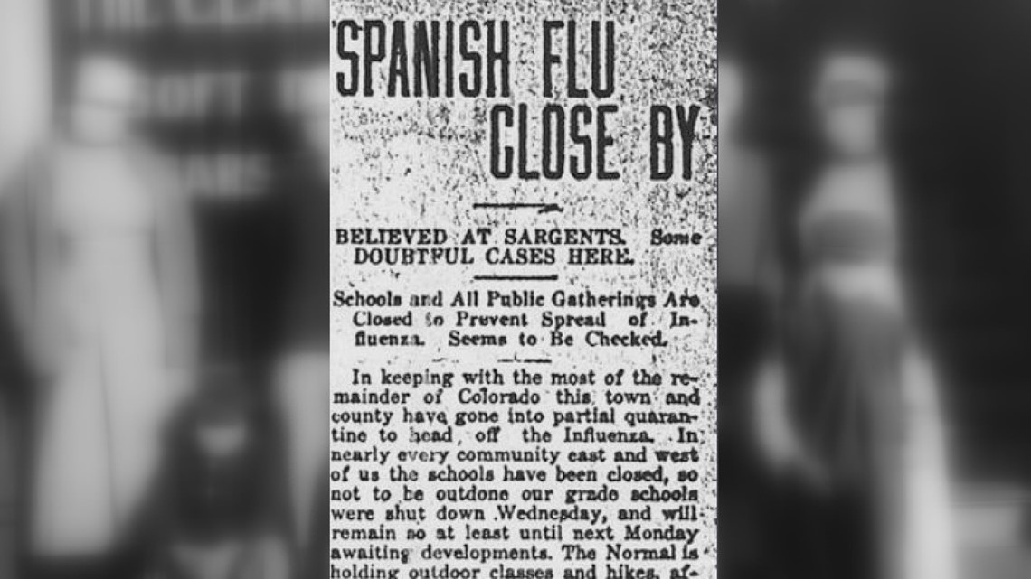
Gunnison, a farming and mining town of about 1,300 people, had special reason to fear. Two railroads connected it to Denver and other population centers, many badly hit. “The flu is after us” the Gunnison News-Champion warned on 10 October. “It is circulating in almost every village and community around us.”
Here’s one of the Gunnison News-Champion articles – mentioning the town of Sargents, just 30 miles east of Gunnison:
What happened next is instructive amid a new global health emergency a century later as the world struggles react to the emergence of a new coronavirus. Gunnison declared a “quarantine against all the world.” It erected barricades, sequestered visitors, arrested violators, closed schools and churches and banned parties and street gatherings, a de facto lockdown that lasted four months.
It worked. Gunnison emerged from the pandemic’s first two waves – by far the deadliest – without a single case. It was one of a handful of so-called “escape communities” that researchers have analyzed for insights into containing the apparently uncontainable.
“Gunnison’s management of the influenza situation, one hallmarked by the application of protective sequestration, is particularly impressive when one considers that nearly every nearby town and county was severely affected by the pandemic,” the University of Michigan Medical School said in a 2006 report for the Pentagon’s Defense Threat Reduction Agency. “The town of Gunnison was exceptional.”
I’m not very far into my book (the one about the fictional town in Washington State that enacted a quarantine like Gunnison’s), but the opening chapter followed a couple of townspeople who were posted as guards at a felled tree that blocked the main road into town. A soldier they didn’t know approached the roadblock. He was filthy, his uniform was in rags, and he was clearly ill. The guards warned him away, but he kept on coming. They didn’t want to take him into custody, for fear of infection. “Stop right now, or I’ll shoot,” said one. The soldier kept on coming, claiming that he was starving and exhausted and couldn’t walk the 15 miles to the nearest town. The guard aimed for the man’s chest, but he kept coming. He pulled the trigger. . . .
I hope that such drama did not happen in Gunnison.
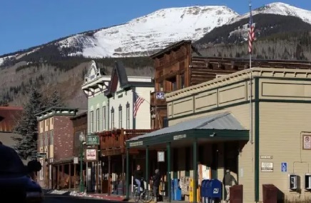
Time for a quick visit to Crested Butte. The town of Crested Butte is nestled between two significant mountain peaks: Crested Butte (no surprise, there), and Mount Emmons:
There’s a ski resort on Crested Butte, but more importantly (for me) is the fact that there’s a huge molybdenum ore deposit under Mount Emmons. From Wiki:
The molybdenum deposit under Mount Emmons is one of the largest in the United States. Jason Blevins from The Denver Post wrote an article about the deposit, starting with this picture of Mount Emmons looming over downtown Crested Butte:
Some excerpts:
This end-of-the-road village has spent nearly 40 years transforming itself from a mining town into a thriving tourist destination despite the threat of a huge molybdenum mine on the hill overlooking downtown.
For decades, every time molybdenum prices peaked, locals raised money and filed lawsuits to fight a proposed 1,000-worker mine digging 25 million tons of high-grade moly from the belly of beloved Mount Emmons. The crusade was at times so pitched that residents pledged to lay down in the middle of Whiterock Avenue to block ore-hauling trucks.
“This fight has defined our community for so long and has been an amazing sort of rally cry for what it means to be Crested Butte,” said Glenn Michel, mayor of the 1,500-resident town where a new economy is anchored in tourism and outdoor recreation in some of Colorado’s most pristine playgrounds.
Freeport-McMoRan — the world’s largest moly producer and owner of moly mining claims on Mount Emmons — has inked a preliminary deal to permanently remove these claims and return about 9,000 acres to the Forest Service.
Excellent news for the town; although the mine would have been an economic boon of sorts.
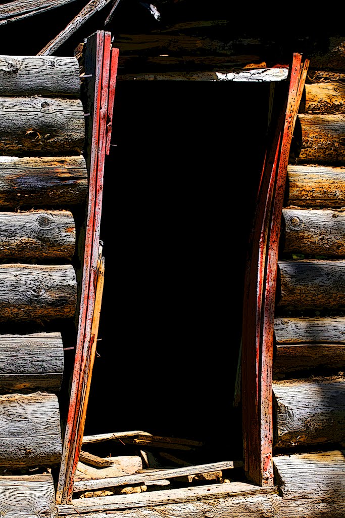
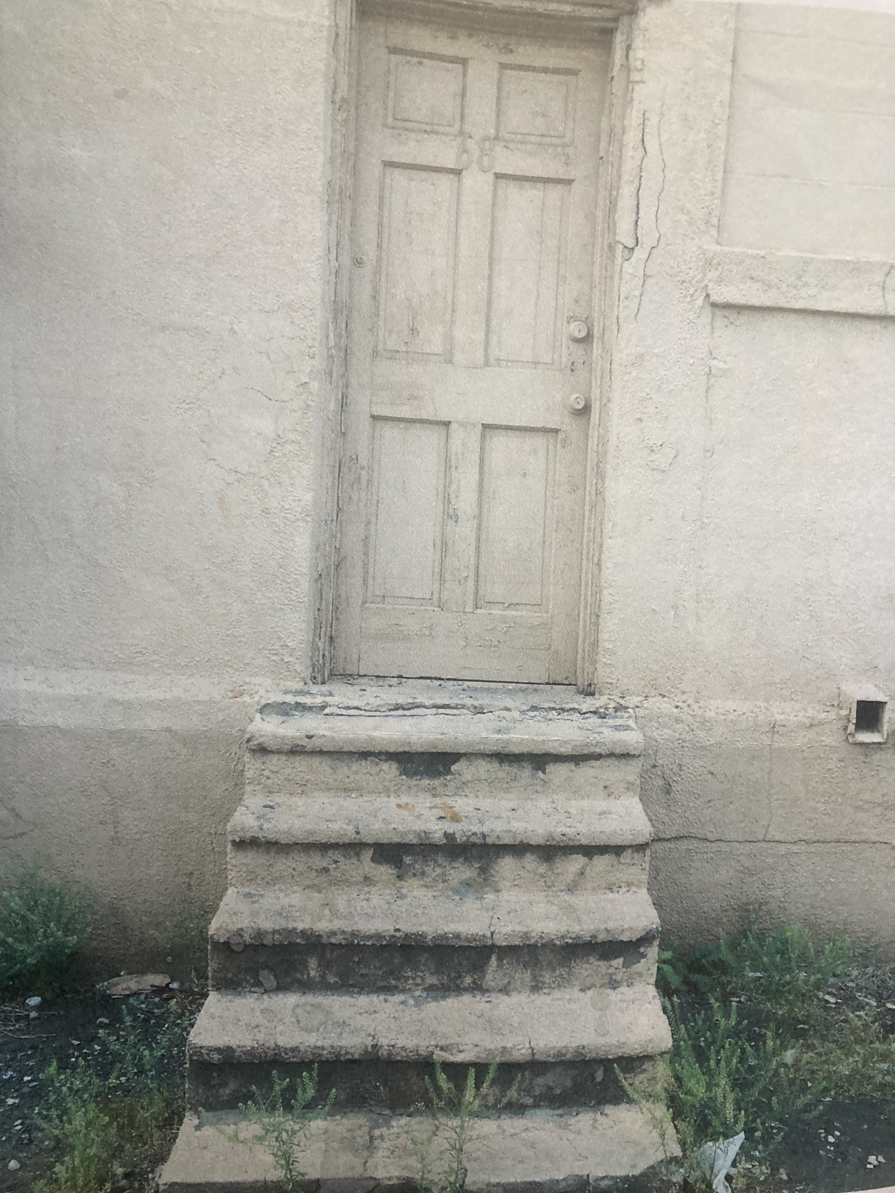
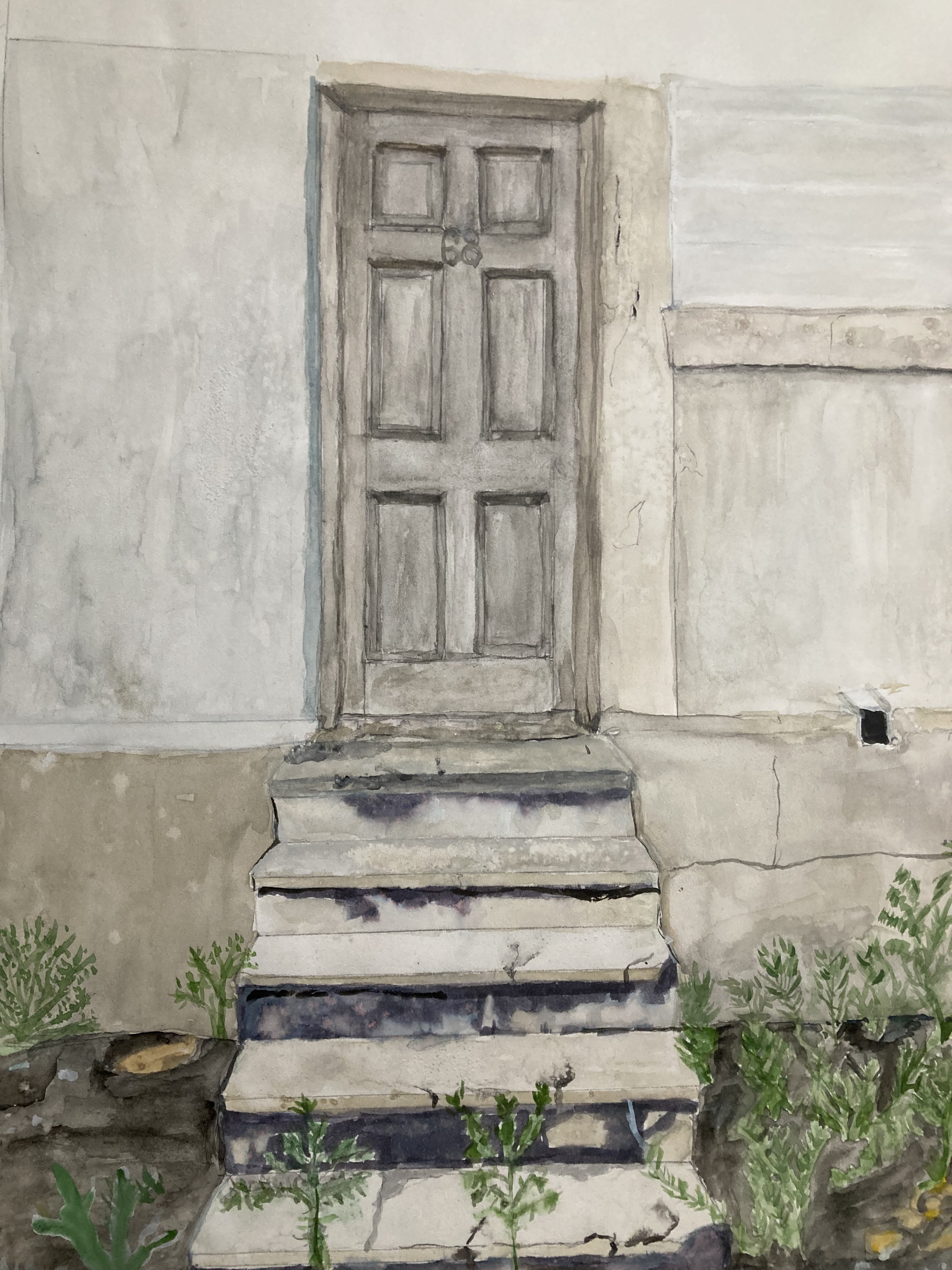
One of the main reasons I decided to talk about molybdenum and Mount Emmons is because of the mining comany Freeport-McMoRan. Our company – Hill Environmental Group – performed an environmental clean-up project at a Freeport McMoRan’s copper product manufacturing plant in Elizabeth NJ – now shut down and abandoned. I was the safety guy on the project, and drove to Elizabeth every day for a couple of months. Anyway, there were some old industrial buildings around the copper plant, and the doorway into one abandoned buildings caught my eye. I took a picture of it, and shared it with my wife, Jody.
Here’s the picture (actually, a picture of a print; I couldn’t find my original):
Jody has turned into quite the watercolor artist. Here’s her rendition of the old door:
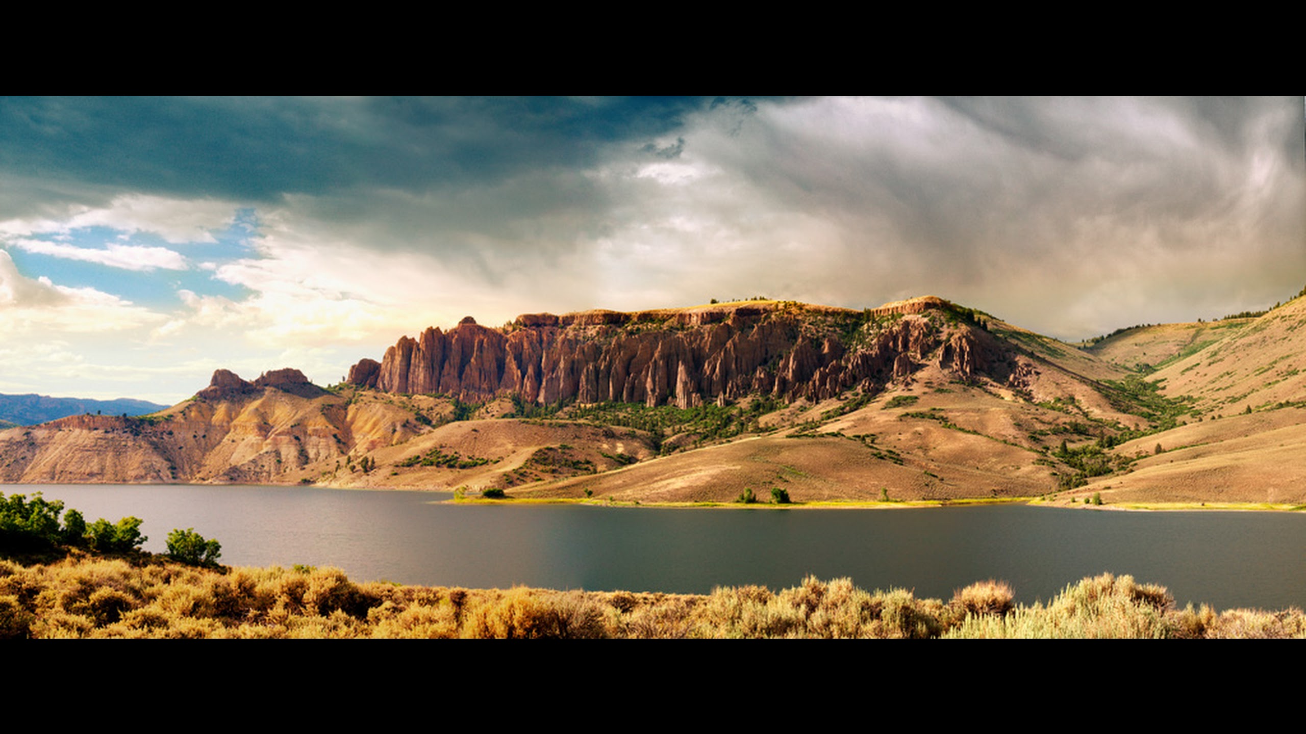
I’ll close with this shot of the Blue Mesa Reservoir posted on GE by Wolfgang Staudt:
That’ll do it . . .
KS
Greg
© 2022 A Landing A Day