First timer? In this formerly once-a-day blog (and now pretty much a once-a-week blog), I use an app that provides a random latitude and longitude that puts me somewhere in the continental United States (the lower 48). I call this “landing.”
I keep track of the watersheds I land in, as well as the town or towns I land near. I do some internet research to hopefully find something of interest about my landing location.
To find out more about A Landing A Day (like who “Dan” is) please see “About Landing” above. To check out some relatively recent changes in how I do things, check out “About Landing (Revisited).”
Landing number 2540; A Landing A Day blog post number 985
True confession: This Montana landing should have been posted before the already-posted Iowa landing. Unless you pay close attention to the above numbers (and the numbers in ALADus Obscurus), you’d never know . . .

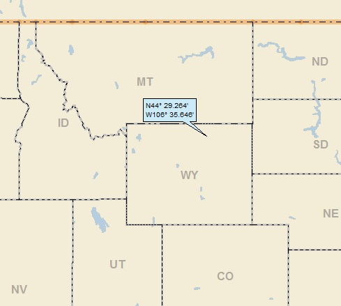
Dan: Today’s lat/long (N46o 16.622’, W113o 50.332) puts me in W-central Montana:

My local land shows a string of small towns running N-S (along the Bitterroot River as it turns out), but not much else:

I have to jump over to Google Earth (GE) to check out my local watershed:

As you can see, I landed in the watershed of Falls Creek. And yes, there are waterfalls on Falls Creek, pictures of which I’ll share at the end of this post. Zooming back:

Falls Creek flows into Daly Creek. Headed over to StreetAtlas:

Although you’ll have to trust me on this, Daly Creek flows into Skalkaho Creek, on to the Bitterroot River (4th hit), on to Clark Fork (25th hit). Although not shown, Clark Ford more-or-less turns into the Pend Oreille River (27th hit), which makes its way to the mighty Columbia (188th hit). FYI, the Columbia is number 4 on my list of river hits behind the Mississippi (981), the Missouri (447) and the Colorado (193).
Look at the above streams-only StreetAtlas map; you can the very wiggly state boundary between Montana and Idaho. Hmmmm. It’s not a river (which most wiggly state boundaries are), and it’s not the Continental Divide (since the Bitterroot River is east of the boundary and in the Columbia R watershed). Well, it turns out that the boundary runs along the crest of the Bitterroot Mountains, thereby marking the western edge of the Bitterroot River watershed:

Sorry about the typo. “Rot” is bad enough, but “Bitterrot?” Oh, well. Anyway, as you can see, the MT/ID boundary is marked by two different drainage divides. There’s a story here.
From The Third Mellennium Online (3rd1000.com):
In May of 1864, Congress established a new territory of Montana from what then was northeast Idaho and the present Idaho-Montana boundary was fixed by statute. The line Congress chose was mainly the Bitterroot range in the north and, farther south, the Continental Divide.
A great many years after the Bitterroot boundary had been defined by law, a decidedly peculiar legend grew up. In this strange legend the choice of the Bitterroots, instead of the Continental Divide, is blamed on a misguided boundary survey.
More than one variation of this fictitious account of the boundary choice is available: While headed north along the Continental Divide, the surveyors got drunk and did not know what they were doing, or were bribed by unscrupulous Montana agents, or got too excited about gold mining to pay attention to their job, or had defective equipment, or simply got lost and followed the wrong range of mountains.
In any event, the legend has it that the boundary surveyors made a truly colossal error in following the Bitterroots instead of the Continental Divide as they allegedly were supposed to–and that as a result Idaho lost Missoula, Butte, and all the rest of Montana which is west of the Rockies.
When the survey took place (1904-1906), the surveyors proceeded from north to south, obviously negating the entire “lost surveyors” story. It’s interesting that for 40 years, the actual border between the two states was not surveyed . . .
Here’s a GE look up the Bitterroot Mountains:

Although I couldn’t get the state boundary to show, it wiggles its way north. Anyway, I suspect that people who lived up in the mountains in the late 1800s didn’t know what state they were in until after the survey . . .
While perusing GE, I zoomed way in on my landing:

Look at all of those fallen trees! I looked all around my landing and discovered a huge area with the same type of scenery:

It’s not logging. Maybe a fire? This covers about 3000 acres! I then found this, from Hamilton’s 1240 KLYQ News Radio:

The associated article says that the fire had burned 2000 acres in the mountains east of Hamilton. A fire it is, then.
Let’s move up to Stevenson. From Wiki:
Stevensville is officially recognized as the first permanent settlement of non-indigenous peoples in the state of Montana. Forty-eight years before Montana became the nation’s 41st state, Stevensville was settled by Jesuit Missionaries at the request of the Bitterroot Salish tribe.
I don’t think I’ve ever heard of Christian missionaries being invited by Indians. Back to Wiki:
Between 1812 and 1821, the Salish learned about the “powerful medicine” of Christianity and Jesuit missionaries from Iroquois fur traders. In 1831, four young Salish men were dispatched to St. Louis, Missouri, to request “Black Robes” for the tribe. The four Salish men were directed to the home and office of William Clark (of Lewis and Clark fame) to make their request. At that time Clark was in charge of administering the territory they called home.
Through the perils of their trip, two of the Salish died at the home of General Clark.
[Wait a second. They traveled from far western Montana to St. Louis, and then died when they got there? I wonder if they were exposed to small pox or some other “white man’s disease” when they approached St. Louis?]
The remaining two Salish men secured a visit with St. Louis Bishop Joseph Rosati, who assured them that missionaries would be sent to the Bitterroot Valley when funds and missionaries were available in the future.
Again in 1835 and 1837 the Bitterroot Salish dispatched men to St. Louis to request missionaries, but to no avail.
[Wow. This tribe really wanted the powerful medicine.]
Finally in 1839 a group of Iroquois and Salish met Father Pierre-Jean De Smet in Council Bluffs. The meeting resulted in De Smet promising to fulfill their request for a missionary the following year.
In 1841, De Smet led a group of Jesuits to the Bitterroot and founded St. Mary’s Mission. It became the first permanent white settlement in what is now Montana.
The name of the settlement was changed from St. Mary’s to Stevensville in 1864 to honor territorial governor Isaac Stevens.
When I was looking at the Wiki entry for the Bitterroot River, I saw this:
The early Jesuit priest, Father De Smet, named it St. Mary’s River. By the time of Washington Territory surveys by Governor Isaac I. Stevens in 1853, the name had been translated to Bitterroot River.
Poor Father De Smet. He ended up 0 for 2 in his attempt to name things “St. Mary.”
And yes, there is a plant known as bitterroot, after which the river and mountains are named. The root (although presumably bitter) was eaten by many Indian tribes. It is a flowering plant, the State flower of Montana:

I knew I had run into the good Father De Smet during a previous post: Lake De Smet, Wyoming (February 2015). I remembered that the lake (besides being named for Father De Smet) has a very cool geologic history. From that post:
So, I Googled Lake De Smet and the only, I repeat, the only Wiki entry that deals with the lake is entitled: “Lake De Smet Segment, Bozeman Trail.” Although this sounded a little obscure (and because I didn’t see the expected “Lake De Smet” Wiki entry), I clicked on it. It did, in fact, have a couple of paragraphs about the Lake:
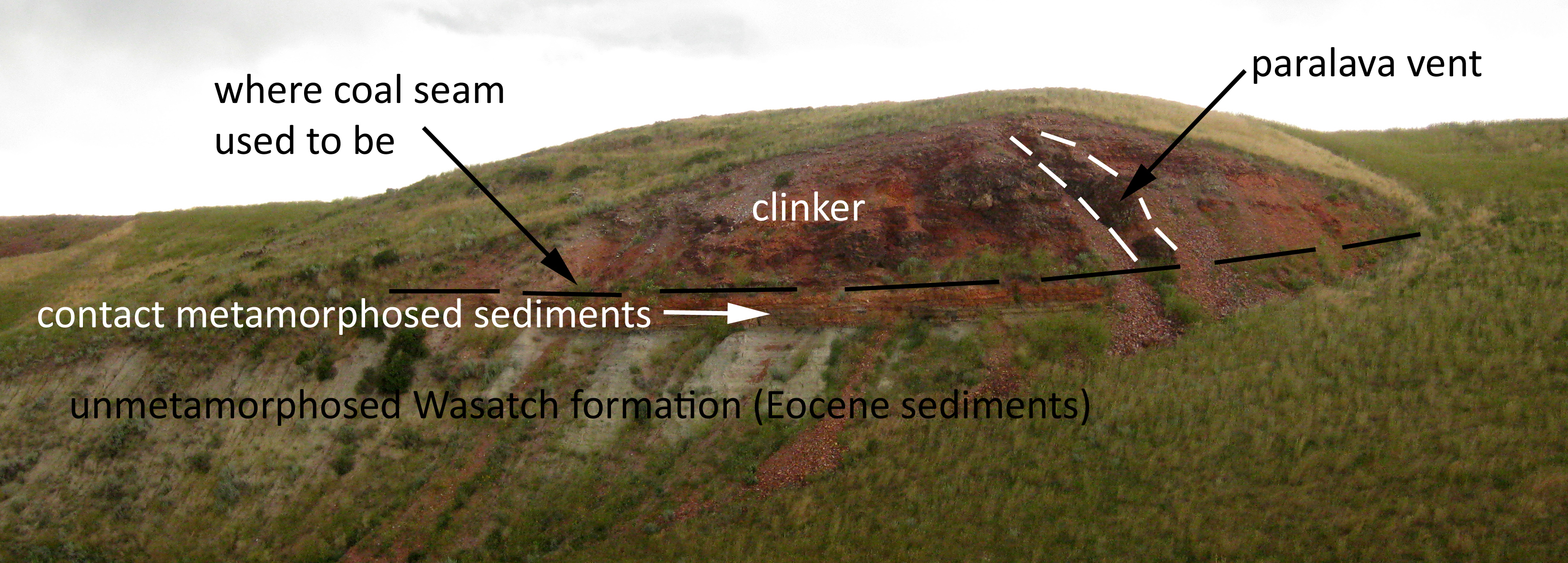
Lake De Smet occupies a natural internally-drained basin. It is one of several basins in the Buffalo area that were formed by coal seam fires. After the coal deposits burned, the clinker and other sediments collapsed into the space vacated by the burned coal forming a natural basin.
[Short aside. My regulars will realize my delight that this is an internally-drained lake not called “Devil’s Lake.]
Wow. Very cool – a burned-out coal seam caused a lake! My curiosity was piqued, so of course, I looked a little harder for the straight-ahead Wiki entry on the lake. No luck.
So Wiki failed me, but this sounds like a great story! I renewed my Google search. I went to WondersOfWyoming.com let me know that Father De Smet was “the first white man to lay eyes on it back in 1840.”
So, this coal seam fire wasn’t anything recent – it must have been a natural event. I need more information!
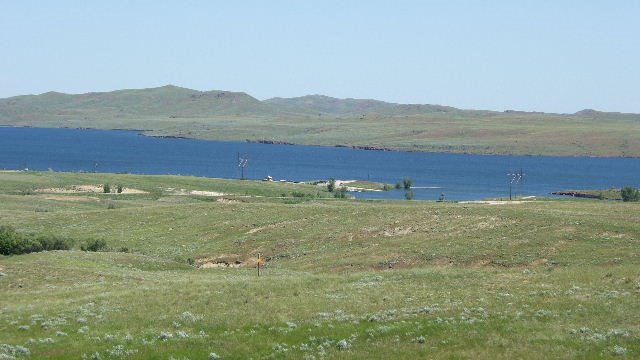
I went deep into Google searching for “Lake De Smet geology” (with many fruitless detours checking out various entries that might have some good information, but didn’t). I made it all the way to page 8 of my Google search. I next-to-never go 8 pages deep on a Google search! But there, I found a blog, “Gravel Beach” with a post about Lake De Smet. The author of the blog evidently has a thing about gravel beaches, and he stumbled on a gravel beach at the south end of Lake De Smet. He took this picture:

And he had this to say:
The hills surrounding the lake are Tertiary (Eocene) sedimentary rocks, marked by resistant outcroppings of clinker. Clinker is a red or black rock that results when coal seams burn and bake the overlying sediments (see Callan Bentley’s Mountain Beltway Blog at AGU).
This beach was at the south end of the lake, next to the dam, and consists entirely of gravel-sized clinker. Finally, some verification about the burning coal seam! So, of course, I went to the Mountain Beltway Blog. Here are some excerpts fro Callan Bentley’s blog:
Have you ever seen anything like this?

You’re looking at an outcrop of very interesting rock. The bright red stuff is officially called “clinker,” though many of the Wyoming locals where it outcrops incorrectly call it “scoria.”
What is clinker? It’s sedimentary rock that’s been baked by a burning coal seam beneath. The idea is that in places where sedimentary strata including coal outcrop on the surface, the coal seams can be set alight by prairie wildfires or lightning strikes, and then they burn back deeper and deeper underground, away from the surface outcrop.
Feverishly continuing my Google search, I found an obscure USGS publication that had a single picture of the Lake, with a caption stating that the lake formed when a 100 to 200 foot-thick coal seam (part of the Wasatch formation mentioned above) burned. As the seam burned, the land above it subsided, creating a natural low area where water accumulated. Nothing about when it happened or any other details.
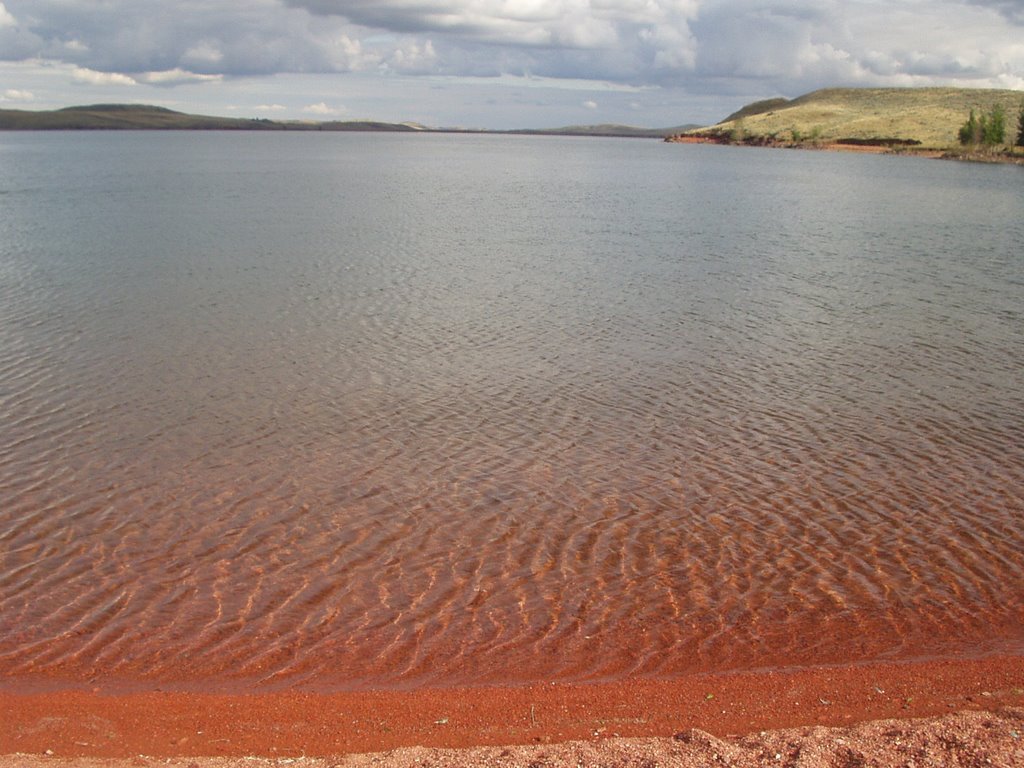
From the Wyoming Geological Survey, in an article about Wyoming Coal Geology, I found this picture of a thick coal seam exposed in a strip mine (probably in Gillette):

This gives you an idea of how a thick coal seam can be exposed at the surface. The article mentioned the Lake De Smet area (which is why it showed up on my Google search), saying that coal seams there are as thick as 200’.
So, let me say again. I am shocked (and appalled) that something as interesting as the origin of Lake De Smet is so ill-addressed on the internet. Could it be that there is no significant geological literature about the subject?? I mean really!
When did the coal seam catch fire? How long did it burn? When did the lake actually form? Does anybody have a cross-section of the lake showing where the coal seam used to be?
While I’m sure the lake’s not 300 years old (the evidence would be more raw). I guess it could be 1,000 years old (although I’d say it’s unlikely for the same reason); maybe 10,000 years old (why not?); 100,000 years old (maybe not that old, because the lake would be filled in by sedimentation by now). Hey – what do I know? Not much.
Today’s update: Now six years later, I once again searched for Lake De Smet geology, and found nothing new of particular significance. The only improvement in the search results is the fifth reference listed:

Back to Skalkaho country. Here’s a shot of the Skalkaho Falls from Hamilton’s own KLYQ News:

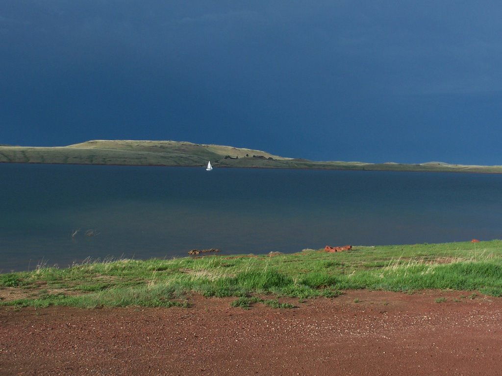
And, further upstream on Falls Creek (and closer to my landing) is this shot posted on GE by Eric Michaels:

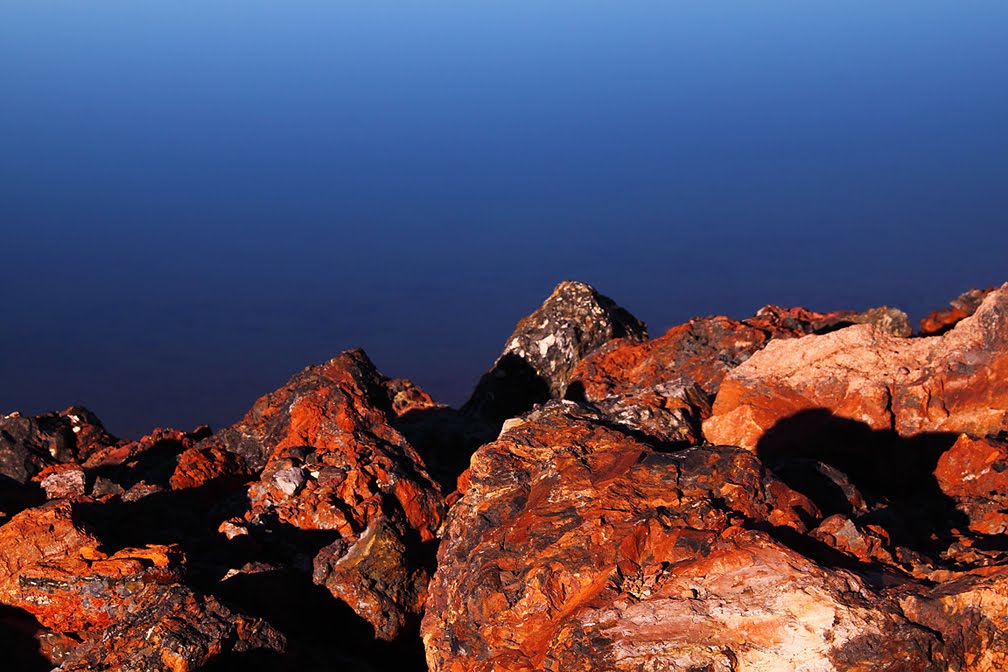
I’ll close this out with this shot of the Bitterroot Mountains posted on GE by Chris Hammock:

That’ll do it . . .
KS
Greg
© 2021 A Landing A Day